Sumter in Sumter County, South Carolina — The American South (South Atlantic)
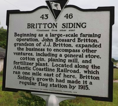
The Britton Community / Britton Siding
(side 1)
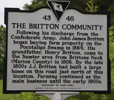
Following his discharge from the Confederate Army, John James Britton began buying farm property on the Pocotaligo Swamp in 1864. His grandfather, Henry Britton, came to the Sumter area from Britton’s Neck (Marion County) in 1806. By the late 1800s J.J. Britton had built a large home on this road just north of this location. Farming continued as the main business until the early 1900s.
Erected 2014 by The Sumter County Historical Commission. (Marker Number 43-46.)
Topics. This historical marker is listed in these topic lists: Agriculture • Industry & Commerce • Railroads & Streetcars • War, US Civil. A significant historical year for this entry is 1864.
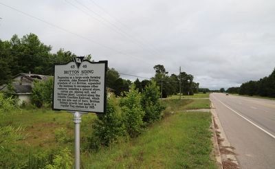
Location. 33° 50.653′ N, 80° 18.004′ W. Marker is in Sumter, South Carolina, in Sumter County. Marker is on U.S. 521 north of Britton Road, on the right when traveling north. Touch for map. Marker is at or near this postal address: 2695 US-521, Sumter SC 29153, United States of America. Touch for directions.
Other nearby markers. At least 8 other markers are within 6 miles of this marker, measured as the crow flies. Site of The Battle of Dingle's Mill (approx. 3 miles away); Battle of Dingles Mill (approx. 3 miles away); a different marker also named Battle of Dingle's Mill (approx. 3 miles away); Henry J. Maxwell Farm (approx. 4.2 miles away); St. Paul African American Methodist Episcopal Church (approx. 4.7 miles away); Kendall Institute (approx. 5.2 miles away); First Baptist Church (approx. 5˝ miles away); Bethel Baptist Church (approx. 5.6 miles away). Touch for a list and map of all markers in Sumter.
Credits. This page was last revised on June 2, 2023. It was originally submitted on May 28, 2023, by Dave W of Co, Colorado. This page has been viewed 124 times since then and 45 times this year. Photos: 1, 2, 3. submitted on May 28, 2023, by Dave W of Co, Colorado. • Bernard Fisher was the editor who published this page.


