Near Adamsboro in Cass County, Indiana — The American Midwest (Great Lakes)
Former Miami Indian Village
Photographed by Trevor L Whited, May 30, 2023
1. Former Miami Indian Village Marker
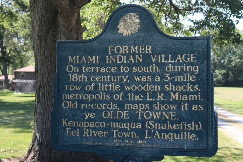
On terrace to south, during 18th century, was a 3-mile row of little wooden shacks, metropolis of the E.R. Miami. Old records, maps show it as ye Olde Towne, Kenapaco-maqua (Snakefish), Eel River Town, L'Anguille.
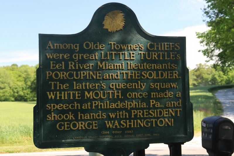
Among Olde Towne's Chiefs were great Little Turtle's Eel River Miami lieutenants: Porcupine and The Soldier. The latter's queenly squaw, White Mouth, once made a speech at Philadelphia, Pa., and shook hands with President George Washington!
Erected 1966 by L'Anguille Valley Historical Assn: Charles Duret Hume. Pres.
Topics. This historical marker is listed in these topic lists: Indigenous Peoples and Communities • Settlements & Settlers.
Location. 40° 48.338′ N, 86° 14.81′ W. Marker is near Adamsboro, Indiana, in Cass County. It is on County Road E250N 0.4 miles County Road 725E, on the right when traveling east. Touch for map. Marker is at or near this postal address: 6708 E Co Rd 250 N, Logansport IN 46947, United States of America. Touch for directions.

Regionally, this marker is in Northern Indiana. It is also in the American Midwest and
this page online
Other nearby markers. At least 8 other markers are within 7 miles of this marker, measured as the crow flies: Wilkinson's Expedition / James Wilkinson (1757-1825) (a few steps from this marker); Wilkinson's Expedition (about 600 feet away, measured in a direct line); Olde Towne Battle (approx. 0.7 miles away); Dentzel Carousel (approx. 6½ miles away); Potawatomi Encampment (approx. 6.6 miles away); Wilmer Flory Daylilies (approx. 6.7 miles away); Logansport Settlers in the Ninth Street Cemetery (approx. 6.9 miles away); The Kendrick-Baldwin Home (approx. 7 miles away). Touch for a list and map of all markers in Adamsboro.
Photographed by Trevor L Whited, May 30, 2023
2. Former Miami Indian Village Marker
Photographed by Trevor L Whited, May 30, 2023
3. Former Miami Indian Village Marker
Credits. This page was last revised on May 31, 2023. It was originally submitted on May 29, 2023, by Trevor L Whited of Kokomo, Indiana. This page has been viewed 759 times since then and 121 times this year. Photos: 1, 2, 3. submitted on May 29, 2023, by Trevor L Whited of Kokomo, Indiana. • Devry Becker Jones was the editor who published this page.
