Draper in Salt Lake County, Utah — The American Mountains (Southwest)
Draperville Fort
1854-1864
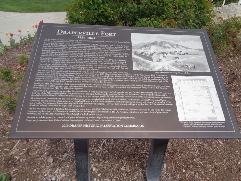
According to the Eleventh General Epistle of the Presidency of The Church of Jesus Christ of Latter-day Saints, dated 10 April 1854, Brigham Young addressed the Saints as follows: "…from hence forth, let one and all go forth with one accord and build their forts, wall in their cities and villages, herd and guard their cattle and other property, and keep their guns and ammunition in good order and convenience, ready for instant use."
Beginning in late 1854, the fort was erected as protection for pioneers who had been homesteading in the area since 1849. Skirmishes erupted from Sanpete to Salt Lake Counties between warriors of Timpanogos Ute Chief Walkara and settlers. Walkara had become upset by Mormon efforts to stifle Indian slave trading and by the increased intrusion of settlers into traditional Native American hunting grounds.
Ebenezer Brown and his family were the first settlers to arrive in "South Willow Creek*" in 1849. Ebenezer's homestead was 160 acres. Because of the Indians' threat and Brigham Young's directive, Ebenezer donated 5 acres of his property to build a fort where members of the community could gather together and feel safe.
The walls that surrounded the fort were made of adobe brick and clay and took two years to build. The fort measured 126.5 yards east to west and 192.5 yards north to south. The walls were 8 feet high and 1 foot wide with lookout slots every 14 feet. All the homes faced the center of the fort.
The first house built was Ebenezer's. Running west along the south wall were three other small houses. Perry Fitzgerald's two-story home was built on the east wall; to the west was the LDS Church tithing office and granary and the Relief Society Hall. Ebenezer's son, Norman Brown, built an adobe brick home. This house also served as the first schoolhouse. The entrance to the fort was a road through a wide opening in the northwest corner of the fort and in front of Lauritz Smith's blacksmith shop. A garden area, in the southwest end of the fort, included a small orchard of apple and peach trees. The garden was planted by William Terry with seeds he carried across the plains from Rhode Island. John Fitzgerald's home was built on the northeast corner of the fort. John's mother, Ann, had a candy store attached to the home.
By the year 1855, the population of the community had grown to 222 people. Until then, church, school, and public meetings were held in homes. More space was needed, so in 1860, the vestry was built across from the Norman Brown home. In 1863
the main hall was added to the vestry, and from that time, the building was known as "The Old White Meetinghouse."
The people of the community never lacked for entertainment. A large dance pavilion was built near the west gate. In 1859, the 80-foot by 100-foot bowery was built east of the White Meetinghouse. The pavilion was a large, open building in the middle of the fort near the east side. It was made of poles and had a thatched roof of willows for shade and was used during the warm summer months for large gatherings, such as church conferences, concerts, and performances.
Most families in the community had their own homes, cows, sheep and other livestock outside of the fort. Hostilities had increased between the Native Americans and the settlers, whose homes were raided and livestock stolen, so the people lived in their homes during the day and returned to the safety of the fort at night. The temporary homes were very small, with room for only sleeping. They were built of wood and logs, with dirt floors and slanted thatched roofs of sod and willows. Some were no larger than a wagon box.
The fort was never attacked. Brigham Young signed a peace treaty with Chief Walkara in 1854, and Indian difficulties ceased in the late 1850s. The settlers began moving back into their homesteads, and the fort walls were gradually dismantled. The Old White Meetinghouse and some of the original homes remained, and in 1892 the Draper First Ward Church was built on the property.
The fort served the pioneer settlers well and provided sanctuary and security, uniting them during insecure times.
*-Draper was first known as South Willow Creek then Draperville from 1854 to 1877, when it was shortened to Draper.
Erected 2019 by Draper Historic Preservation Commission.
Topics. This historical marker is listed in these topic lists: Education • Forts and Castles • Native Americans • Settlements & Settlers. A significant historical date for this entry is April 10, 1854.
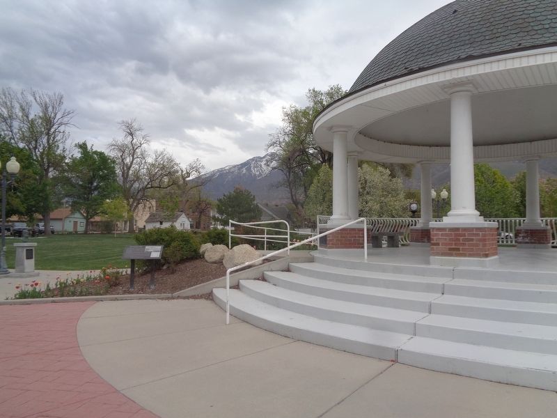
Location. 40° 31.327′ N, 111° 51.935′ W. Marker is in Draper, Utah, in Salt Lake County. Marker can be reached from 900 East south of East 12600 South. Marker is located at Draper Historic Park. Touch for map. Marker is at or near this postal address: 12625 900 E, Draper UT 84020, United States of America. Touch for directions.
Other nearby markers. At least 8 other markers are within walking distance of this marker. Perry Fitzgerald (here, next to this marker); William Draper Jr. (a few steps from this marker); Early Draper Gathering Places (a few steps from this marker); Peter Anthon Nielsen (within shouting distance of this marker); Henry Eastman Day (within shouting distance of this marker); Enniss Family Memorial in Draper (within shouting distance of this marker); Old Meeting House (within shouting distance of this marker); First Settlers of Draper (within shouting distance of this marker). Touch for a list and map of all markers in Draper.
Credits. This page was last revised on May 30, 2023. It was originally submitted on May 30, 2023, by Jason Voigt of Glen Carbon, Illinois. This page has been viewed 69 times since then and 13 times this year. Photos: 1, 2. submitted on May 30, 2023, by Jason Voigt of Glen Carbon, Illinois.

