Downtown in San Antonio in Bexar County, Texas — The American South (West South Central)
Historical Features along San Pedro Creek
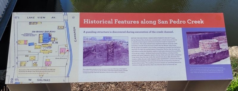
Before the San Pedro Creek Improvements Project began, the San Antonio River Authority commissioned a cultural resources survey to identify archaeological and historical sites that might be impacted by construction. The study revealed many significant features along the creek, including a circular stone structure located near the Menger Soap Works. As the project proceeded in 2017, further investigations revealed that the feature was built of rough, dry-stacked pieces of limestone. The fact that the stone was laid without mortar and therefore unable to hold water eliminated the possibility of its use as a cistern. Artifacts found around the feature, including bottles, pottery, and metal fragments, dated to the late 1800s and early 1900s, indicating it was newer than the soap works that opened here about 1860. Because of its location within the new creek channel, a plan was devised to preserve the fragile structure by encasing it with mortared stonework and exposing only the top portion above water. This puzzling structure remains an interesting feature for visitors to study and develop their own theories about its historical use.
Captions
Left: The location of the stone structure is indicated on this 1896 map illustrating the Menger Soap Works site and adjoining property.
Base map: Insurance Maps, San Antonio, Texas; New York: Perris Map Co. 1896.
Middle: The unidentified cylindrical stone structure is seen here following archaeological excavations conducted during the San Pedro Creek Improvements Project. The pipe running toward the creek from the bottom of the structure adds to the mystery.
Courtesy: Raba-Kistner Environmental, Inc., San Antonio.
Right: To protect and preserve the stone structure in the original locus, a plan was devised to surround it with a casing of mortared limestone. The structure is seen here before the creek channel was filled with water. Today only the top portion is exposed above the water line.
Courtesy: San Antonio River Authority
Erected 2018 by San Pedro Creek Cultural Park. (Marker Number 10.)
Topics. This historical marker is listed in these topic lists: Anthropology & Archaeology • Industry & Commerce • Parks & Recreational Areas. A significant historical year for this entry is 2017.
Location. 29° 25.732′ N, 98° 29.772′ W. Marker is in San Antonio, Texas, in Bexar County. It is in Downtown. Marker is at the intersection of Camaron Street
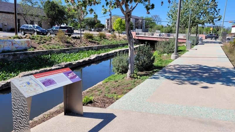
and West Martin Street, on the left when traveling north on Camaron Street. The marker is located on the south side of the Martin Street Bridge in the San Pedro Creek Culture Park along the hiking trail. Touch for map. Marker is at or near this postal address: 441 Camaron Street, San Antonio TX 78205, United States of America. Touch for directions.
Other nearby markers. At least 8 other markers are within walking distance of this marker. Early Industry Along San Pedro Creek (a few steps from this marker); Menger Soap Works (within shouting distance of this marker); A Living Heritage: City Streets and the Legacy of Early Settlers (within shouting distance of this marker); The Living Worlds of San Pedro Creek (about 500 feet away, measured in a direct line); The Taming of San Pedro Creek (about 500 feet away); The Barrio del Norte (about 700 feet away); Houston Street (approx. 0.2 miles away); The Golden Age of Entertainment Along the Creek (approx. 0.2 miles away). Touch for a list and map of all markers in San Antonio.
Also see . . . Where beauty meets purpose. San Pedro Creek Culture Park (Submitted on June 7, 2023, by James Hulse of Medina, Texas.)
Credits. This page was last revised on June 7, 2023. It was originally submitted on June 7, 2023, by James Hulse of Medina, Texas. This page has been viewed 58 times since then and 7 times this year. Photos: 1, 2, 3. submitted on June 7, 2023, by James Hulse of Medina, Texas.


