Cayey in Municipio de Cayey, Puerto Rico — The Caribbean (The West Indies)
Los Empedrados en el Atrio de la Iglesia y Lado Sur
Plaza de Recreo Ramón Frade
— [The Pavement of the Church and South Side] —

Photographed By Devry Becker Jones (CC0), June 5, 2023
1. Los Empedrados en el Atrio de la Iglesia y Lado Sur Marker
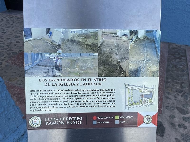
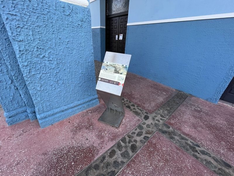
Estás caminando sobre una recreación del empedrado que acogía todo el lado oeste de la iglesia y que fue identificado mientras se hacían las excavaciones. A su mano derech e izquierda hay unos cuadrángulos en rojo cuya parte interior era en tierra. El atrio empedrado era la entrada más primitiva a este lugar y la piedra chinos de río fue el material que utilizaron. Muestra un patrón de piedras pequeñas, medianas y grandes, colocadas de plano, alineadas, formando un piso frente a la puerta atrial, y luego presenta una prolongación de los hileras que se extiende en dirección norte/sur hasta alcanzar las esquinas de la iglesia.
You are walking on the reconstructed pavement that housed the entire west side of the church that was identified while excavations were performed. To the right and left there are some quadrangles in red whose inner part was on the ground. The cobbled atrium was the earliest entrance which was made of Chinese river stone. It shows a pattern of small, medium and large stones, placed flat and aligned, forming the floor in front of the atrium door, and then presents long rows that extend north and south until reaching the corners of the church.
Erected 2021 by Municipio de Cayey.
Topics. This historical marker is listed in these topic lists: Anthropology & Archaeology • Churches & Religion • Colonial Era.
Location. 18° 6.764′ N, 66° 9.953′ W. Marker is in Cayey in Municipio de Cayey, Puerto Rico. Marker is on Calle Núñez Romero east of Calle Luis Muñoz Rivera (Puerto Rico Route 170), on the right when traveling east. Touch for map. Marker is at or near this postal address: Calle Núñez Romero 104, Cayey PR 00736, United States of America. Touch for directions.
Other nearby markers. At least 8 other markers are within walking distance of this marker. Réplicas de Osamentas de Adultos (here, next to this marker); Hallazgos Arqueológicos (here, next to this marker); a different marker also named Hallazgos Arqueológicos (a few steps from this marker); Iglesia Nuestra Señora de la Asunción (a few steps from this marker); Réplicas de Osamentas de Niños y Familias (a few steps from this marker); "El Pan Nuestro" (a few steps from this marker); Fundadores de Nuestra Ciudad (within shouting distance of this marker); En Memoria a los Fundadores y Primeras Familias Cayeyanas. (within shouting distance of this marker). Touch for a list and map of all markers in Cayey.

Photographed By Devry Becker Jones (CC0), June 5, 2023
2. Los Empedrados en el Atrio de la Iglesia y Lado Sur Marker
Credits. This page was last revised on July 7, 2023. It was originally submitted on June 9, 2023, by Devry Becker Jones of Washington, District of Columbia. This page has been viewed 49 times since then and 6 times this year. Photos: 1, 2. submitted on June 9, 2023, by Devry Becker Jones of Washington, District of Columbia.