De Baarsjes in Amsterdam, North Holland, Netherlands — Northwestern Europe
Reinier Claeszen
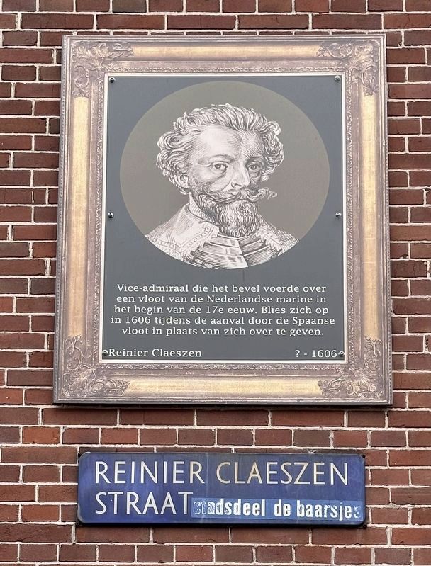
Photographed by Andrew Ruppenstein, May 7, 2023
1. Reinier Claeszen Marker

Vice-admiraal die het bevel voerde over een vloot van de Nederlandse marine in het begin van de 17e eeuw. Blies zich op in 1606 tijdens de aanval door de Spaanse vloot in plaats van zich over te geven.
Vice Admiral who commanded a fleet of the Dutch navy in the early 17th century. Blown up in 1606 during the attack by the Spanish fleet instead of surrendering.
Erected by Geef Straten Een Gezicht.
Topics and series. This historical marker is listed in this topic list: Wars, Non-US. In addition, it is included in the Give Streets a Face / Geef Straten Een Gezicht series list. A significant historical date for this entry is October 7, 1606.
Location. 52° 22.305′ N, 4° 51.735′ E. Marker is in Amsterdam, Noord-Holland (North Holland). It is in De Baarsjes. It is at the intersection of Reinier Claeszenstraat and Maarten Harpertszoon Trompstraat, on the left when traveling north on Reinier Claeszenstraat. Touch for map. Marker is at or near this postal address: Maarten Harpertszoon Trompstraat 39, Amsterdam, Noord-Holland 1056 JC, Netherlands. Touch for directions.

Regionally,
this page online
Other nearby markers. At least 8 other markers are within walking distance of this marker: Maarten Harpertzoon Tromp (within shouting distance of this marker); Willem de Zwijger / William the Silent (within shouting distance of this marker); Willem II van der Marck Lumey (within shouting distance of this marker); Jan Carel Josephus van Speijk (about 150 meters away, measured in a direct line); Jacob van Wassenaer Obdam (about 150 meters away); Egbert Bartholomeusz Kortenaer (approx. 0.3 kilometers away); Johan Anthoniszoon van Riebeeck (approx. 0.3 kilometers away); Krommertstraat (approx. 0.3 kilometers away). Touch for a list and map of all markers in Amsterdam.
Also see . . . Reinier Claeszen (Wikipedia, in Dutch).
Overview (in translation): Reinier Claeszen (? - Cape Sint-Vincent, October 7, 1606) was vice admiral under Willem de Soete van Laecke Haulthain, who commanded a fleet of the Dutch navy in the(Submitted on June 10, 2023.)early 17th century. With his fleet he was attacked in 1606 off the Cabo de São Vicente (Dutch: Cape Sint-Vincent) in Portugal by the Spanish fleet, after which he chose to blow up his own fleet instead of surrendering.Photographed by Andrew Ruppenstein, May 7, 20232. Reinier Claeszen Marker - wide view


Photographed by Johannes Hinderikus Egenberger (via Wikimedia Commons)
3. De Heldendood van Reinier Claeszen
The Heroic Death of Reinier Claeszen
Credits. This page was last revised on December 30, 2023. It was originally submitted on June 10, 2023, by Andrew Ruppenstein of Lamorinda, California. This page has been viewed 227 times since then and 29 times this year. Photos: 1, 2, 3. submitted on June 10, 2023, by Andrew Ruppenstein of Lamorinda, California.
