Peñuelas in Municipio de Peñuelas, Puerto Rico — The Caribbean (The West Indies)
La Locomotora "La Negra Cocola"
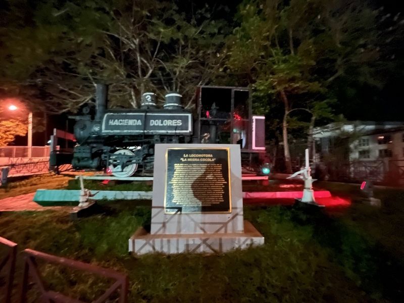
[The Locomotive "La Negra Cocola"]
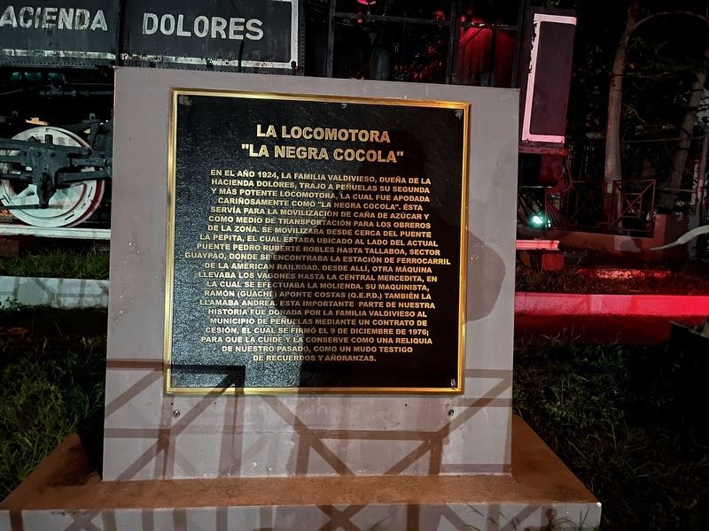

En el año 1924, la familia Valdivieso, dueña de la hacienda dolores, trajo a Peñuelas su segunda y más potente locomotora, la cual fue apodada cariñosamente como "La Negra Cocola". Ésta servía para la movilización de caña de azúcar y como medio de transportación para los obreros de la zona. Se movilizaba desde cerca del puente la pepita, el cual estaba ubicado al lado del actual puente Petro Ruberté Robles hasta tallaboa, sector Guaypao, donde se encontraba la estación de ferrocarril de la American Railroad. Desde allí, otra máquina llevaba los vagones hasta la Central Mercedita, en cual se efectuaba la molienda. Su maquinista, Ramón (Guaché) Aponte Costas (Q.E.P.D.) también la llamaba Andrea. Esta importante parte de nuestra historia fue donada por la familia valivieso al Municipio de Peñuelas mediante un contrato de cesión, el cual se firmó el 9 de diciembre de 1976; para que la cuite y la conserve como una reiquia de nuestro pasado, como un mudo testigo de recuerdos y añoranzas.
In 1924, the Valdivieso family, owners of the Dolores hacienda, brought their second and most powerful
this page online
Erected by Municipio de Peñuelas.
Topics. This historical marker is listed in these topic lists: Agriculture • Industry & Commerce • Railroads & Streetcars. A significant historical date for this entry is December 9, 1976.
Location. 18° 3.457′ N, 66° 43.367′ W. Marker is in Peñuelas in Municipio de Peñuelas, Puerto Rico. It is on Calle Cotto north of CAlle Amalia Marín, on the right when traveling north. Touch for map. Marker is at or near this postal address: Calle Cotto

Regionally, this marker is on the Southern Coastal Zone and in the Greater Ponce Area. Globally, it is one of the Greater Antilles on the Caribbean Sea, on in the Atlantic Ocean, in North America, in the Western Hemisphere, in the Western World, and in the Anglosphere. Historically, it finds itself in what was once a Spanish colony.
Other nearby markers. At least 8 other markers are within walking distance of this marker: Fuente Tipo "Bizcocho" (within shouting distance of this marker); Ángel Pacheco Alvarado (within shouting distance of this marker); Leyenda del Río Guayanés (within shouting distance of this marker); El Flamboyán (within shouting distance of this marker); Monumento al Soldado Caído (within shouting distance of this marker); El Güiro (within shouting distance of this marker); a different marker also named Monumento al Soldado Caído (about 300 feet away, measured in a direct line); Mariano Quiñones (approx. half a kilometer away). Touch for a list and map of all markers in Peñuelas.
Credits. This page was last revised on December 14, 2023. It was originally submitted on June 11, 2023, by Devry Becker Jones of Washington, District of Columbia. This page has been viewed 729 times since then and 124 times this year. Photos: 1, 2. submitted on June 11, 2023, by Devry Becker Jones of Washington, District of Columbia.
Editor’s want-list for this marker. Clear, daylight photos of the marker and its context. • Can you help?
