Near Idaho City in Boise County, Idaho — The American West (Mountains)
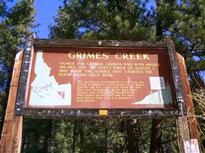
Grimes' Creek
The party was searching for a rich basin described to Splawn a year earlier by an Indian. Farther up this creek, they found the gold they were looking for. A few days later, Grimes was killed at Grimes Pass (it was blamed on Indians) and his partners had to bury him in a prospect hole nearby.
Erected by Idaho Historical Society. (Marker Number 188.)
Topics and series. This historical marker is listed in these topic lists: Natural Resources • Settlements & Settlers. In addition, it is included in the Idaho State Historical Society series list. A significant historical year for this entry is 1862.
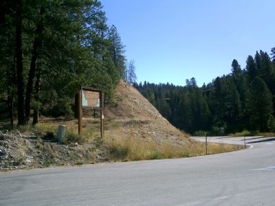
Location. 43° 43.553′ N, 115° 57.066′ W. Marker is near Idaho City, Idaho, in Boise County. Marker is at the intersection of State Highway 21 at milepost 28 and Grimes Creek Road, on the left when traveling north on State Highway 21. Touch for map. Marker is in this post office area: Boise ID 83716, United States of America. Touch for directions.
Other nearby markers. At least 8 other markers are within 10 miles of this marker, measured as the crow flies. The Old Toll Road (approx. 7.1 miles away); Idaho City (approx. 7.8 miles away); George Kettler's Blacksmith Shop (approx. 9.1 miles away); a different marker also named George Kettler's Blacksmith Shop (approx. 9.1 miles away); Idaho Territorial Penitentiary (approx. 9.2 miles away); Saint Joseph's Catholic Church (approx. 9.2 miles away); The Chinese Legacy in Boise Basin (在愛达荷城的华人) (approx. 9.2 miles away); Masonic Temple (approx. 9.2 miles away). Touch for a list and map of all markers in Idaho City.
Additional keywords. Mining
Credits. This page was last revised on June 16, 2016. It was originally submitted on September 20, 2009, by Rebecca Maxwell of Boise, Idaho. This page has been viewed 2,654 times since then and 58 times this year. Photos: 1, 2, 3. submitted on September 20, 2009, by Rebecca Maxwell of Boise, Idaho. • Craig Swain was the editor who published this page.


