Beaufort in Carteret County, North Carolina — The American South (South Atlantic)
Cape Lookout Lighthouse
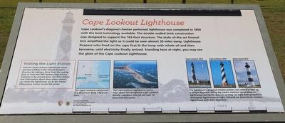
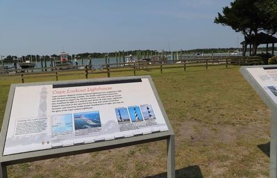
Cape Lookout's diagonal checker patterned lighthouse was completed in 1859 with the best technology available. The double-walled brick construction was designed to support the 163-foot structure. The state-of-the-art Fresnel lens amplified the light so it could be seen almost 30 miles away. Lighthouse Keepers who lived on the cape first lit the lamp with whale oil and then kerosene, until electricity finally arrived. Standing here at night, you may see the glow of the Cape Lookout Lighthouse.
Visiting the Light Station
Visit the Cape Lookout Lighthouse tower and the exhibits in the historic Keepers’ Quarters by taking a ferry from the nearby dock or from the NPS Harkers Island Ferry Gateway or by private boat. For ferry tickets and information about days when visitors can climb the lighthouse, go to the visitor Information Center across the street.
(captions)
The Cape Lookout Lighthouse is a 45 minute ferry ride from here.
The Cape Lookout Lighthouse warns ships about the dangerous Cape Lookout Shoals—sandbars that jut out over 10 miles into the ocean.
Cape Lookout 1859 • Cape Hatteras 1870 • Bodie Island 1872
The lighthouse's diagonal checker pattern was added in 1873 a a unique daymark. Using day marks, mariners can distinguish lighthouses during the day, just as they use light flash patterns to distinguish lighthouses at night. Pictured are three North Carolina lighthouses with their daymarks.
Erected by National Park Service, U.S. Department of the Interior in partnership with the Town of Beaufort, N.C.
Topics. This historical marker is listed in these topic lists: Communications • Parks & Recreational Areas • Waterways & Vessels. A significant historical year for this entry is 1859.
Location. 34° 42.894′ N, 76° 39.734′ W. Marker is in Beaufort, North Carolina, in Carteret County. Marker is on Front Street east of Pollock Street, on the right when traveling east. Touch for map. Marker is at or near this postal address: 704 Front St, Beaufort NC 28516, United States of America. Touch for directions.
Other nearby markers. At least 8 other markers are within walking distance of this marker. Shackleford's Wild Horses (here, next to this marker); Dividing Line Between Old & New Town (within shouting distance of this marker); Marine Research (approx. 0.2 miles away); John G. Newton (approx. 0.2 miles away); Michael John Smith (approx. 0.2 miles away); Old Burying Ground (approx. ¼ mile away); Menhaden Fishermen Monument (approx. ¼ mile away); Beaufort (approx. ¼ mile away). Touch for a list and map of all markers in Beaufort.
Credits. This page was last revised on June 16, 2023. It was originally submitted on June 16, 2023, by Dave W of Co, Colorado. This page has been viewed 55 times since then and 6 times this year. Photos: 1, 2. submitted on June 16, 2023, by Dave W of Co, Colorado. • Bernard Fisher was the editor who published this page.

