Sandy Hook in Middletown Township in Monmouth County, New Jersey — The American Northeast (Mid-Atlantic)
Spermaceti Cove Station No. 2
Aids to Navigation
— Maritime History —
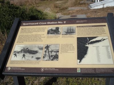
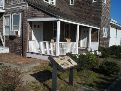
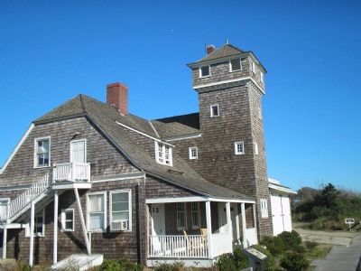
Commerce in and out of New York Harbor made the waters off Sandy Hook the busiest in the country. Surfmen stationed on Sandy Hook rescued hundreds of passengers and crew from ships wrecked along the coast. The Spermaceti Cove station, built in 1894, replaced an earlier one near the same site.
U.S. Life-Saving Service
During the 1870s, the United States Life-Saving Service (USLSS) was officially established to patrol the coast and rescue people stranded by shipwrecks. By 1900, forty-two Life-Saving Stations were operating along the New Jersey coast. In all, over 270 stations were built along the Atlantic, Pacific, Gulf, and Great Lakes shorelines. When the U.S. Coast Guard was established in 1915, it assumed the search and rescue mission of the U.S. Life-Saving Service.
Erected by National Park Service, State of New Jersey Division of Parks & Forestry.
Topics. This historical marker is listed in this topic list: Waterways & Vessels. A significant historical year for this entry is 1894.
Location. 40° 25.597′ N, 73° 59.048′ W. Marker is in Middletown Township, New Jersey, in Monmouth County. It is in Sandy Hook. Marker can be reached from Hartshorne Drive, on the right when traveling north. Marker is located at the Sandy Hook Visitor Center. Touch for map. Marker is in this post office area: Highlands NJ 07732, United States of America. Touch for directions.
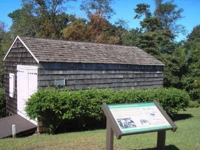
Other nearby markers. At least 8 other markers are within 2 miles of this marker, measured as the crow flies. Sandy Hook (within shouting distance of this marker); U.S. Life-Saving Station / Spermaceti Cove - Holly Forest (about 300 feet away, measured in a direct line); a different marker also named Sandy Hook (approx. 0.2 miles away); Discover Sandy Hook (approx. 0.2 miles away); Nike Missile Site (approx. half a mile away); a different marker also named Sandy Hook (approx. ¾ mile away); British Embarkation (approx. 1.4 miles away); a different marker also named Sandy Hook (approx. 1.4 miles away). Touch for a list and map of all markers in Middletown Township.
More about this marker. The top of the marker contains two old photographs. One depicts “Station Keeper Captain Joel Wooley, on far right, outside Spermaceti Cove Life-Saving Station No. 2, circa 1900.” The other shows “The British ship ‘County of Edinburg’, grounded off Squan Beach, New Jersey in February 1900.” Two photographs at the bottom of the marker are of USLSS surfmen at work. One has a caption of “Launching the Life Boat at Sea Bright. Life Saving
equipment included a lifeline fired from shore to ships in distress, a life boat rowed out from shore, and a lifecar shuttled between ship and shore. (From Frank Leslie’s Illustrated Newspaper, February 1, 1873).” The second photograph has the caption “One way USLSS surfmen rescued passengers was by firing a projectile, with a rope attached, over the ship’s mast. Heavier lines were then used to haul victims back to shore in a ‘breeches buoy’. From ‘The Illustrated London News’, October 1886.”
The lower right of the marker features a map of the New Jersey and southern Long Island coastline indicating the locations of Life-Saving Stations.
Also see . . . New Jersey Coastal Heritage Trail Route. National Park Service website. (Submitted on September 21, 2009, by Bill Coughlin of Woodland Park, New Jersey.)
Credits. This page was last revised on February 7, 2023. It was originally submitted on September 21, 2009, by Bill Coughlin of Woodland Park, New Jersey. This page has been viewed 959 times since then and 13 times this year. Photos: 1, 2, 3, 4. submitted on September 21, 2009, by Bill Coughlin of Woodland Park, New Jersey.


