Capron in Southampton County, Virginia — The American South (Mid-Atlantic)
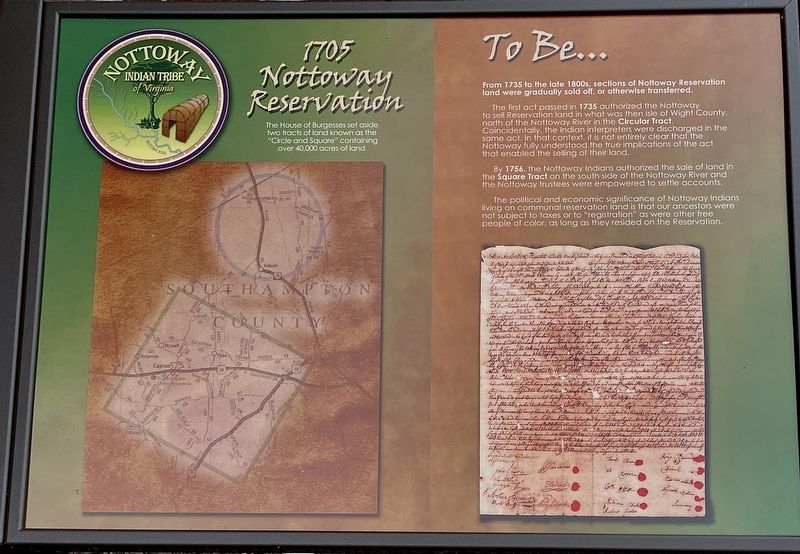
1705 Nottoway Reservation
Nottoway Indian Tribe of Virginia
The House of Burgesses set aside two tracts of land known as the "Circle and Square" containing over 40,000 acres of land.
To Be…
From 1735 to the late 1800s, sections of Nottoway Reservation land were gradually sold off, or otherwise transferred.
The first act passed in 1735 authorized the Nottoway to sell Reservation land in what was then Isle of Wight County, north of the Nottoway River in the Circular Tract. Coincidentally, the Indian interpreters were discharged in the same act. In that context, it is not entirely clear that the Nottoway fully understood the true implications of the act that enabled the selling of their land.
By 1756, the Nottoway Indians authorized the sale of land in the Square Tract on the south side of the Nottoway River and the Nottoway trustees were empowered to settle accounts.
The political and economic significance of Nottoway Indians living on communal reservation land is that our ancestors were not subject to taxes or to "registration" as were other free people of color, as long as they resided on the Reservation.
Erected by Nottoway Indian Tribe of Virginia.
Topics. This historical marker is listed in these topic lists: Colonial Era • Native Americans. A significant historical year for this entry is 1705.
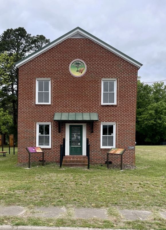
Location. 36° 42.374′ N, 77° 12.169′ W. Marker is in Capron, Virginia, in Southampton County. Marker is at the intersection of Main Street and Southampton Parkway (U.S. 58), on the right when traveling south on Main Street. This marker is located in front of the Nottoway Indian Tribe of Virginia Community House and Interpretive Center. Touch for map. Marker is at or near this postal address: 23186 Main Street, Capron VA 23829, United States of America. Touch for directions.
Other nearby markers. At least 8 other markers are within 8 miles of this marker, measured as the crow flies. From Barter… To Buffer… (here, next to this marker); Nottoway Indian History (a few steps from this marker); Dred Scott And The Blow Family (approx. 3.4 miles away); Buckhorn Quarters (approx. 3.4 miles away); Blackhead Signpost Road (approx. 5 miles away); Nottoway Indians (approx. 5.3 miles away); Nat Turner’s Insurrection (approx. 6.1 miles away); Helping Hand Cemetery (approx. 7.4 miles away). Touch for a list and map of all markers in Capron.
Also see . . .
1. Nottoway Indian Tribe of Virginia Community House and Interpretive Center. (Submitted on June 16, 2023, by Brandon D Cross of Flagler Beach, Florida.)
2. Nottoway Indian Tribe of Virginia. (Submitted on June 16, 2023, by Brandon D Cross of Flagler Beach, Florida.)
Credits. This page was last revised on June 17, 2023. It was originally submitted on June 16, 2023, by Brandon D Cross of Flagler Beach, Florida. This page has been viewed 112 times since then and 24 times this year. Photos: 1, 2. submitted on June 16, 2023, by Brandon D Cross of Flagler Beach, Florida. • Bernard Fisher was the editor who published this page.

