Capron in Southampton County, Virginia — The American South (Mid-Atlantic)
From Barter… To Buffer…
Nottoway Indian Tribe of Virginia
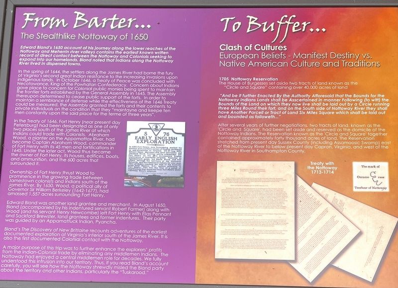
The Stealthlike Nottoway of 1650
Edward Bland’s 1650 account of his journey along the lower reaches of the Nottoway and Meherrin river valleys contains the earliest known written record of direct contact between the Nottoway and Colonials seeking to expand into our homelands. Bland noted that Indians along the Nottoway River lived in dispersed towns.
In the spring of 1644, the settlers along the James River had borne the fury of Virginia's second great Indian resistance to the increasing invasions upon Indigenous lands. In October 1646, a Treaty of Peace was concluded with Necotowance, King of the Powhatan Confederacy. Concern about Indians gave place to concern for Colonial public monies being spent to maintain the frontier forts established by the General Assembly in 1645. The Assembly thereupon determined to cease public support of the forts. In order to maintain a semblance of defense while the effectiveness of the 1646 Treaty could be measured, the Assembly granted the forts and their contents to private individuals on the condition that they "maintayne and keepe ten men constantly upon the said place for the terme of three years".
In the Treaty of 1646, Fort Henry (near present day Petersburg) had been designated as one of only two places south of the James River at which Indians could trade with Colonists. Abraham Wood, a planter on the Appomattox River, had become Captain Abraham Wood, commander of Fort Henry with its 45 men and fortifications in 1645. Under the later act, Wood thus became the owner of Fort Henry, its houses, edifices, boats, and ammunition, and the 600 acres that surrounded it.
Ownership of Fort Henry thrust Wood to prominence in the growing trade between Jamestown colonists and Indians south of the James River. By 1650, Wood, a political ally of Governor Sir William Berkeley (1642-1677), had amassed 1,557 acres surrounding Fort Henry.
Edward Bland was another land grantee and merchant. In August 1650, Bland (accompanied by his indentured servant Robert Farmer) along with Wood (and his servant Henry Newcombe) left Fort Henry with Élias Pennant and Sackford Brewster, land grantees and former indentures. Their party was guided by an Appamattuck Indian, Pyancha.
Bland's The Discovery of New Brittaine recounts adventures of the earliest documented exploration of Virginia's interior south of the James River. It is also the first documented Colonial contact with the Nottoway.
A major purpose of this trip was to further enhance the explorers' profits from the Indian-Colonial trade by eliminating any middlemen Indians. The Nottoway had enjoyed a central middlemen role for decades. We fully understood this intrusion into our territory. Thus, if you read Bland's account carefully, you will see how the Nottoway shrewdly misled the Bland party about the territory and other Indians, particularly the "Tuskarood."
Clash of Cultures
European Beliefs - Manifest Destiny vs. Native American Culture and Traditions
1705 Nottoway Reservation
The House of Burgesses set aside two tracts of land known as the "Circle and Square" containing over 40,000 acres of land.
"And be it further Enacted By the Authority Afforesaid that the Bounds for the Nottoway Indians Lands shall be Asscertained in manner Following (to Whitt) the Bounds of the Land on which they now live shall be laid out by a three Miles Round their fort, and on the South side of Nottoway River they shall have Another Parcell or Tract of Land Six Miles Square which shall be laid out and bounded as followeth…”
After several years of further negotiations, two tracts of land, known as the Circle and Square, had been set aside and reserved as the domicile of the Nottoway Indians. The Reservation known as the 'Circle and Square' together contained approximately forty thousand acres of land. The Reservation stretched from present day Sussex County (including Assamoosic Swamp) east of the Nottoway River to below present day Capron, Virginia, and west of the Nottoway River in Southampton County.
(caption) Treaty with the Nottoway 1713-1714
Erected by Nottoway Indian Tribe of Virginia.
Topics. This historical marker is listed in these topic lists: Colonial Era • Native Americans • Settlements & Settlers. A significant historical month for this entry is October 1646.
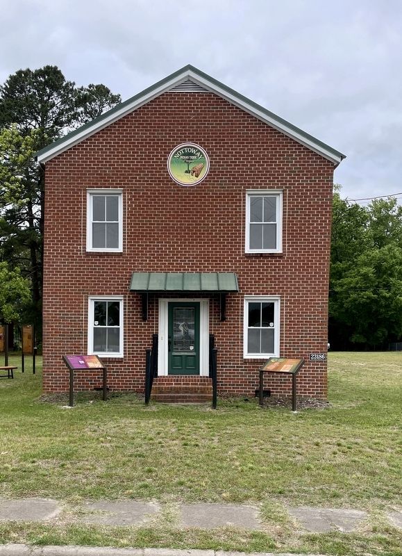
Location. 36° 42.372′ N, 77° 12.171′ W. Marker is in Capron, Virginia, in Southampton County. Marker is at the intersection of Main Street and Southampton Parkway (U.S. 58), on the right when traveling south on Main Street. This marker is located in front of the Nottoway Indian Tribe of Virginia Community House and Interpretive Center. Touch for map. Marker is at or near this postal address: 23186 Main Street, Capron VA 23829, United States of America. Touch for directions.
Other nearby markers. At least 8 other markers are within 8 miles of this marker, measured as the crow flies. 1705 Nottoway Reservation (here, next to this marker); Nottoway Indian History (a few steps from this marker); Dred Scott And The Blow Family (approx. 3.4 miles away); Buckhorn Quarters (approx. 3.4 miles away); Blackhead Signpost Road (approx. 5 miles away); Nottoway Indians (approx. 5.3 miles away); Nat Turner’s Insurrection (approx. 6.1 miles away); Helping Hand Cemetery (approx. 7.4 miles away). Touch for a list and map of all markers in Capron.
Also see . . .
1. Nottoway Indian Tribe of Virginia Community House and Interpretive Center. (Submitted on June 16, 2023, by Brandon D Cross of Flagler Beach, Florida.)
2. Nottoway Indian Tribe of Virginia. (Submitted on June 16, 2023, by Brandon D Cross of Flagler Beach, Florida.)
Additional keywords. From Barter… To Buffer…
Credits. This page was last revised on June 17, 2023. It was originally submitted on June 16, 2023, by Brandon D Cross of Flagler Beach, Florida. This page has been viewed 89 times since then and 22 times this year. Photos: 1, 2. submitted on June 16, 2023, by Brandon D Cross of Flagler Beach, Florida. • Bernard Fisher was the editor who published this page.

