South Riding in Loudoun County, Virginia — The American South (Mid-Atlantic)
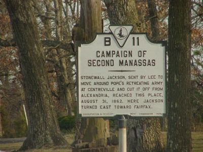
Campaign of Second Manassas
Erected 1929 by Conservation & Development Commission. (Marker Number B-11.)
Topics and series. This historical marker is listed in this topic list: War, US Civil. In addition, it is included in the Virginia Department of Historic Resources (DHR) series list. A significant historical year for this entry is 1862.
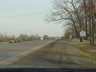
Location. 38° 54.809′ N, 77° 28.768′ W. Marker is in South Riding, Virginia, in Loudoun County. Marker is on John Mosby Highway (U.S. 50) west of Pleasant Valley Road (the one in Loudoun County), on the right when traveling east. Marker is near the border with Fairfax County. U.S. Route 50 is called Lee Jackson Memorial Highway in Fairfax County. Touch for map. Marker is in this post office area: Chantilly VA 20152, United States of America. Touch for directions.
Other nearby markers. At least 8 other markers are within 3 miles of this marker, measured as the crow flies. The Distinguished Flying Cross Society (approx. 2 miles away); F-100 Super Sabre Society (approx. 2 miles away); F-86 Sabre Pilots Association (approx. 2 miles away); The Flying Tigers (approx. 2 miles away); Piedmont Airlines (approx. 2 miles away); The Tuskegee Airmen (approx. 2 miles away); What is Foamhenge at Cox Farms? (approx. 2.4 miles away); The Settle-Dean Cabin (approx. 2˝ miles away).
More about this marker. There is a newer marker with this same number titled “Battle of Chantilly” (which see) on the Fairfax County Parkway in Fairfax County.
Related markers. Click here for a list of markers that are related to this marker. To better understand the relationship, study each marker in the order shown.
Also see . . . 2nd Bull Run Campaign, VA. (Submitted on February 16, 2006.)
Additional keywords. Civil War
Credits. This page was last revised on July 14, 2019. It was originally submitted on February 16, 2006, by J. J. Prats of Powell, Ohio. This page has been viewed 2,357 times since then and 28 times this year. Last updated on September 3, 2007, by Craig Swain of Leesburg, Virginia. Photos: 1, 2. submitted on February 16, 2006, by J. J. Prats of Powell, Ohio.

