Highlands in Monmouth County, New Jersey — The American Northeast (Mid-Atlantic)
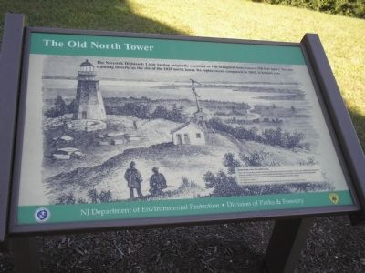
The Old North Tower
Photographed by Bill Coughlin, September 20, 2009
1. The Old North Tower Marker
The Navesink Highlands Light Station originally consisted of two octagonal stone towers 320 feet apart. You are standing directly on the site of the 1828 north tower. Its replacement, completed in 1862, is behind you.
[Caption:]
Sandy Hook, from the Lighthouses.
This 1861 illustration shows the first north tower and the foundation of the new lighthouse being laid. The two smaller structures on the lighthouse property are the New York Sandy Hood Telegraph Company (1854) and the Merchants Exchange semaphore tower (1829).
Erected by NJ Department of Environmental Protection, Division of Parks & Forestry.
Topics and series. This historical marker is listed in these topic lists: Notable Buildings • Waterways & Vessels. In addition, it is included in the Lighthouses series list. A significant historical year for this entry is 1828.
Location. This marker has been replaced by another marker nearby. It was located near 40° 23.798′ N, 73° 59.153′ W. Marker was in Highlands, New Jersey, in Monmouth County. It could be reached from Lighthouse Road. Marker is located at the Twin Lights Historic Site. Touch for map. Marker
this page online

Regionally, this marker was in New Jersey’s Central Jersey, specifically on the Jersey Shore, and in the New York City Metropolitan Area. It was also in the American Northeast, in the Mid-Atlantic, and on the Eastern Seaboard. Globally, it was in the North Atlantic Region, North America, the Western Hemisphere, the Western World, and the Anglosphere. Historically, it found itself in what was once New Netherland and also one of the original Thirteen Colonies.
Other nearby markers. At least 8 other markers are within walking distance of this location: The Navesink Light Station (here, next to this marker); a different marker also named Navesink Light Station (here, next to this marker); Spermaceti Cove Life Saving Station (within shouting distance of this marker); Spermaceti Cove Lifesaving Station (within shouting distance of this marker); Powerhouse (within shouting distance of this marker); a different marker also named Telegraph and Radar at Twin Lights (within shouting distance of this marker); a different marker
Photographed by Bill Coughlin, September 20, 2009
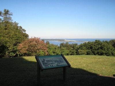
2. Twin Light Marker
Other markers no longer nearby. Telegraph and Radar at Twin Lights (was here, next to this marker but has been replaced with another marker now near it); Marconi at Twin Lights (was here, next to this marker but has been replaced with another marker now near it); Spermaceti Cove Lifeboat Station (was a few steps from this marker but has been replaced with another marker now near it); The Navesink Highlands Light Station (was within shouting distance of this marker but has been replaced with another marker now near it).
More about this marker. The background of the marker contains a picture of the original north tower at Navesink. It has a caption of “Sandy Hook, from the Lighthouses. This 1861 illustration shows the first north tower and the foundation of the new lighthouse being laid. The two smaller structures on the lighthouse property are the New York Sandy Hook Telegraph Company (1854) and the Merchants Exchange
Photographed by Bill Coughlin, September 20, 2009
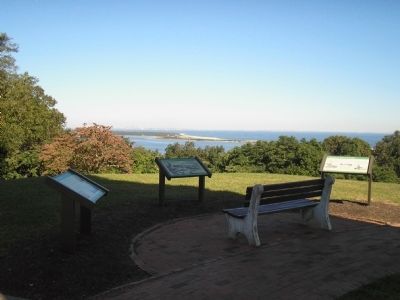
3. Markers at Twin Lights Historic Site
Several markers are found at this location. The "Old North Tower" marker is the one in the center of the photo.
Related marker. Click here for another marker that is related to this marker. This marker has been replaced with the linked marker.
Also see . . . Navesink Twin Lights. Wikipedia entry (Submitted on April 3, 2021, by Larry Gertner of New York, New York.)
Photographed by Bill Coughlin, September 20, 2009
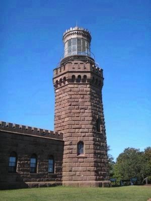
4. The New North Tower
This tower replaced the Old North Tower mentioned on the marker.
Photographed by Bill Coughlin, September 20, 2009
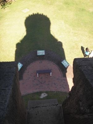
5. The Old North Tower Marker
The Old North Tower Marker (center) as viewed from the top of the present North Tower.
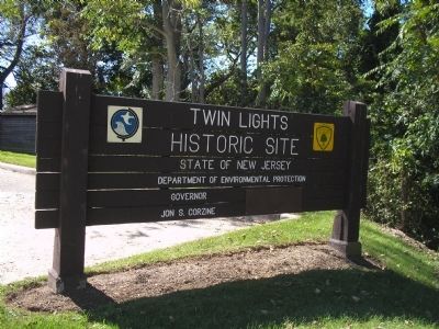
Photographed by Bill Coughlin, September 20, 2009
6. Twin Lights Historic Site
The marker is located at the Twin Lights Historic Site
Credits. This page was last revised on October 19, 2022. It was originally submitted on September 21, 2009, by Bill Coughlin of Woodland Park, New Jersey. This page has been viewed 948 times since then and 41 times this year. Photos: 1, 2, 3, 4, 5, 6. submitted on September 21, 2009, by Bill Coughlin of Woodland Park, New Jersey.
