Kingsbridge in the Bronx in Bronx County, New York — The American Northeast (Mid-Atlantic)
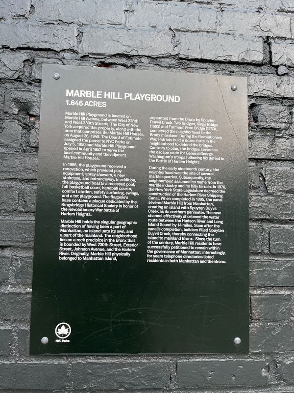
Marble Hill Playground
1.646 Acres
Marble Hill Playground is located on Marble Hill Avenue, between West 228th and West 230th Streets. The City of New York acquired this property, along with the area that comprises the Marble Hill Houses, on August 26, 1948. The Board of Estimate assigned the parcel to NYC Parks on July 5, 1950 and Marble Hill Playground opened in April 1952 to serve the local community and the adjacent Marble Hill Houses.
In 1986, the playground received a renovation, which provided play equipment, spray showers, a new staircase, and entraceway. In addition, the playground boasts a recessed pool, full basketball court, handball courts, comfort station, safety surfacing, swings, and a tot playground. The flagpole's base contains a plaque dedicated by the Kingsbridge Historical Society in honor of the Revolutionary War battle of Harlem Heights.
Marble Hill holds the singular geographic distinction of having been a part of Manhattan, an island unto its own, and a part of the mainland. The neighborhood lies on a rock precipice in the Bronx that is bounded by West 230th Street, Exterior Street, Johnson Avenue, and the Harlem River. Originally, Marble Hill physically belonged to Manhattan Island, separated from the Bronx by Spuyten Duyvil Creek. Two bridges, Kings Bridge (1693) and Farmers' Free Bridge (1759), connected the neighborhood to the Bronx mainland. During the Revolutionary War, Patriots built a dozen forts in the neighborhood to defend the bridges. Contrary to plan, the bridges served as the escape route for General George Washington's troops following his defeat in the Battle of Harlem Heights.
During the early nineteenth century, the neighborhood was the site of several marble quarries. Subsequently, the neighborhood assumed its name from the marble industry and its hilly terrain. In 1876, the New York State Legislature decreed the construction of the Harlem River Shipping Canal. When completed in 1895, the canal severed Marble Hill from Manhattan, creating an island with Spuyten Duyvil Creek as its northern perimeter. The new channel effectively shortened the water route between the Hudson River and Long Island Sound by 14 miles. Soon after the canal's completion, builders filled Spuyten Duyvil Creek, thereby connecting the island to mainland Bronx. Since the turn of the century, Marble Hill residents have successfully petitioned to remain within the governance of Manhattan; interestingly, for years telephone directories listed residents in both Manhattan and the Bronx.
Erected by NYC Parks.
Topics and series. This historical marker is listed in these topic lists: Parks & Recreational Areas • Political Subdivisions • War, US Revolutionary • Waterways & Vessels. In addition, it is included in the NYC Parks series list. A significant historical month for this entry is April 1952.
Location. 40° 52.664′ N, 73° 54.475′ W. Marker is in Bronx, New York, in Bronx County. It is in Kingsbridge. Marker is at the intersection of West 230th Street and Marble Hill Avenue, on the left when traveling west on West 230th Street. Touch for map. Marker is at or near this postal address: 237 West 230th Street, Bronx NY 10463, United States of America. Touch for directions.
Other nearby markers. At least 8 other markers are within one mile of this marker, measured as the crow flies. The Wading Place / Kings Bridge / Fort Prince Charles (about 400 feet away, measured in a direct line); Original King's Bridge (about 400 feet away); Carolina Baptist Church (approx. 0.2 miles away); Fort Number Four (approx. 0.6 miles away); Fort Independence Park (approx. 0.7 miles away); Shorakkopoch (approx. 0.9 miles away); The Hessian Military Hut (approx. one mile away); The Military Hut (approx. one mile away). Touch for a list and map of all markers in Bronx.
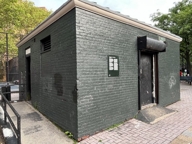
More about this marker. While the marker is on a facility in Marble Hill Playground and shares the history of how Marble Hill is part of the Borough of Manhattan, the border between Manhattan and the Bronx bisects the park. Hence, the marker is physically located in the Borough of the Bronx in the Kingsbridge neighborhood.
Credits. This page was last revised on June 19, 2023. It was originally submitted on June 19, 2023, by Devry Becker Jones of Washington, District of Columbia. This page has been viewed 79 times since then and 13 times this year. Photos: 1, 2. submitted on June 19, 2023, by Devry Becker Jones of Washington, District of Columbia.
Editor’s want-list for this marker. Photo of the Kingsbridge Historical Society plaque, possibly qualifying for its own profile. • Can you help?

