Sugar Hill in Manhattan in New York County, New York — The American Northeast (Mid-Atlantic)
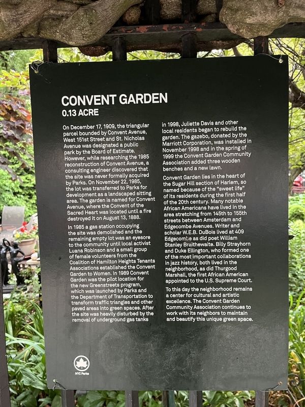
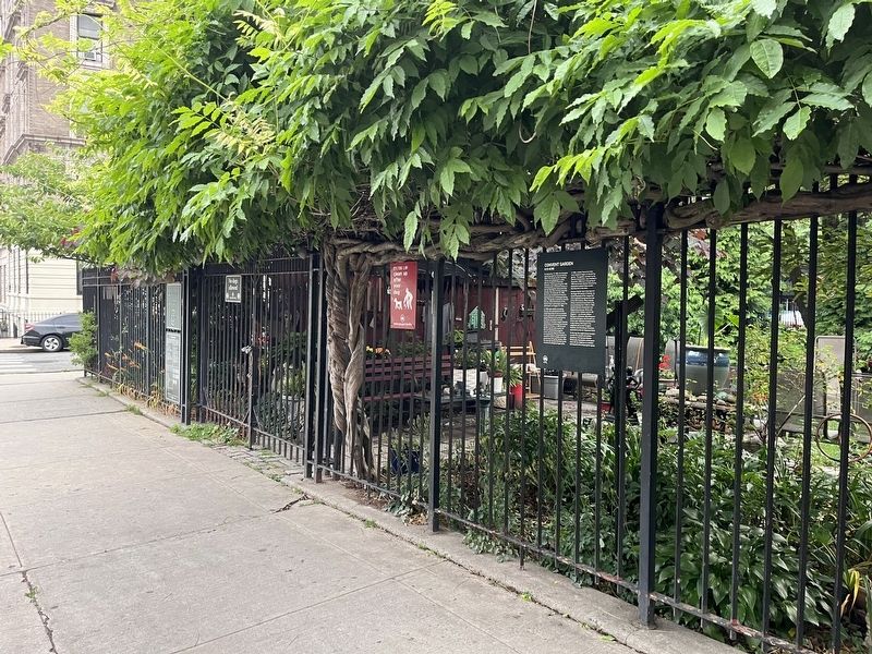
Convent Garden
0.13 Acre
On December 17, 1908, the triangular parcel bounded by Convent Avenue, West 151st Street and St. Nicholas Avenue was designated a public park by the Board of Estimate. However, while researching the 1985 reconstruction of Convent Avenue, a consulting engineer discovered that the site was never formally acquired by Parks. On November 22, 1985, the lot was transferred to Parks for development as a landscaped sitting area. The garden is named for Convent of the Sacred Heart was located until a fire destroyed it on August 13, 1888.
In 1985 a gas station occupying the site was demolished and the remaining empty lot was an eyesore to the community until local activist to the community until local activist Luana Robinson and a small group of female volunteers from the Coalition of Hamilton Heights Tenants Associations established the Convent Garden to Women. In 1989 Convent Garden was the pilot location for the new Greenstreets program, which was launched by Parks and the Department of Transportation to transform traffic triangles and other paved areas into green spaces. After the site was heavily disturbed by the removal of underground gas tanks in 1998, Juliette Davis and other local residents began to rebuild the garden. The gazebo, donated by the Marriott Corporation, was installed in November 1998 and in the spring of 1999 the Convent Garden Community Association added three wooden benches and a new lawn.
Convent Garden lies in the heart of the Sugar Hill section of Harlem, so named because of the "sweet life" of its residents during the first half of the 20th century. Many notable African Americans have lived in the area stretching from 145th the 155th streets between Amsterdam and Edgecombe Avenues. Writer and scholar W.E.B. DuBois lived at 409 Edgecombe as did poet William Stanley Braithewaite. Billy Strayhorn and Duke Ellington, who formed one of the most important collaborations in jazz history, both lived in the neighborhood, as did Thurgood Marshall, the first African American appointed to the U.S. Supreme Court.
To this day the neighborhood remains a center for cultural and artistic excellence. The Convent Garden Community Association continues to work with its neighbors to maintain and beautify this unique green space.
Erected by NYC Parks.
Topics. This historical marker is listed in these topic lists: African Americans • Arts, Letters, Music • Churches & Religion • Entertainment • Government & Politics • Parks & Recreational Areas • Settlements & Settlers • Women. A significant historical date for this entry is August 13, 1888.
Location. 40° 49.701′ N, 73° 56.555′ W. Marker is in Manhattan, New York, in New York County. It is in Sugar Hill. Marker is on St. Nicholas AVenue north of West 151st Street, on the right when traveling south. Touch for map. Marker is at or near this postal address: 826 St Nicholas Avenue, New York NY 10031, United States of America. Touch for directions.
Other nearby markers. At least 8 other markers are within walking distance of this marker. Middle Redoubt of the American Army 1776 (approx. 0.2 miles away); Sugar Hill Luminaries Lawn (approx. 0.2 miles away); Holcombe Rucker Park (approx. 0.3 miles away); Jackie Robinson Pool (approx. 0.3 miles away); Greg Marius Court (approx. 0.3 miles away); a different marker also named Holcombe Rucker Park (approx. 0.3 miles away); The Main Line of Defences (approx. 0.3 miles away); The Church of the Intercession (approx. 0.3 miles away). Touch for a list and map of all markers in Manhattan.
Credits. This page was last revised on June 19, 2023. It was originally submitted on June 19, 2023, by Devry Becker Jones of Washington, District of Columbia. This page has been viewed 76 times since then and 12 times this year. Photos: 1, 2. submitted on June 19, 2023, by Devry Becker Jones of Washington, District of Columbia.

