Roper in Washington County, North Carolina — The American South (South Atlantic)
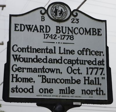
Edward Buncombe
1742-1778
Photographed by Dave W, June 21, 2023
1. Edward Buncombe Marker
Continental Line officer. Wounded and captured at Germantown, Oct. 1777. Home, “Buncombe Hall,” stood one mile north.
Erected 2014 by North Carolina. (Marker Number B-23.)
Topics. This historical marker is listed in these topic lists: Colonial Era • Settlements & Settlers • War, US Revolutionary. A significant historical month for this entry is October 1777.
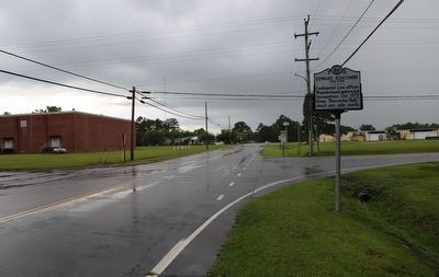
Location. 35° 52.54′ N, 76° 37.126′ W. Marker is in Roper, North Carolina, in Washington County. It is at the intersection of Buncombe Avenue and Cross Road, on the right when traveling west on Buncombe Avenue. Touch for map. Marker is at or near this postal address: 202 W Millpond Rd, Roper NC 27970, United States of America. Touch for directions.

Regionally, this marker is in North Carolina’s Coastal Plain. It is also in the American South, specifically in the Upper South, in the Tidewater, and on the Eastern Seaboard. Globally, it is in the North Atlantic Region, North America, the Western Hemisphere, the Western World, and the Anglosphere. Historically, it finds itself in what was once the territory of the Mississippian Culture, one of the
this page online
Other nearby markers. At least 8 other markers are within 7 miles of this marker, measured as the crow flies: Sleepy Hollow (a few steps from this marker); St. Luke's Episcopal Church (approx. 1.6 miles away); Mackeys Ferry (approx. 3.8 miles away); Battle of Plymouth (approx. 6 miles away); The Return of a Native (approx. 6.1 miles away); Naval Action (approx. 6.8 miles away); Plymouth Massacre (approx. 6.8 miles away); Fort Compher Battlefield (approx. 6.9 miles away). Touch for a list and map of all markers in Roper.
Other markers no longer nearby. Buncombe Hall (was here, next to this marker but has been replaced with another marker now near it); a different marker also named Mackeys Ferry (was approx. 3.8 miles away but has been confirmed missing); Ransom's Assault (was approx. 6.4 miles away but has been confirmed missing).
Related marker. Click here for another marker that is related to this marker. Old Marker At This Location titled "Buncombe Hall".
Photographed by Dave W, June 21, 2023
2. Edward Buncombe Marker
Credits. This page was last revised on June 22, 2023. It was originally submitted on June 22, 2023, by Dave W of Co, Colorado. This page has been viewed 292 times since then and 32 times this year. Photos: 1, 2. submitted on June 22, 2023, by Dave W of Co, Colorado. • Bernard Fisher was the editor who published this page.
