Williamsburg in James City County, Virginia — The American South (Mid-Atlantic)
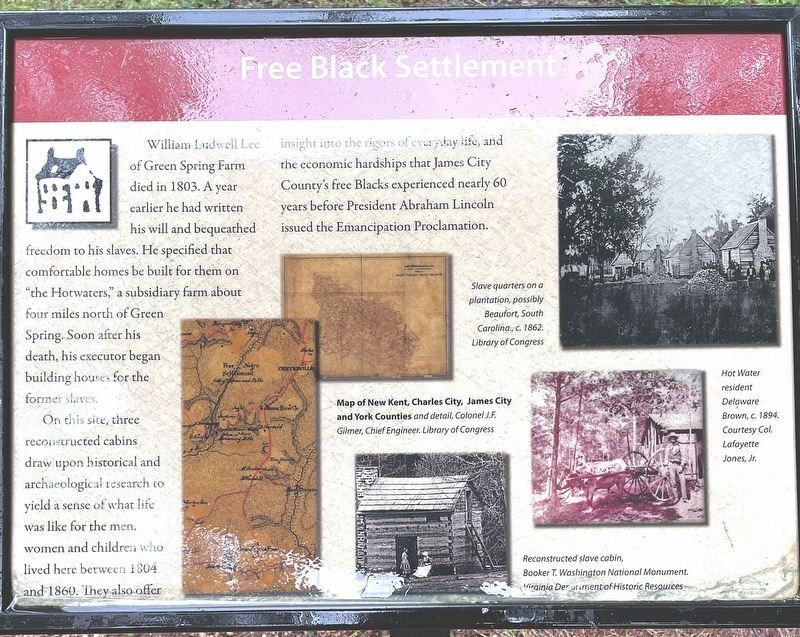
Free Black Settlement
Freedom Park
William Ludwell Lee of Green Spring Farm died in 1803. A year earlier he had written his will and bequeathed freedom to his slaves. He specified that comfortable homes be built for them on "the Hotwaters," a subsidiary farm about four miles north of Green Spring. Soon after his death, his executor began building houses for the former slaves.
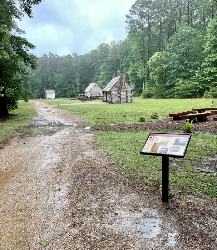
On this site, three reconstructed cabins draw upon historical and archaeological research to yield a sense of what life was like for the men, women and children who lived here between 1804 and 1860. They also offer insight into the rigors of everyday life and the economic hardships that James City County's free Blacks experienced nearly 60 years before President Abraham Lincoln issued the Emancipation Proclamation.
(captions)
Slave quarters on a plantation, possibly Beaufort, South Carolina., c. 1862. Library of Congress
Map of New Kent, Charles City, James City and York Counties and detail, Colonel J.F. Gilmer, Chief Engineer. Library of Congress
Hot Water resident Delaware Brown, c. 1894. Courtesy Col. Lafayette Jones, Jr.
Reconstructed slave cabin, Booker T. Washington National Monument. Virginia Department of Historic Resources
Erected by Freedom Park.
Topics. This historical marker is listed in these topic lists: African Americans • Parks & Recreational Areas • Settlements & Settlers. A significant historical year for this entry is 1803.
Location. 37° 19.077′ N, 76° 47.969′ W. Marker is in Williamsburg, Virginia, in James City County. Marker can be reached from Hotwater Trail, one mile west of Centerville Road (Virginia Route 614), on the left when traveling west. This marker is located on the grounds of Freedom Park within the Free Black Settlement section. Touch for map. Marker is at or near this postal address: 5537 Centerville Road, Williamsburg VA 23188, United States of America. Touch for directions.
Other nearby markers. At least 8 other markers are within 3 miles of this marker, measured as the crow flies. Jackson Home (within shouting distance of this marker); Brown Home (about 300 feet away, measured in a direct line); Lightfoot Home (about 400 feet away); Welcome to Freedom Park (about 500 feet away); Engagement at Spencer's Ordinary (about 500 feet away); Early Settlement and Cemetery (about 600 feet away); Hot Water / Centerville (approx. half a mile away); Six-Mile Ordinary (approx. 2.9 miles away). Touch for a list and map of all markers in Williamsburg.
Credits. This page was last revised on August 17, 2023. It was originally submitted on June 22, 2023, by Brandon D Cross of Flagler Beach, Florida. This page has been viewed 149 times since then and 74 times this year. Photos: 1, 2. submitted on June 22, 2023, by Brandon D Cross of Flagler Beach, Florida. • Bernard Fisher was the editor who published this page.

