
Morristown in Hamblen County, Tennessee — The American South (East South Central)
Cheek's Crossroads
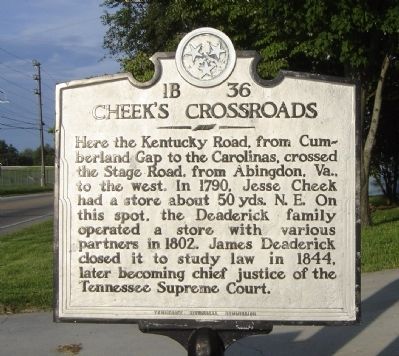
Photographed by Craig Swain, August 19, 2009
1. Cheek's Crossroads Marker
Erected by Tennessee Historical Commission. (Marker Number 1B 36.)
Topics and series. This historical marker is listed in these topic lists: Government & Politics • Roads & Vehicles • Settlements & Settlers. In addition, it is included in the Tennessee Historical Commission series list. A significant historical year for this entry is 1790.
Location. 36° 15.037′ N, 83° 12.697′ W. Marker is in Morristown, Tennessee, in Hamblen County. It is on E Andrew Johnson Highway (U.S. 11), on the right when traveling west. Touch for map. Marker is in this post office area: Morristown TN 37813, United States of America. Touch for directions.

Regionally, this marker is in East Tennessee. It is also in the American South, specifically in the Upper South, in Appalachia,
this page online
Other nearby markers. At least 8 other markers are within 4 miles of this marker, measured as the crow flies: Hayslope (approx. ¾ mile away); Bethesda Presbyterian Church (approx. 0.9 miles away); Russellville Area (approx. 0.9 miles away); Longstreet's Billet (approx. one mile away); Longstreet's Headquarters (approx. one mile away); Coffman House (approx. 2.2 miles away); Return From Kentucky (approx. 3.4 miles away); Crockett Tavern (approx. 3.7 miles away). Touch for a list and map of all markers in Morristown.
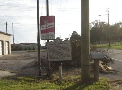
Photographed by Craig Swain, August 19, 2009
2. Cheek's Crossroads Marker
Credits. This page was last revised on June 16, 2016. It was originally submitted on September 23, 2009, by Craig Swain of Leesburg, Virginia. This page has been viewed 2,543 times since then and 69 times this year. Photos: 1, 2. submitted on September 23, 2009, by Craig Swain of Leesburg, Virginia.
