
Sandy Hook in Middletown Township in Monmouth County, New Jersey — The American Northeast (Mid-Atlantic)
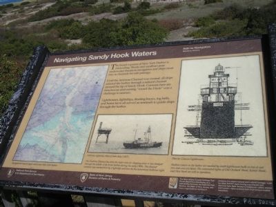
Navigating Sandy Hook Waters
Aids to Navigation
| — | Maritime History | — |
Photographed by Bill Coughlin, September 20, 2009
1. Navigating Sandy Hook Waters Marker
Until the Ambrose Channel was created, all ships entered the harbor through a natural channel around the tip of Sandy Hook. Currents here are treacherous and coming “round the Hook” was a challenge to seamen.
Lighthouses, lightships, floating buoys, fog bells, and horns have all served as sentinels to guide ships through the harbor.
Erected by National Park Service, State of New Jersey Division of Parks & Forestry.
Topics and series. This historical marker is listed in this topic list: Waterways & Vessels. In addition, it is included in the Lighthouses series list.
Location. 40° 28.3′ N, 74° 0.359′ W. Marker is in Middletown Township, New Jersey, in Monmouth County. It is in Sandy Hook. It can be reached from North Bragg Drive. Marker is in the Sandy Hook Unit of Gateway National Recreation Area, at the northern part of the peninsula. Touch for map. Marker is in this post office area: Highlands NJ 07732, United
this page online

Regionally, this marker is in New Jersey’s Central Jersey, specifically on the Jersey Shore, and in the New York City Metropolitan Area. It is also in the American Northeast, in the Mid-Atlantic, and on the Eastern Seaboard. Globally, it is in the North Atlantic Region, North America, the Western Hemisphere, the Western World, and the Anglosphere. Historically, it finds itself in what was once New Netherland and also one of the original Thirteen Colonies.
Other nearby markers. At least 8 other markers are within walking distance of this marker: Fort Hancock (about 500 feet away, measured in a direct line); The World War II Years (approx. 0.2 miles away); Chemical Laboratory (approx. ¼ mile away); Locomotive Engineer’s House (approx. ¼ mile away); Site of Master Mechanic’s Quarters (approx. ¼ mile away); Proving Ground Foreman’s House (approx. 0.3 miles away); Fort Hancock Officers’ Club (approx. 0.3 miles away); Barracks, School, Headquarters (approx. 0.4 miles away).
More about this marker. The left side of the map contains a Navigational map of Upper and Lower New
Photographed by Bill Coughlin, September 20, 2009
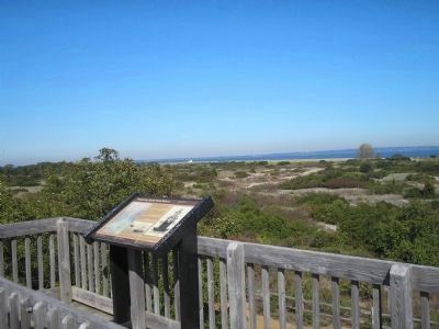
2. Sandy Hook Marker
The marker is part of the New Jersey Coastal Heritage Trail Route.
Also see . . . New Jersey Coastal Heritage Trail Route. National Park Service website. (Submitted on September 24, 2009, by Bill Coughlin of Woodland Park, New Jersey.)
Photographed by Bill Coughlin, September 20, 2009
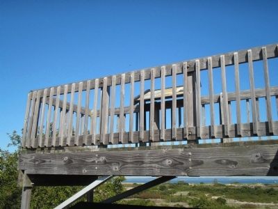
3. Observation Deck at Sandy Hook
The "Navigating Sandy Hook Waters" Marker is located on an observation deck on the beach.
Photographed by Bill Coughlin, September 20, 2009
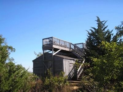
4. Navigating Sandy Hook Waters Marker
Marker can be seen here on the elevated observation deck on the Sandy Hook beach.
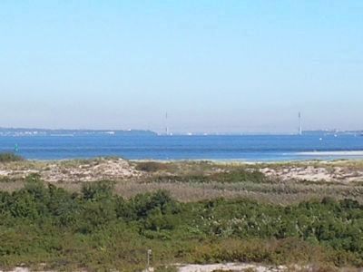
Photographed by Bill Coughlin, September 20, 2009
5. View from the Marker
New York Harbor as seen from the observation deck. The Verrazano – Narrows Bridge connecting Staten Island and Brooklyn is also visible in the photo.
Credits. This page was last revised on February 7, 2023. It was originally submitted on September 24, 2009, by Bill Coughlin of Woodland Park, New Jersey. This page has been viewed 1,552 times since then and 37 times this year. Photos: 1, 2, 3, 4, 5. submitted on September 24, 2009, by Bill Coughlin of Woodland Park, New Jersey.
