Richmond in Chesterfield County, Virginia — The American South (Mid-Atlantic)
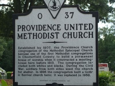
Providence United Methodist Church
Erected 1991 by Department of Historic Resources. (Marker Number O-37.)
Topics and series. This historical marker is listed in these topic lists: Churches & Religion • War, US Civil. In addition, it is included in the Virginia Department of Historic Resources (DHR) series list. A significant historical year for this entry is 1807.
Location. 37° 29.099′ N, 77° 32.95′ W. Marker is in Richmond, Virginia, in Chesterfield County. Marker is on South Providence Road near Midlothian, on the right when traveling north. Touch for map. Marker is at or near this postal address: 814 South Providence Road, Richmond VA 23236, United States of America. Touch for directions.
Other nearby markers. At least 8 other markers are within 5 miles of this marker, measured as the crow flies. Bethlehem Baptist Church (approx. 1.8 miles away); First Railroad in Virginia (approx. 2.7 miles away); Black Heath (approx. 3.9 miles away); Huguenot Settlement (approx. 3.9 miles away); Trabue's Tavern (approx. 4.4 miles away); Atlantic Coastline Railroad Bridge (approx. 4.4 miles away); Frederick William Sievers (approx. 4.4 miles away); Forest Hill Park (approx. 4.6 miles away). Touch for a list and map of all markers in Richmond.
Credits. This page was last revised on June 16, 2016. It was originally submitted on September 24, 2009, by Kelly Siech of Fort Rucker, Alabama. This page has been viewed 1,291 times since then and 34 times this year. Photo 1. submitted on September 24, 2009, by Kelly Siech of Fort Rucker, Alabama. • Craig Swain was the editor who published this page.
