Atlantic Highlands in Monmouth County, New Jersey — The American Northeast (Mid-Atlantic)
Highest Point on the Atlantic Seaboard
Mount Mitchill
— Coastal Habitats —
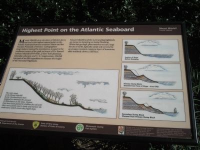
Mount Mitchill, at an elevation of 266 feet above sea level, is the highest natural point on the Atlantic Seaboard between southern Maine and the Yucatan Peninsula of Mexico. Cartographers (map makers) named the prominence, located in the southwest corner of the park, in honor of Dr. Samuel Latham Mitchill (1764-1831), a New York physician, naturalist, educator, and U. S. Congressman. Mitchill was part of an 1816 expedition to measure the height of the Navesink Highlands.
Mount Mitchill and the surrounding highlands are prone to slumping or slump blocking. When this geological phenomenon occurs, large blocks of earth, typically sandy soil covered by an erosion-resistant capstone layer of ironstone, slide suddenly down a cliff face.
Erected by National Park Service, State of New Jersey.
Topics. This historical marker is listed in this topic list: Natural Features. A significant historical year for this entry is 1816.
Location. 40° 24.481′ N, 74° 0.302′ W. Marker is in Atlantic Highlands, New Jersey, in Monmouth County. Marker is on Ocean Blvd, on the right when traveling north. Marker is located at the Mount Mitchill Scenic Overlook. Touch for map. Marker is at or near this postal address: 460 Ocean Boulevard, Atlantic Highlands NJ 07716, United States of America. Touch for directions.
Other nearby markers. At least 8 other markers are within one mile of this marker, measured as the crow flies. Friends of Monmouth County 9/11 Memorial (within shouting distance of this marker); Raritan Bay & New York Harbor (within shouting distance of this marker); Longshore Sediment Movement (within shouting distance of this marker); The Hartshorne Legacy (approx. 0.6 miles away); Captain Joshua Huddy — Prisoner of War (approx. 0.6 miles away); Henry Hudson Springs (approx. 0.8 miles away); British Campsite (approx. 0.8 miles away); a different marker also named British Campsite (approx. 1.1 miles away). Touch for a list and map of all markers in Atlantic Highlands.
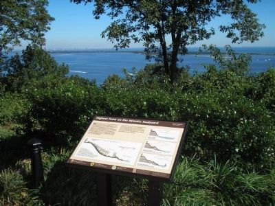
More about this marker. The bottom left of the marker contains a picture of the slope of Mount Mitchill with the caption “The view areas at the Mount Mitchill Scenic Overlook have been designed to minimize the amount of disturbance on the slope. Mature trees have been planted to stabilize the soil with their root systems and to shade and nurture the understory which covers this fragile slope.” The right side of the marker features a series of three pictures showing the profile of Mount Mitchill at various points in time. The first depicts a “Section of Slope Before Slumping.” The second shows the “Primary Slump Block Sheared from Face of Slope – circa 1782.” The last picture
displays the “Secondary Slump Block Sheared from Primary Slump Block.”
Also see . . .
1. Mount Mitchill Scenic Overlook. Monmouth County Park System website. (Submitted on September 24, 2009, by Bill Coughlin of Woodland Park, New Jersey.)
2. New Jersey Coastal Heritage Trail Route. National Park Service website. (Submitted on September 24, 2009, by Bill Coughlin of Woodland Park, New Jersey.)
Credits. This page was last revised on March 10, 2021. It was originally submitted on September 24, 2009, by Bill Coughlin of Woodland Park, New Jersey. This page has been viewed 4,639 times since then and 233 times this year. Photos: 1, 2, 3, 4. submitted on September 24, 2009, by Bill Coughlin of Woodland Park, New Jersey.


