Near Flovilla in Butts County, Georgia — The American South (South Atlantic)
Indian Springs
A Fortuitous Delay
| — | March to the Sea Heritage Trail | — |
Photographed by Duane and Tracy Marsteller, June 10, 2023
1. Indian Springs Marker
this page online
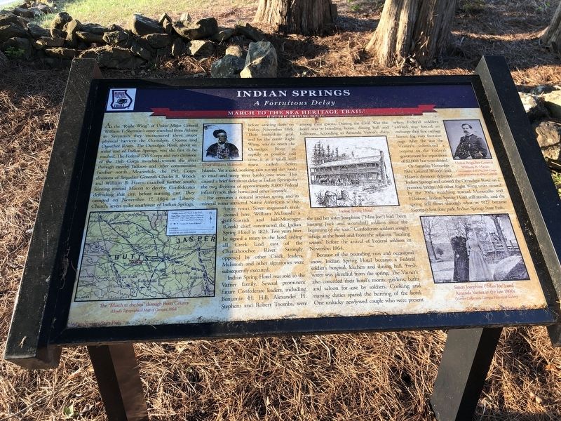
For centuries a natural artesian spring and its mineral water attracted Native Americans to this future resort. Seven stagecoach trails crossed here. William McIntosh, a half-Scottish and half-Muscogee (Creek) chief, constructed the Indian Spring Hotel in 1823. Two years later he signed a treaty in the hotel ceding all Creek land east of the Chattahoochee River. Strongly opposed by other Creek leaders, McIntosh and other signatories were subsequently executed.
Indian Spring Hotel was sold to the Varner family. Several prominent future Confederate leaders, including Benjamin H. Hill, Alexander H. Stephens and Robert Toombs, were among their guests. During the Civil War the hotel was a boarding house, dining hall and ballroom. According to Amanda Varner's diary, she and her sister Josephine (“Miss Joe”) had “been nursing [sick and wounded] soldiers since the beginning of the war.” Confederate soldiers sought refuge at the hotel and from the adjacent “healing waters” before the arrival of Federal soldiers in November 1864.
Because of the pounding rain and occasional snow, Indian Spring Hotel became
Photographed by Duane and Tracy Marsteller, June 10, 2023
2. Indian Springs Marker
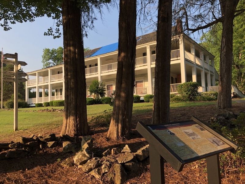
The Indian Spring Hotel is in the background.
On Saturday, November 19th, Generals Woods' and Hazen's divisions departed Indian Springs and crossed the Ocmulgee River on a pontoon bridge. All other Right Wing units crossed by the 20th, marching toward Monticello and Hillsboro. Indian Spring Hotel still stands, and the spring still flows through what in 1927 became Georgia's first state park, Indian Springs State Park.
[Captions]
• The “March to the Sea” through Butts County (Lloyd's Topographical Map of Georgia, 1864)
• Chief William McIntosh
• Indian Spring Hotel
• Union Brigadier General William B. Hazen Commander, 2nd Div., 15th Corps (after promotion to Major General)
• Sisters Josephine (“Miss Joe”) and Amanda Varner in the late 1800s (Varner Collection, Georgia Historical Society)
Erected by Georgia Civil War Heritage Trails. (Marker Number R6.)
Topics and series. This historical marker is listed in these topic lists: Industry & Commerce • War, US Civil • Waterways & Vessels. In addition, it is included in the Georgia Civil War Trails series list. A significant historical date for this entry is November 18, 1864.
Location. 33° 14.675′ N, 83° 55.231′ W. Marker is near Flovilla, Georgia, in Butts County. It is on State Highway 42 north of Harris Street. Marker is at the hotel driveway's connection with GA-42. Touch for map. Marker is at or near this postal address: 1807 GA-42, Flovilla GA 30216, United States of America. Touch for directions.

Regionally, this marker is in the Piedmont. It is also in the American South and specifically in the Deep South. Globally, it is in North America, the Western Hemisphere, the Western World, and the Anglosphere. Historically, it finds itself in what was once the territory of the Mississippian Culture, one of the original Thirteen Colonies, one of the Confederate States of America, and the Antebellum South.
Other nearby markers. At least 8 other markers are within 5 miles of this marker, measured as the crow flies: William McIntosh (within shouting distance of this marker); Sherman’s Right at Indian Springs (approx. 0.2 miles away); Indian Springs State Park (approx. 0.2 miles away); Indian Spring (approx. 0.2 miles away); “Idlewilde” (approx. ¼ mile away); Iron Springs (approx. 3.1 miles away); Kilpatrick at Cork (approx. 3.7 miles away); Jackson Veterans Memorial Park / All Gave Some, Some Gave All (approx. 4.3 miles away). Touch for a list and map of all markers in Flovilla.
Another marker is no longer nearby. McIntosh House (was about 400 feet away, measured in a direct line but has been confirmed missing).
Credits. This page was last revised on June 30, 2023. It was originally submitted on June 30, 2023, by Duane and Tracy Marsteller of Murfreesboro, Tennessee. This page has been viewed 693 times since then and 88 times this year. Photos: 1, 2. submitted on June 30, 2023, by Duane and Tracy Marsteller of Murfreesboro, Tennessee.
