Niantic in East Lyme in New London County, Connecticut — The American Northeast (New England)
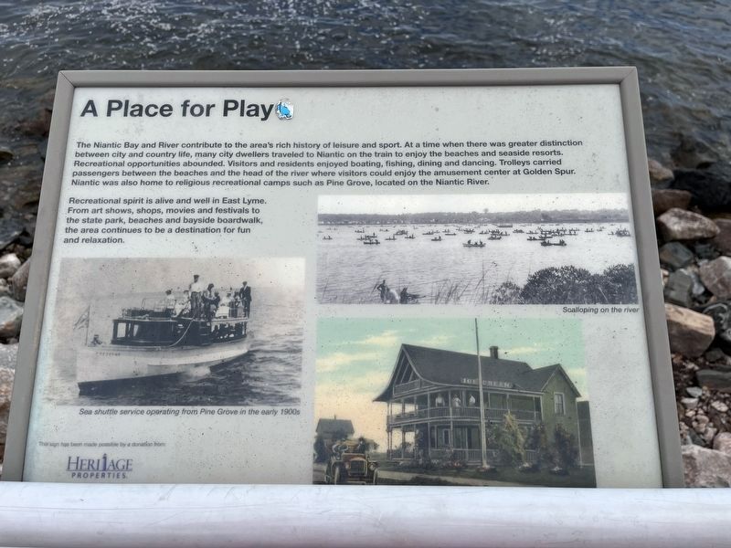
A Place for Play
The Niantic Bay and River contribute to the area's rich history of leisure and sport. At a time when there was greater distinction between city and country life, any city dwellers traveled to Niantic on the train to enjoy the beaches and seaside resorts. Recreational opportunities abounded. Visitors and residents enjoyed boating, fishing, dining and dancing. Trolleys carried passengers between the beaches and the head of the river where visitors could enjoy the amusement center at Golden Spur. Niantic was also home to religious recreational camps such as Pine Cove, located on the Niantic River.
Recreational spirit is alive and well in East Lyme. From art shows, shops, movies and festivals to the state park, beaches and bayside boardwalk, the area continues to be a destination for fun and relaxation.
Erected by East Lyme Public Trust Foundation, Inc., with funding by Heritage Properties.
Topics. This historical marker is listed in these topic lists: Churches & Religion • Parks & Recreational Areas • Railroads & Streetcars • Waterways & Vessels.
Location. 41° 19.357′ N, 72° 11.577′ W. Marker is in East Lyme, Connecticut, in New London County. It is in Niantic. Marker is on Boardwalk, 0.2 miles east of Baptist Lane, on the right when traveling east. Touch for map. Marker is at or near this postal address: 30 Main Street, Niantic CT 06357, United States of America. Touch for directions.
Other nearby markers. At least 8 other markers are within 3 miles of this marker, measured as the crow flies. The Iron Horse (about 300 feet away, measured in a direct line); A Glimpse into the Past (about 400 feet away); McCook Point (about 400 feet away); East Lyme Veterans Memorial (about 400 feet away); East Lyme Honor Roll (about 400 feet away); The Hole in the Wall (approx. 0.2 miles away); East Lyme (approx. 0.4 miles away); Bride Brook (approx. 2.6 miles away). Touch for a list and map of all markers in East Lyme.
Credits. This page was last revised on March 27, 2024. It was originally submitted on June 30, 2023, by Devry Becker Jones of Washington, District of Columbia. This page has been viewed 55 times since then and 9 times this year. Photos: 1, 2. submitted on June 30, 2023, by Devry Becker Jones of Washington, District of Columbia.

