Fort Garland in Costilla County, Colorado — The American Mountains (Southwest)
Fort Garland
2001
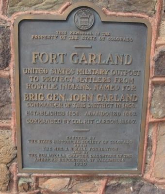
1. Fort Garland Marker
Property of the State of Colorado
———
Fort Garland
United States military outpost
to protect settlers from
hostile Indians. Named for
Brig. Gen. John Garland
Commander of this district in 1858
Established 1858. Abandoned 1883
Commanded by Col. Kit Carson 1866-7
———
Erected 1930 by Historical Society of Colorado, Mrs. J.N. Hall Foundation and Huajatolla Chapter, Daughters of the American Revolution. (Marker Number 16.)
Topics and series. This historical marker is listed in these topic lists: Forts and Castles • Indigenous Peoples and Communities • Settlements & Settlers. In addition, it is included in the Buffalo Soldiers, the Daughters of the American Revolution (DAR), and the History Colorado series lists. A significant historical year for this entry is 1858.
Location. Marker has been permanently removed. It was located near 37° 25.455′ N, 105° 25.895′ W. Marker was in Fort Garland, Colorado, in Costilla County. It was on State Highway 159 0.2 miles south of U.S. 160, on the left when traveling north. Touch for map. Marker was at or near this postal address: 29477 Highway
this page online
We have been informed that this marker is no longer there and will not be replaced. This page is an archival view of what was.
Regionally, this marker was in the San Juan Mountains and in the San Luis Valley. It was also in the American Mountain West. Globally, it was in North America, the Rocky Mountains, the Western Hemisphere, the Western World, and the Anglosphere. Historically, it found itself in what was once New Spain and also the Republic of Texas.

Other nearby markers. At least 8 other markers are within 5 miles of this location, measured as the crow flies: A different marker also named Fort Garland (a few steps from this marker); Fort Garland / Buffalo Soldiers (within shouting distance of this marker); Costilla County Veterans Memorial (approx. 0.6 miles away); Welcome to El Valle De San Luis (approx. 3.8 miles away); Peacekeepers of the Frontier (approx. 3.8 miles away); Railroad Steams into El Valle de San Luis (approx. 3.8 miles away); Six Miles of Separation (approx. 3.8 miles away); Trails Through Time (approx. 4½ miles away). Touch for a list and map
2001
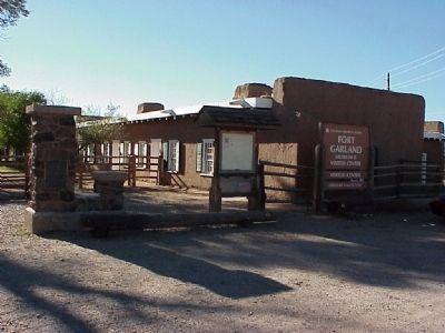
2. Fort Garland
Marker is located on the far left stone pillar.
Also see . . .
1. Fort Garland. Wikipedia article (Submitted on September 25, 2009.)
2. Fort Garland Museum. Colorado's Museum Trail website entry (Submitted on September 25, 2009.)
Additional keywords. Buffalo Soldiers, Ute Indians

Photographed by Cosmos Mariner, July 12, 2025
3. Fort Garland Marker
The marker has been removed from this stone pillar at the Fort Garland Museum - Fort Garland State Historical Monument entrance.
Credits. This page was last revised on August 10, 2025. It was originally submitted on September 25, 2009. This page has been viewed 2,059 times since then and 32 times this year. Photos: 1, 2. submitted on September 25, 2009. 3. submitted on August 10, 2025, by Cosmos Mariner of Cape Canaveral, Florida. • Syd Whittle was the editor who published this page.
