Atlantic Highlands in Monmouth County, New Jersey — The American Northeast (Mid-Atlantic)
Longshore Sediment Movement
Littoral Drift
— Coastal Habitats —
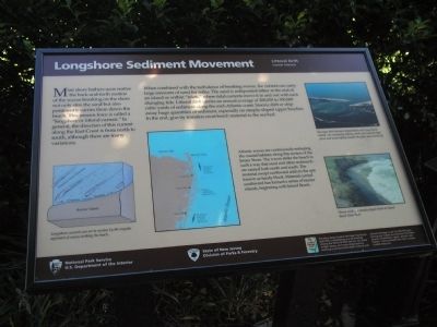
Most shore bathers soon realize the back-and-forth motion of the waves breaking on the shore not only stirs the sand but also persistently carries them down the beach. This unseen force is called a “longshore or littoral current.” In general, the direction of this current along the East Coast is from north to south, although there are many variations.
When combined with the turbulence of breaking waves, the current can carry large amounts of sand for miles. The sand is redeposited either at the end of an island or within “inlets,” where tidal currents move it in and out with each changing tide. Littoral drift carries an annual average of 200,000 to 300,000 cubic yards of sediment along the mid-Atlantic coast. Storms shift or strip away huge quantities of sediment, especially on steeply-sloped upper beaches. In the end, gravity transfers most beach material to the sea bed.
Atlantic waves are continuously reshaping the coastal habitats along this section of the Jersey Shore. The waves strike the beach in such a way that sand and other sediments are carried both north and south. The material swept northward adds to the spit known as Sandy Hook. Material carried southward has formed a series of barrier islands, beginning with Island Beach.
Erected by National Park Service, State of New Jersey.
Topics. This historical marker is listed in this topic list: Waterways & Vessels.
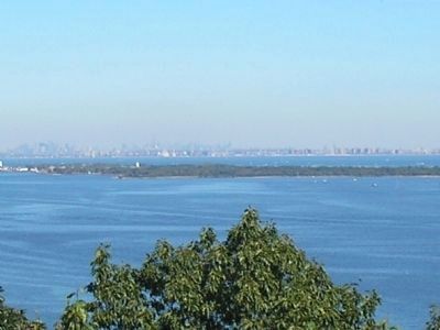
Location. 40° 24.463′ N, 74° 0.263′ W. Marker is in Atlantic Highlands, New Jersey, in Monmouth County. Marker can be reached from Ocean Blvd, on the right when traveling north. Marker is located in Mount Mitchill Scenic Overlook. Touch for map. Marker is in this post office area: Atlantic Highlands NJ 07716, United States of America. Touch for directions.
Other nearby markers. At least 8 other markers are within one mile of this marker, measured as the crow flies. Raritan Bay & New York Harbor (a few steps from this marker); Friends of Monmouth County 9/11 Memorial (within shouting distance of this marker); Highest Point on the Atlantic Seaboard (within shouting distance of this marker); Captain Joshua Huddy — Prisoner of War (approx. 0.6 miles away); The Hartshorne Legacy (approx. 0.6 miles away); Henry Hudson Springs (approx. 0.8 miles away); British Campsite (approx. 0.9 miles away); a different marker also named British Campsite (approx. 1.1 miles away). Touch for a list and map of all markers in Atlantic Highlands.
More about this marker. The bottom left of the marker contains an illustration of Longshore current generation and direction off the coast of a Barrier Island. It has a caption of “Longshore currents are set
in motion by the angular approach of waves striking the beach.” Next to this is a map of the Jersey Shore from Raritan Bay and Sandy Hook southward to Bay Head. Noted on the map are the northward and southward direction of sand movement and the position of the shoreline before erosion. On the right side of the marker are two photographs. The upper picture is of “Barnegat Inlet between Island Beach and Long Beach Island – its constantly shifting sands and currents both caress and unmercifully assault the plant and animal life.” Below this is a picture of “Waves eroding a steeply-sloped beach at Island Beach State Park.”
Also see . . .
1. New Jersey Coastal Heritage Trail Route. National Park Service website. (Submitted on September 25, 2009, by Bill Coughlin of Woodland Park, New Jersey.)
2. Mount Mitchill Scenic Overlook. Monmouth County Park System website. (Submitted on September 25, 2009, by Bill Coughlin of Woodland Park, New Jersey.)
Credits. This page was last revised on March 10, 2021. It was originally submitted on September 25, 2009, by Bill Coughlin of Woodland Park, New Jersey. This page has been viewed 1,300 times since then and 21 times this year. Photos: 1, 2, 3. submitted on September 25, 2009, by Bill Coughlin of Woodland Park, New Jersey.


