Middletown Township near Highlands in Monmouth County, New Jersey — The American Northeast (Mid-Atlantic)
Lighting the Way
Gateway National Recreation Area
— Sandy Hook —
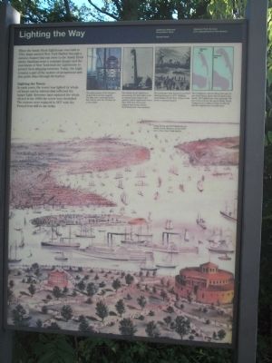
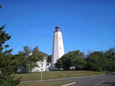
When the Sandy Hook Lighthouse was built in 1764, ships entered New York Harbor through a natural channel that ran close to the Sandy Hook shore. Sandbars were a constant danger and the merchants of New York built the Lighthouse to protect their shipping interests. Today, the Light remains a part of the system of navigational aids that guide ships through the harbor.
Lighting the Tower
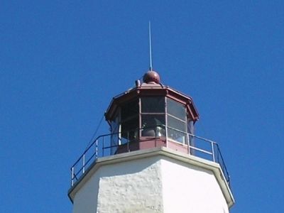
In early days, the tower was lighted by whale oil lamps and by mirrors that reflected the lamps’ lights. Kerosene later replaced the whale oil and in the 1920s the tower was electrified. The mirrors were replaced in 1857 with the Fresnel lens still in use today.
Erected by National Park Service, U.S. Department of the Interior.
Topics and series. This historical marker is listed in these topic lists: Landmarks • Waterways & Vessels. In addition, it is included in the Lighthouses series list. A significant historical year for this entry is 1764.
Location. 40° 27.644′ N, 74° 0.117′ W. Marker is near Highlands, New Jersey, in Monmouth County. It is in Middletown Township. Marker is on Gateway NRA Road, on the right when traveling north. Marker is located in the Fort Hancock Historic District, at the north end of the parking lot southwest of the lighthouse. Touch for map. Marker is in this post office area: Highlands NJ 07732, United States of America. Touch for directions.
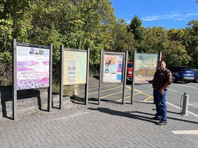
Other nearby markers. At least 8 other markers are within walking distance of this marker. Discover Sandy Hook (here, next to this marker); Sandy Hook (a few steps from this marker); Fire House Number 2 (within shouting distance of this marker); Mortar Battery (within shouting distance of this marker); Chow Time! (within shouting distance of this marker); Fill’er Up! (within shouting distance of this marker); Climate Crisis (about 300 feet away, measured in a direct line); Sarah Patterson Johnson (about 300 feet away). Touch for a list and map of all markers in Highlands.
More about this marker. The background of the marker contains a picture of many ships off lower Manhattan, with a caption of “Sandy Hook and the Highlands are visible in the distance in this early 1872 view of the New York harbor.” A series of pictures appear along the top of the marker. The first is a photo of a Fresnel lens and has a caption of “The glass prisms of the beehive-shaped Fresnel lens magnify the light into a powerful beam that can be seen for 19 miles on a clear night,” Next to this is a picture of the nearby lighthouse and the caption “The Sandy Hook Lighthouse was among the first lights built in America and today is the nation’s oldest lighthouse
Also see . . .
1. Sandy Hook Lighthouse, NJ. Lighthouse Friends website. (Submitted on September 26, 2009, by Bill Coughlin of Woodland Park, New Jersey.)
2. New Jersey Lighthouse Society. Website homepage (Submitted on September 26, 2009, by Bill Coughlin of Woodland Park, New Jersey.)
Credits. This page was last revised on February 7, 2023. It was originally submitted on September 26, 2009, by Bill Coughlin of Woodland Park, New Jersey. This page has been viewed 969 times since then and 10 times this year. Photos: 1. submitted on September 26, 2009, by Bill Coughlin of Woodland Park, New Jersey. 2. submitted on October 18, 2022, by Devry Becker Jones of Washington, District of Columbia. 3, 4. submitted on September 26, 2009, by Bill Coughlin of Woodland Park, New Jersey.


