Near Sharpsburg in Washington County, Maryland — The American Northeast (Mid-Atlantic)
The Maryland Campaign of 1862
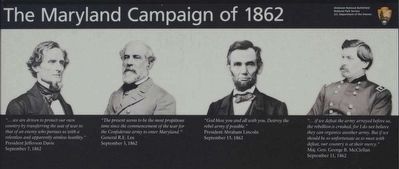
"...we are driven to protect our own country by transferring the seat of war to that of an enemy who pursues us with a relentless and apparently aimless hostility."
President Jefferson Davis
September 7, 1862
"The present seems to be the most propitious time since the commencement of the war for the Confederate army to enter Maryland."
General R.E. Lee
September 2, 1862
"God bless you and all with you. Destroy the rebel army if possible."
President Abraham Lincoln
September 15, 1862
"...if we defeat the army arrayed before us, the rebellion is crushed, for I do not believe they can organize another army. But if we should be so unfortunate as to meet with defeat, our country is at their mercy."
Maj. Gen. George B. McClellan
September 11, 1862
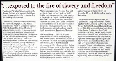
"...exposed to the fire of slavery and freedom"
That is how Pvt. Julius Rabardy described the chaos at Antietam as he lay on the battlefield, caught between the lines, his leg shattered by the musketry of both armies.
The Battle of Antietam was the culmination of the Maryland Campaign of 1862, the first invasion of the North by Confederate General Robert E. Lee and the Army of Northern Virginia. Southern armies were also advancing in Kentucky and Missouri as the tide of war flowed north. After Lee's dramatic victory at the Second Battle of Manassas during the last two days of August, he wrote to Confederate President Jefferson Davis that "we cannot afford to be idle." Lee wanted to keep the offensive and secure Southern independence through victory in the North; influence the fall mid-term elections; obtain much needed supplies; move the war out of Virginia, possibly into Pennsylvania; and to liberate Maryland, a Union state, but a slave-holding border state divided in its sympathies.
After splashing across the Potomac River and arriving in Frederick, Maryland, Lee boldly divided his army to capture the Union garrison at Harpers Ferry, Virginia (now West Virginia). The 12,000 Union soldiers there threatened Lee's vital link south. Gen. Thomas "Stonewall" Jackson and about half of the army were sent to capture the Union garrison. The rest of the Confederates moved north and west toward South Mountain and Hagerstown, Maryland.
In Washington, D.C., President Abraham Lincoln turned to Major General George B. McClellan to protect the capital and respond to the invasion. McClellan quickly reorganized the demoralized Army of the Potomac and advanced toward Lee. The armies first clashed on South Mountain where on September 14 the Confederates tried unsuccessfully to block the Federals at three mountain passes - Turners, Fox, and Crampton Gaps. Following the Confederate retreat from South Mountain, Lee considered returning to Virginia. However, with word of Jackson's capture of Harpers Ferry on September 15, Lee decided to make a stand at Sharpsburg.
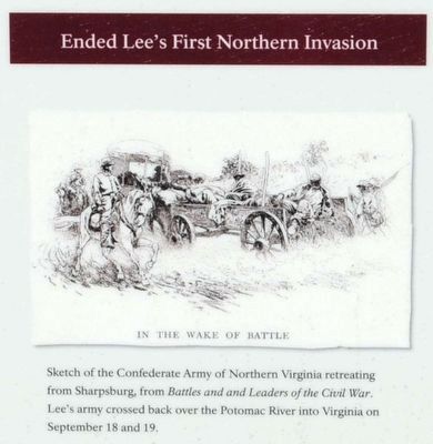
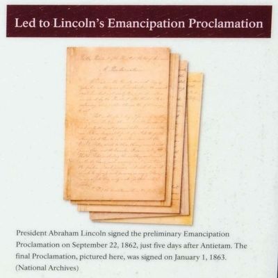
The twelve hour battle began at dawn on September 17. Savage, incomparable combat raged across the Cornfield, East Woods, West Woods, the Sunken Road, and Burnside Bridge as Lee shifted his men to withstand each of the Union thrusts. Despite more than 23,000 casualties of the nearly 100,000 engaged, both armies stubbornly held their ground as the sun set on the devastated landscape. The next day, September 18, the opposing armies gathered their wounded and buried their dead. That night Lee's army withdrew back across the Potomac to Virginia, ending Lee's first invasion of the North. Lee's retreat provided President Lincoln the opportunity he had been waiting for to issue the preliminary Emancipation Proclamation. Now the war had a dual purpose of preserving the Union and ending slavery.
Erected 2009 by Antietam National Battlefield - National Park Service - Department of the Interior.
Topics and series. This historical marker is listed in this topic list: War, US Civil. In addition, it is included in the Former U.S. Presidents: #16 Abraham Lincoln series list. A significant historical date for this entry is September 17, 1862.
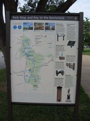
Location. 39° 28.452′ N, 77° 44.717′ W. Marker is near Sharpsburg, Maryland, in Washington County. Marker is on Dunker Church Road, on the right when traveling north. Located at the Antietam National Battlefield, in front of the visitor center. Touch for map. Marker is in this post office area: Sharpsburg MD 21782, United States of America. Touch for directions.
Other nearby markers. At least 10 other markers are within walking distance of this marker. Battlefield Namesake (a few steps from this marker); A Deadly Struggle (within shouting distance of this marker); Twentieth Regiment (within shouting distance of this marker); 3rd Maryland Volunteer Infantry (within shouting distance of this marker); Twelfth Army Corps (within shouting distance of this marker); A Converging Storm of Iron (within shouting distance of this marker); A Savage Continual Thunder (within shouting distance of this marker); Model 1841 6-Pounder Gun (within shouting distance of this marker); Model 1857 12-Pounder Gun-Howitzer (within shouting distance of this marker); Lee’s Artillery Battalion (within shouting distance of this marker). Touch for a list and map of all markers in Sharpsburg.
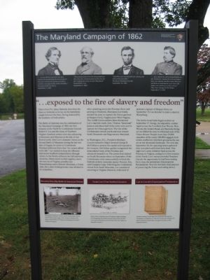
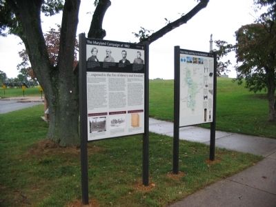
More about this marker. At the top of the marker are portraits of President Davis, General Lee, President Lincoln, and General McClellan.
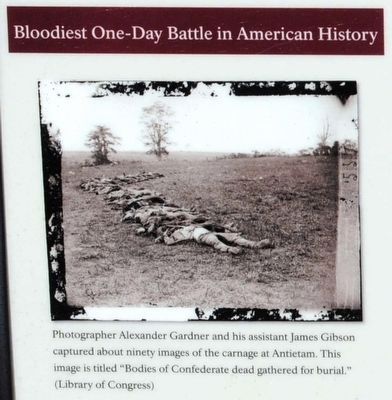
At the bottom are three illustrations. On the left is one titled Bloodiest one-day battle in American history captioned - Photographer Alexander Gardner and his assistant James Gibson captured about ninety images of the carnage at Antietam. This image is titled "Bodies of Confederate dead gathered for burial."
In the center is a drawing titled Ended Lee's first Northern invasion captioned - Sketch of the Confederate Army of Northern Virginia retreating from Sharpsburg, from Battles and Leaders of the Civil War. Lee's army crossed back over the Potomac River into Virginia on September 18 and 19.
On the right is a photo titled Led to Lincoln's Emancipation Proclamation captioned - President Abraham Lincoln signed the preliminary Emancipation Proclamation on September 22, 1862, just five days after Antietam. The final Proclamation, pictured here, was signed on January 1, 1863.
Also see . . . Antietam National Battlefield. National Park Service website entry (Submitted on September 27, 2009, by Craig Swain of Leesburg, Virginia.)
Credits. This page was last revised on May 13, 2022. It was originally submitted on September 27, 2009, by Craig Swain of Leesburg, Virginia. This page has been viewed 1,412 times since then and 19 times this year. Photos: 1. submitted on September 27, 2009, by Craig Swain of Leesburg, Virginia. 2, 3, 4, 5, 6. submitted on October 14, 2015, by Brian Scott of Anderson, South Carolina. 7, 8. submitted on September 27, 2009, by Craig Swain of Leesburg, Virginia.
