Near San Miguel de Cozumel in Cozumel, Quintana Roo, Mexico — The Yucatan Peninsula (The Southeast)
Estructura Las Columnas / The Columns Structure
Inscription.
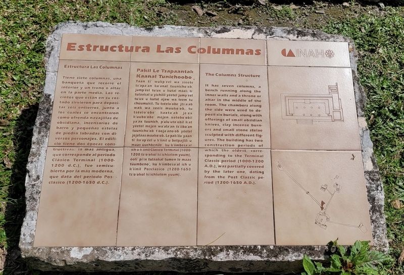
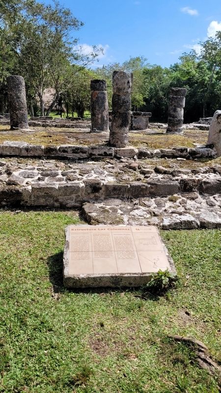
Tiene siete columnas, una banqueta que recorre el interior y un trono o altar en la parte media. Los recintos que están en su costado sirvieron para depositar seis entierros, junto a los cuales se encontraron como ofrenda navajillas de obsidiana, incensarios de barro y pequeñas estelas de piedra labradas con diversos personajes. El edificio tiene dos épocas constructivas: la mas antigua, que corresponde al periodo Clásico Terminal (1000- 1200 d.C.), fue semicubierta por la más moderna, que data del periodo Posclásico (1200-1650 d.C.).
Mayan:
Pakil Le Tsapaantak Kaanal Tunichoobo
Yaan ti' wukp'éel wa sieete ts'apa'an ka'anal tuunicho'ob, jump'éel tu'ux u kutal maak ti tulaakal u yichilil yéetel jump'éel tu'ux u kutal ajaw wa. teem tu chúumukil. Tu tséelo'obe' jts'a'ab wak wa seeis muuko'ob, tu tséelo obe kaxta'ab je'ex k'uubo'obe' mejen xotobo'obil ya'ax tuunich, p'ulu'uto'obil k'at yéetel mejen wa'ala'an ts'iiba'an tuunicho'ob t'ooja'ano'ob yéetel jejelaas maako'ob. Le pak'ila'yaan ti' ka'ap'éel u k'iinil u betpajlil: u maas uuchbenile', ku k'iimbesa'al ich u k'iinil Clásico Terminal (1000- 1200 ts'o'okol ki'ichkelem yuum), ooli' pi'ix tuláakal tumen le maas tüumbeno', ku k'iimbesa'al ich u k'iinil Posclásico (1200-1650 ts'o'okol ki'ichkelem yuum).
The Columns Structure
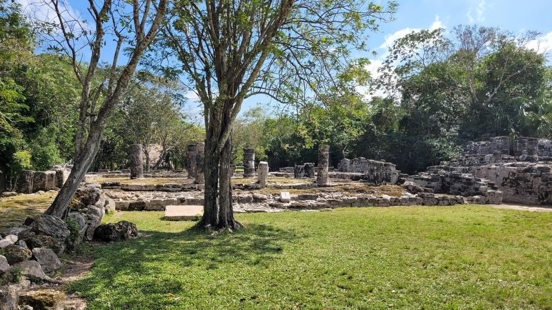
It has seven columns, a bench running along the inner walls and a throne or altar in the middle of the room. The chambers along the side were used to deposit six burials, along with offerings of small obsidian knives, clay incense burners and small stone stelae sculpted with different figures. The building has two construction periods of which the oldest, corresponding to the Terminal Classic period (1000-1200 A.D.), was partially covered by the later one, dating from the Post Classic period (1200-1650 A.D.).
Erected by Instituto Nacional de Antropología e Historia (INAH).
Topics. This historical marker is listed in these topic lists: Anthropology & Archaeology • Architecture • Native Americans. A significant historical year for this entry is 1200.
Location. 20° 30.006′ N, 86° 50.771′ W. Marker is near San Miguel de Cozumel, Quintana Roo, in Cozumel. Marker is on San Gabriel Road, 6 kilometers east of Tran. de Cozumel. The marker is located at the northern section of the Zona Arqueológica San Gervasio. Touch for map. Marker is in this post office area: San Miguel de Cozumel QR 77684, Mexico. Touch for directions.
Other nearby markers. At least 8 other markers are within walking distance of this marker. Estructura El Altar / The Altar Structure (a few steps from this marker); Estructura Los Nichos / The Niches Structure (a few steps from this marker); Estructura 25 B / Structure 25 B (within shouting distance of this marker); Estructura El Alamo / The Alamo Structure (within shouting distance of this marker); Estructura El Osario / The Ossuary Structure (within shouting distance of this marker); Estructura Los Murales / The Murals Structure (within shouting distance of this marker); Estructura El Palacio / The Palace Structure (within shouting distance of this marker); Estructura El Arco / The Arch Structure (about 90 meters away, measured in a direct line). Touch for a list and map of all markers in San Miguel de Cozumel.
Also see . . . San Gervasio (Maya site). Wikipedia
San Gervasio is an archaeological site of the pre-Columbian Maya civilization, located in the northern third of the island of Cozumel off the northeastern coast of the Yucatán Peninsula, in what is now the Mexican state of Quintana Roo. San Gervasio's pre-Hispanic name was Tantun Cuzamil, Mayan for Flat Rock in the place of the Swallows. The ruins were once a hub of worship of the goddess Ix Chel, an aged deity of childbirth, fertility, medicine, and weaving. Pre-Columbian Maya women would try to travel to San Gervasio and make offerings at least once in their lives.(Submitted on July 8, 2023, by James Hulse of Medina, Texas.)
Credits. This page was last revised on July 12, 2023. It was originally submitted on July 8, 2023, by James Hulse of Medina, Texas. This page has been viewed 44 times since then and 9 times this year. Photos: 1, 2, 3. submitted on July 8, 2023, by James Hulse of Medina, Texas.


