Near San Miguel de Cozumel in Cozumel, Quintana Roo, Mexico — The Yucatan Peninsula (The Southeast)
La Historia de San Gervasio / The History of San Gervasio
Inscription.
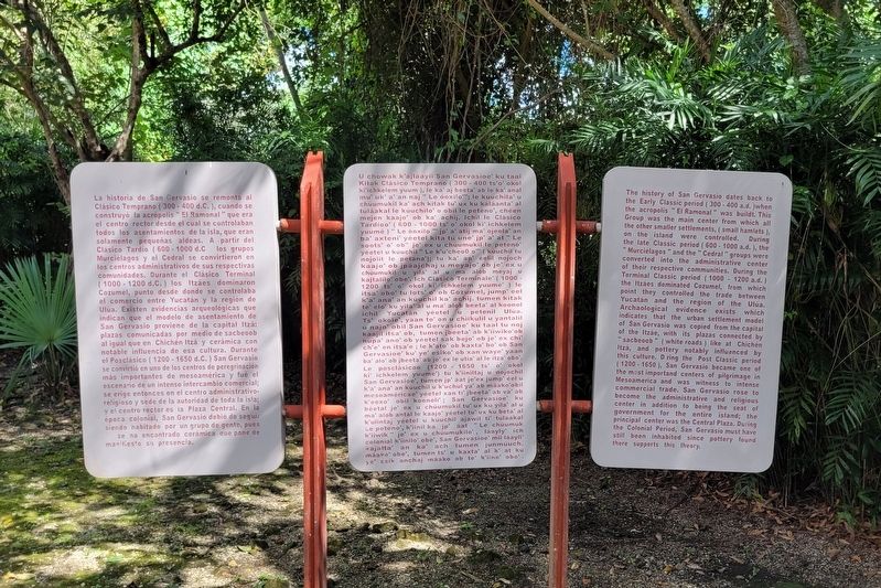
Mayan:
U chowak k'ajláayil San Gervasioe' ku taal Kitak Clásico Temprano (300-400 ts'o' okol ki'ichkelem yuum ), le ka' aj beeta' ab le ka' anal mu' uk' a' an naj Le óoxilo""; le kuuchila' u chúumukil ka' ach kitak tu' ux ku kaláanta' al tuláakal le kuuchilo' o obil le peteno', chéen mejen kaajo' ob ka' achij. Ichil le Clásico Tardíoo' (600-1000 ts' o' okol ki' ichkelem yuumé)" Le óoxilo jp' a' atij ma' ojeela' an ba' axteni' yéetel kita tú une' jp' a' at Le soots' o' ob" je' ex u chúumukil le peteno' yéetel u kúuchil" Le k'u'cheol o"" (kúuchil tu nojolit le petana'); tu ka' ap' éelil nojoch kaajo' ob jpáajchaj u meyajo' ob je' ex u chúumukil u yila' al u alob meyaj u ma kajtalilo' obe'. Ich Clásico Terminale' (1000 - 1200 ts' o' okol ki' ichkelem yuumé') le itsa' obo' tu lots' o' ob Cozumel, jump' eel k'a' ana' an kúuchil ka' achij. tumen kitak te' elo' ku yila' al u ma' alob beeta' al koonol ichil Yucatán yéetel petenil Ulúa. u Ts' okole', yaan to' on u chiikulil u yantalil u najo' obil San Gervasioe' ku taal tu noj kaajil itsa' ob, tumen jbeeta' ab k'iiwiko'ob nupa' ano' ob yéetel sak bejo' ob je' ex chi' ch'e' en itsa'e; le k'ato' ob kaxta' bo' ob San Gervasioe' ku' ye' esiko' ob xan waye' yaan ba' alo' ob jbeeta'
ab je' ex le utia' al le itza' obo'. Le posclásicoo (1200 1650 ts' o' okol ki ichkelem yuume') tu k'iiniltaj u nojochil San Gervasioe', tumen jp' áat je'ex jump' éel u k'a' ana' an kuuchil u k'uchul ya' ab máako'obil mesoaméricae' yéetel xan ti' jbeeta' ab va' ab k'eexo' obil koonoli'; San Gervasioe' ku béetal je' ex u chúumukil tu' ux ku yila' al u ma' alob antal le kaajo' yéetel tu' ux ku beta' al k'ulintaj yéetel u kúuchil ajawil ti' tulaakal Le peteno', k'iinil ka jp' áat "Le chúumuk k'iiwik je' ex u chúumukilo', láayly' ich colonial k'iinilo' obe', San Gervasioe' mii láayli' kajalta' an ka' ach tumen junmúuch. máako' obe', tumen ts' u kaxta' al k' at ku ye' esik anchaj máako ob te' k'iino' obo'.
The history of San Gervasio dates back to the Early Classic period (300-400 a.d. )when the acropolis "El Ramonal" was buildt. This Group was the main center from which all the other smaller settlements, ( small hamlets), on the island were controlled. During the late Classic period (600 - 1000 a.d.), the "Murciélagos" and the "Cedral " groups were converted into the administrative center of their respective communities. During the Terminal Classic period (1000 - 1200 a.d.) the Itzáes dominated Cozumel, from which point they controlled the trade between Yucatán and the region of the Ulúa. Archaological evidence exists which indicates that the urban settlement model of San Gervasio was copied from the capital of the Itzáe, with its plazas connected by "sacbeoob" (white roads) like at Chichén Itzá, and pottery notably influenced by this culture. During the Post Classic period (1200-1650), San Gervasio became one of the most importand centers of pilgrimage in Mesoamerica and was witness to intense commercial trade. San Gervasio rose to become the administrative and religious center in addition to being the seat of government for the entire island; the principal center was the Central Plaza. During the Colonial Period, San Gervasio must have still been inhabited since pottery found there supports this theory.
Erected by Instituto Nacional de Antropología e Historia (INAH).
Topics. This historical marker is listed in these topic lists: Anthropology & Archaeology • Architecture • Native Americans. A significant historical year for this entry is 1650.
Location. 20° 29.93′ N, 86° 50.704′ W. Marker is near San Miguel de Cozumel, Quintana Roo, in Cozumel. Marker can be reached from San Gabriel Road, 6 kilometers east of Tran. de Cozumel. The marker is located at the ticket entrance to the Zona Arqueológica San Gervasio. Touch for map. Marker is in this post office area: San Miguel de Cozumel QR 77684, Mexico. Touch for directions.
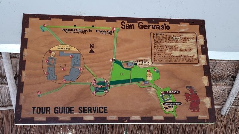
Other nearby markers. At least 8 other markers are within walking distance of this marker. Estructura La Tumba / The Tomb Structure (within shouting distance of this marker); Estructura Manitas / The Little Hands Structure (within shouting distance of this marker); Estructura Chichan Nah / The Small House Structure (within shouting distance of this marker); Estructuras 31 y 32 / Structures 31 & 32 (about 120 meters away, measured in a direct line); Estructura 25 B / Structure 25 B (about 180 meters away); Estructura Los Nichos / The Niches Structure (about 180 meters away); Estructura El Osario / The Ossuary Structure (about 180 meters away); Estructura Las Columnas / The Columns Structure (about 180 meters away). Touch for a list and map of all markers in San Miguel de Cozumel.
Also see . . . San Gervasio (Maya site). Wikipedia
San Gervasio is an archaeological site of the pre-Columbian Maya civilization, located in the northern third of the island of Cozumel off the northeastern coast of the Yucatán Peninsula, in what is now the Mexican state of Quintana Roo. San Gervasio's pre-Hispanic name was Tantun Cuzamil, Mayan for Flat Rock in the place of the Swallows. The ruins were once a hub of worship of the goddess Ix Chel, an aged deity of childbirth, fertility, medicine, and weaving. Pre-Columbian Maya women would try to travel to San Gervasio and make offerings at least once in their lives.(Submitted on July 8, 2023, by James Hulse of Medina, Texas.)
Credits. This page was last revised on July 12, 2023. It was originally submitted on July 8, 2023, by James Hulse of Medina, Texas. This page has been viewed 54 times since then and 17 times this year. Photos: 1, 2, 3, 4. submitted on July 9, 2023, by James Hulse of Medina, Texas.


