Derry in Natchitoches Parish, Louisiana — The American South (West South Central)
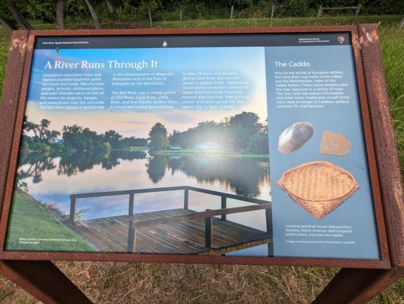
A River Runs Through It
Louisiana's abundant rivers and bayous provided essential paths for travel and trade. Merchandise, people, animals, communications, and even diseases were carried on the waters by dugouts, barges and steamboats over the centuries. The Red River played a central role in the development of Magnolia Plantation and in the lives of everyone on the plantation.
The Red River was a linked system of Old River, Cane River, Little River, and the Rigolet de Bon Dieu. It connected inland Natchitoches to New Orleans and beyond, giving Cane River plantations access to global trade. Steamboats could deliver provisions directly to larger plantations on their way toward Natchitoches, then pick up cotton and other goods for the return trip to New Orleans.
Prior to the arrival of European settlers, the Cane River was home to the Adaes and the Natchitoches, tribes of the Caddo Nation. These native peoples used the river resources in a variety of ways. The river cane was woven into baskets and other items. Freshwater mussel shells were used as temper in Caddoan pottery and later for shell buttons.
Erected by National Park Service.
Topics. This historical marker is listed in these topic lists: Native Americans • Settlements & Settlers • Waterways & Vessels.
Location. 31° 32.918′ N, 92° 56.501′ W. Marker is in Derry, Louisiana, in Natchitoches Parish. Marker is on Highway 119, one mile north of State Highway 1, on the right when traveling north. Touch for map. Marker is at or near this postal address: 1111 LA-119, Cloutierville LA 71416, United States of America. Touch for directions.
Other nearby markers. At least 8 other markers are within walking distance of this marker. Plantation Landscape (within shouting distance of this marker); The Cost of Cotton (about 300 feet away, measured in a direct line); Gardens and Porches (about 400 feet away); Industry vs Manpower (about 400 feet away); Oakland Plantation (about 400 feet away); Magnolia Plantation (about 400 feet away); The Battle of Cloutierville (about 500 feet away); Escaped! Freedom Seekers in 1863 (about 500 feet away). Touch for a list and map of all markers in Derry.
Credits. This page was last revised on July 9, 2023. It was originally submitted on July 9, 2023, by Cajun Scrambler of Assumption, Louisiana. This page has been viewed 78 times since then and 21 times this year. Photos: 1, 2. submitted on July 9, 2023, by Cajun Scrambler of Assumption, Louisiana.

