
Fort Snelling in Hennepin County, Minnesota — The American Midwest (Upper Plains)
An Appreciation: Colonel Josiah Snelling
1782 – 1828
| — | Soldier · Pioneer · Builder | — |

Photographed by McGhiever, June 30, 2023
1. An Appreciation: Colonel Josiah Snelling Marker
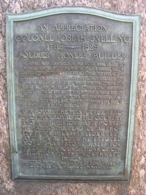
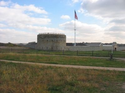
He served with distinction in the Indian wars of the old northwest border and in the War of 1812. In August, 1820, he assumed command of the Fifth United States Infantry at Camp Coldwater on the site of Fort Snelling. Selecting the bluffs at the junction of the rivers for the construction of Fort St. Anthony, he laid the cornerstone September 10, 1820, and built the stone fort which for years was the nation's strongest outpost on the Western Frontier. As a compliment to him the War Department changed the name of the fortification to Fort Snelling.
As a soldier he was a true leader of men, loyal to his country and his superiors; as a pioneer he raised the flag of authority in a lawless wilderness and as a builder he erected more than stone walls for he laid the foundations of civilization in the Northwest.
Colonel W. E. Welsh, Commanding
1928
Erected 1928 by the Garrison of Fort Snelling.
Topics. This historical marker is listed in these topic lists: Forts and Castles • Settlements & Settlers • War of 1812 • Wars, US Indian. A significant historical date for this entry is September 10, 1823.
Location. 44° 53.529′ N,
this page online

Regionally, this marker is in the Twin Cities Metropolitan Area. It is also in the American Midwest, in the Corn Belt, and in the Great River Road Region. Globally, it is in North America, the Western Hemisphere, the Western World, and the Anglosphere. Historically, it finds itself in what was once Rupert’s Land, the territory of the Mississippian Culture, and the Louisiana Purchase.
Other nearby markers. At least 8 other markers are within walking distance of this marker: Giacomo Constantino Beltrami (here, next to this marker); Elizabeth R. Snelling (a few steps from this marker); Service (about 400 feet away, measured in a direct line); Identity (about 400 feet away);
Photographed by Keith L, October 16, 2008
2. Colonel Josiah Snelling Marker
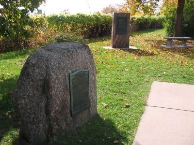
Josiah Snelling became a full Colonel in 1820 and was given control of the 5th Infantry Regiment stationed in the Upper Mississippi River Valley.
Other markers no longer nearby. U.S. Army, Buildings 17 and 18 (was about 400 feet away but has been permanently removed); The Prairie (was about 500 feet away but has been permanently removed).
Also see . . . Josiah Snelling. "Upon arrival at his new post, Snelling found that the garrison he was sent to defend was really more of an encampment, so he began the construction of Fort St. Anthony (later Fort Snelling), an act that would become his greatest accomplishment." (Submitted on March 21, 2009.)
Photographed by Keith L, October 16, 2008
3. Colonel Josiah Snelling Marker (foreground)
Photographed by Keith L, October 16, 2008
4. Fort Snelling
Credits. This page was last revised on June 10, 2025. It was originally submitted on March 21, 2009, by Keith L of Wisconsin Rapids, Wisconsin. This page has been viewed 2,558 times since then and 39 times this year. Last updated on July 10, 2023, by McGhiever of Minneapolis, Minnesota. Photos: 1. submitted on June 9, 2025, by McGhiever of Minneapolis, Minnesota. 2, 3, 4. submitted on March 21, 2009, by Keith L of Wisconsin Rapids, Wisconsin. • J. Makali Bruton was the editor who published this page.
