
Ravenswood in Jackson County, West Virginia — The American South (Appalachia)
George Washington
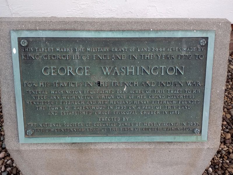
Photographed by Craig Doda, June 25, 2023
1. Georg Washington Marker
Erected 1932 by National Society Of Colonial Dames Of West Virginia.
Topics and series. This historical marker is listed in these topic lists: Religion & Religious Structures • Settlements & Settlers • War, French and Indian. In addition, it is included in the Former U.S. Presidents: #01 George Washington series list. A significant historical year for this entry is 1772.
Location. 38° 56.929′ N, 81° 45.508′ W. Marker is in Ravenswood, West Virginia, in Jackson County. It is at the intersection of Walnut Street and Ann Street, on the right when traveling west on Walnut Street. Touch for map. Marker is at or near this postal address: 405 Walnut Street, Ravenswood
this page online

Regionally, this marker is in West Virginia’s Mid-Ohio Valley. It is also in the American South, specifically in the Upper South, in the Ohio River Valley, in Appalachia, and specifically in Southern Appalachia. Globally, it is in North America, the Western Hemisphere, the Western World, and the Anglosphere. Historically, it finds itself in what was once the territory of the Mississippian Culture.
Other nearby markers. At least 8 other markers are within 4 miles of this marker, measured as the crow flies: Daniel Frost (approx. 0.4 miles away); Hillside Plow (approx. 0.4 miles away); Ravenswood / Ohio River Ford (approx. 0.4 miles away); Ravenswood (approx. 0.4 miles away); Russell Eugene Harmon Memorial (approx. 0.4 miles away); Washington’s Land (approx. 1.7 miles away); Major Daniel McCook (approx. 3.3 miles away in Ohio); Grand Army of the Republic Memorial (approx. 3.3 miles away in Ohio). Touch for a list and map of all markers in Ravenswood.
Another marker is no longer nearby. Battle of Buffington Island (was approx. 2.7 miles away but has been confirmed
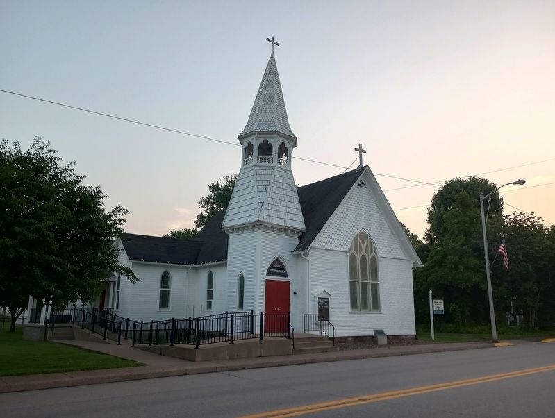
Photographed by Craig Doda, June 25, 2023
2. Grace Evangelical Church
Credits. This page was last revised on July 14, 2023. It was originally submitted on July 12, 2023, by Craig Doda of Napoleon, Ohio. This page has been viewed 613 times since then and 80 times this year. Photos: 1, 2. submitted on July 12, 2023, by Craig Doda of Napoleon, Ohio. • James Hulse was the editor who published this page.
