St. Marys in Auglaize County, Ohio — The American Midwest (Great Lakes)
The headwaters of the St. Marys River lie just southeast of the City of St. Marys.
Inscription.
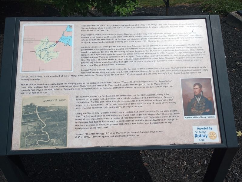
The headwaters of the St. Marys River be just southeast of the City of St. Marys. The ever flows generally northwest to Wayne, Indiana, where it meets with the St. Joseph River in downtown ft. Wayne to form the Maumee River. The Maumee then flows northeast to Lake Erie.
Many Native Americans used the St. Marys River for travel, but they were required to portage then canals between the headwaters of the river and Loramie Creek to the south in order to continue their journey Notorious renegade" James City, who as a youth had been adopted by the Shawnee tribe, recognized the market opportunity created by the numerous travelers along the portage and established a trading post in the area in 1783. The post became known as "Guty's Town."
As Anglo-American settlers pushed westward into Ohio, many severe conflicts with Native Americans arose. The federal government, having disbanded the standing army after the Revolutionary War, organized limited military expeditions to stop attacks on settlers. But after the devastating defeat of General Arthur St. Clair near what is now Fort Recovery, Ohio, a formal reorganized army known as the Legion of the United States was established. In 1792, President George Washington appointed General Anthony Wayne as commander of the Legion. General Wayne proved to be more successful than other generals before him. The defeat of Native American tribes in battle, most notably the Battle of Fallen Timbers in August of 1794 just south of present-day Toledo, was followed by the negotiation of several treaties with the Native Americans that opened up much of what is now Ohio and Indiana for settlement.
General Wayne's troops remained stationed in this area for several years during that time. The General determined that supply forts were needed along the route from Greene Ville to the Maumee River, and in the fall of 1795 he located an important supply fort at Girty's Town on the west bank of the St. Marys River. While Fort St. Marys was not built until 1795, the troops had made camp at Girty's Town during the prior years of the military campaign.
Fort St. Marys served as a supply depot and shipping point at the portage north of Fort Loramie. Wagons filled with supplies from Fort Loramie, Fort Green Vile, and from Fort Hamilton via the Great Miami River, were unloaded at St. Marys and the goods then shipped up the St. Marys River to resupply Fort Wayne and Fort Defiance. Due to the need to ship supplies from the fort, construction of Kentucky boats or pirogues was an important activity at Fort St. Marys.
The exact location of the fort has not been determined, but the 1880 Auglaize County Atlas historical record states that a portion of
the stockade was located where the Lutheran Cemetery currently les. An 1853 plat shows a simple representation of a blockhouse at the corner of that property. It is believed that the fort was constructed generally in the area of James Girty's trading post, which he abandoned prior to the arrival of Wayne's troops.
During the War of 1812, General William Henry Harrison had a fort constructed in the same general area. The fort was known as Fort Barbee and it was much larger than Wayne's Fort St. Marys. Some historical references indicate that a portion of Fort Barbee overlapped the location of fort St. Marys, but because Fort Barbee was so much larger it extended into what is now downtown St. Marys. At one time, as many as 3,000 troops were stationed at Fort Barbee, and General Harrison kept headquarters at the fort as well.
Source: "The Archaeology of Fort St. Marys: Major General Anthony Wayne's fort, 1795 to 1796, Tony DeRegnaucourt and Paulette Hoelscher
Erected by St. Marys Rotary Club.
Topics. This historical marker is listed in these topic lists: Military • Native Americans • Settlements & Settlers • Waterways & Vessels. A significant historical month for this entry is August 1794.
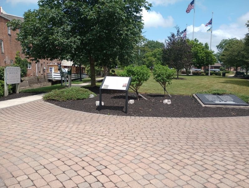
Location. 40° 32.601′ N, 84° 23.251′ W. Marker is in St. Marys , Ohio, in Auglaize County. Marker can be reached from East Spring Street (Ohio Route 29/66) east of Miami and Erie Canal Trail, on the right when traveling east. Touch for map. Marker is at or near this postal address: 101 E Spring St, Saint Marys OH 45885, United States of America. Touch for directions.
Other nearby markers. At least 8 other markers are within walking distance of this marker. Memorial Park (here, next to this marker); Miami and Erie Canal (a few steps from this marker); The "Short Level" of the Miami and Erie Canal (a few steps from this marker); Saint Marys River (a few steps from this marker); St. Marys Veterans Memorial (within shouting distance of this marker); With Honor and Remembrance (within shouting distance of this marker); 136 East Spring Street (within shouting distance of this marker); Serving Our Country (within shouting distance of this marker). Touch for a list and map of all markers in St. Marys.
Credits. This page was last revised on July 21, 2023. It was originally submitted on July 14, 2023, by Craig Doda of Napoleon, Ohio. This page has been viewed 164 times since then and 75 times this year. Photos: 1, 2. submitted on July 14, 2023, by Craig Doda of Napoleon, Ohio. • Devry Becker Jones was the editor who published this page.

