Sagamore Hills Township near Brecksville in Cuyahoga County, Ohio — The American Midwest (Great Lakes)
Restoring The River
Removing Barriers
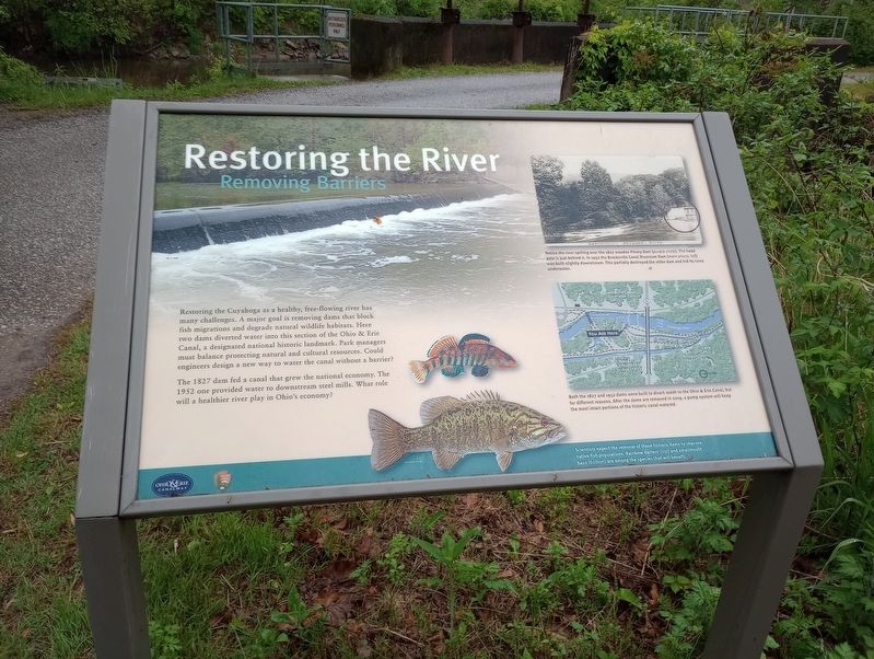
Restoring the Cuyahoga as a healthy, free-flowing river has many challenges. A major goal is removing dams that block fish migrations and degrade natural wildlife habitats. Here two dams diverted water into this section of the Ohio & Erie Canal, a designated national historic landmark. Park managers must balance protecting natural and cultural resources. Could engineers design a new way to water the canal without a barrier?
The 1827 dam fed a canal that grew the national economy. The 1952 one provided water to downstream steel mills. What role will a healthier river play in Ohio's economy?
[Captions:]
Notice the river spilling over the 1827 wooden Pinery Dam (purple circle). The head gate is just behind it. In 1952 the Brecksville Canal Diversion Dam (main photo, left) was built slightly downstream. This partially destroyed the older dam and hid its ruins underwater.
Both the 1827 and 1952 dams were built to divert water to the Ohio & Erie Canal, but for different reasons. After the dams are removed in 2019, a pump system will keep the most intact portions of the historic canal watered.
Scientists expect the removal of these historic dams to improve native fish populations. Rainbow darters (top) and smallmouth bass (bottom) are among the species that will benefit.
Erected by Ohio & Erie Canalway; National Park Service, U.S. Department of the Interior.
Topics and series. This historical marker is listed in these topic lists: Animals • Environment • Industry & Commerce • Waterways & Vessels. In addition, it is included in the Ohio and Erie Canal series list. A significant historical year for this entry is 1827.
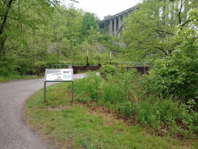
Location. 41° 19.228′ N, 81° 35.221′ W. Marker is near Brecksville, Ohio, in Cuyahoga County. It is in Sagamore Hills Township. Marker can be reached from Ohio & Erie Canal Towpath Trail south of West Aurora Road (Ohio Route 82), on the right when traveling west. Touch for map. Marker is at or near this postal address: 13513 Station Rd, Brecksville OH 44141, United States of America. Touch for directions.
Other nearby markers. At least 8 other markers are within walking distance of this marker. Pinery Narrows (about 400 feet away, measured in a direct line); A Travel Guide for the Valley (about 600 feet away); The Lure of the Countryside (about 600 feet away); Restoring the Cuyahoga River (about 600 feet away); Ohio & Erie Canalway (about 600 feet away); Ride the Rails (about 600 feet away); Welcome to Cuyahoga Valley National Park (about 600 feet away); Lock 36 (approx. 0.2 miles away). Touch for a list and map of all markers in Brecksville.
Credits. This page was last revised on July 24, 2023. It was originally submitted on July 17, 2023, by Craig Doda of Napoleon, Ohio. This page has been viewed 56 times since then and 13 times this year. Photos: 1, 2. submitted on July 17, 2023, by Craig Doda of Napoleon, Ohio. • Devry Becker Jones was the editor who published this page.

