North Waterfront in San Francisco City and County, California — The American West (Pacific Coastal)
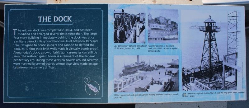
The Dock
Topics. This historical marker is listed in these topic lists: Forts and Castles • Law Enforcement • Parks & Recreational Areas. A significant historical year for this entry is 1854.
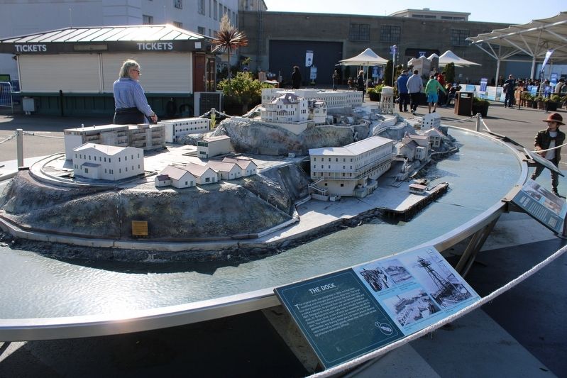
Location. 37° 48.389′ N, 122° 24.259′ W. Marker is in San Francisco, California, in San Francisco City and County. It is in North Waterfront. Marker is on The Embarcadero south of Bay Street, on the right when traveling north. The resin marker is mounted to a 3-D topographical map of Alcatraz Island, with an identical marker on the opposite side. Touch for map. Marker is at or near this postal address: Pier 33, San Francisco CA 94133, United States of America. Touch for directions.
Other nearby markers. At least 8 other markers are within walking distance of this marker. Barracks/Apartments (here, next to this marker); Guardhouse & Sallyport Complex (here, next to this marker); Staff Housing Area (here, next to this marker); Military Schoolhouse (here, next to this marker); Warden’s House and Lighthouse (here, next to this marker); The Post Exchange & Officers' Club (here, next to this marker); Main Prison Building (here, next to this marker); Industrial Buildings (here, next to this marker). Touch for a list and map of all markers in San Francisco.
More about this marker. Inset Images:
Last penitentiary convicts being taken off Alcatraz, March 21, 1963.
An army steamer at the island dock, circa 1902. Note the square cannon ports.
Military personnel and convict workers waiting to board the island launch, circa 1920.
Dock tower was originally built in 1934. It was the only guard tower manned 24 hours a day.
Also see . . . Alcatraz Island. National Park Service: Island of Incarceration, Island of Freedom (Submitted on July 18, 2023, by Joseph Alvarado of Livermore, California.)
Credits. This page was last revised on July 18, 2023. It was originally submitted on July 18, 2023, by Joseph Alvarado of Livermore, California. This page has been viewed 42 times since then and 12 times this year. Photos: 1, 2. submitted on July 18, 2023, by Joseph Alvarado of Livermore, California.

