Genoa in Douglas County, Nevada — The American Mountains (Southwest)
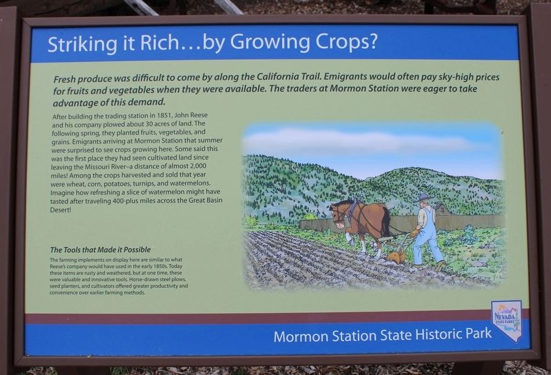
Striking it Rich…by Growing Crops?
After building the trading station in 1851, John Reese and his company plowed about 30 acres of land. The following spring, they planted fruits, vegetables, and grains. Emigrants arriving at Mormon Station that summer were surprised to see crops growing here. Some said this was the first place they had seen cultivated land since leaving the Missouri River-a distance of almost 2,000 miles! Among the crops harvested and sold that year were wheat, corn potatoes, turnips, and watermelons. Imagine how refreshing a slice of watermelon might have tasted after traveling 400-plus miles across the Great Basin Desert!
The Tools that Made it Possible
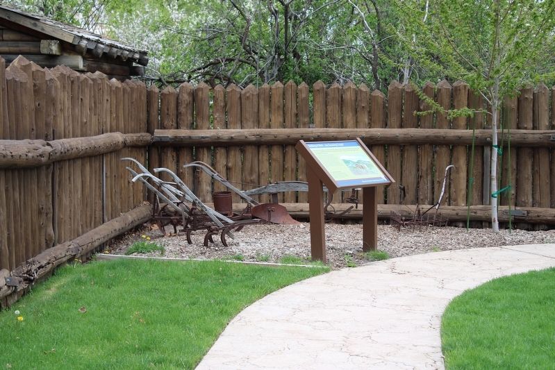
The farming implements on display here are similar to what Reese’s company would have used in the early 1850s. Today these items are rusty and weathered, but at some time, these were valuable and innovative tools. Horse-drawn steel plows, seed planters, and cultivators offered greater productivity and convenience over earlier farming methods.
Erected by Nevada State Parks.
Topics. This historical marker is listed in these topic lists: Agriculture • Parks & Recreational Areas • Settlements & Settlers. A significant historical year for this entry is 1851.
Location. 39° 0.26′ N, 119° 50.704′ W. Marker is in Genoa, Nevada, in Douglas County. Marker can be reached from Main Street north of Genoa Lane (Nevada Route 206), on the right when traveling north. The resin marker is mounted to a metal stand in the stockade. Touch for map. Marker is at or near this postal address: 2295 Main Street, Genoa NV 89411, United States of America. Touch for directions.
Other nearby markers. At least 8 other markers are within walking distance of this marker. Life-giving Nectar (within shouting distance of this marker); Carson Trail - Original Mormon Station (within shouting distance of this marker); Mormon Station State Historic Park (within shouting distance of this marker); The Semi Trucks of the 1800s (within shouting distance of this marker); Welcome to Mormon Station State Historic Park (within shouting distance of this marker); Mormon Station (within shouting distance of this marker); Mormon Station - Genoa (within shouting distance of this marker); The Prairie Schooner (within shouting distance of this marker). Touch for a list and map of all markers in Genoa.
Also see . . . Mormon Station State Historic Park. Nevada State Parks
"...Mormon Station was built in 1851 as a trading post along the Carson Route of the California Trail, providing much needed supplies to weary travelers crossing the Sierra Nevada Mountains."(Submitted on July 23, 2023, by Joseph Alvarado of Livermore, California.)
Credits. This page was last revised on July 26, 2023. It was originally submitted on July 23, 2023, by Joseph Alvarado of Livermore, California. This page has been viewed 53 times since then and 14 times this year. Photos: 1, 2, 3. submitted on July 23, 2023, by Joseph Alvarado of Livermore, California.


