Mendota Heights in Dakota County, Minnesota — The American Midwest (Upper Plains)
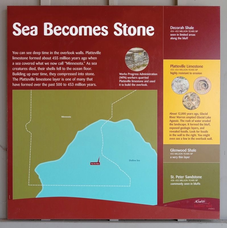
Sea Becomes Stone
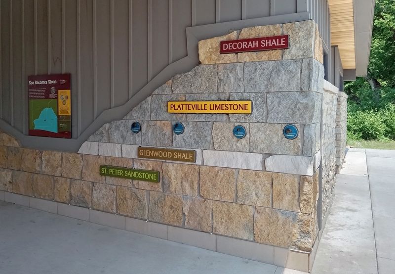
Works Progress Administration (WPA) workers quarried Platteville limestone and used it to build the overlook.
Decorah Shale
454–453 million years BP
seen in limited areas along the bluff
Platteville Limestone
455–454 million years BP
highly resistant to erosion
About 12,000 years ago, Glacial River Warren emptied Glacial Lake Agassiz. The rush of water eroded the landscape. It formed the bluff, exposed geologic layers, and revealed fossils. Look for fossils in the wall to your right. You might even see a few in the overlook wall.
Glenwood Shale
455 million years BP
a very thin layer
St. Peter Sandstone
458–455 million years BP
commonly seen in bluffs
Erected by Dakota County Parks.
Topics and series. This historical marker is listed in these topic lists: Environment • Natural Features • Paleontology. In addition, it is included in the Works Progress Administration (WPA) projects series list.
Location. 44° 52.065′ N, 93° 10.407′ W. Marker is in Mendota Heights, Minnesota, in Dakota County. Marker is on Sibley Memorial Highway west of Minnesota Route 13, on the left when traveling north. The marker is at the Big Rivers Regional Trail west trailhead, at the southeast corner of the restrooms under the picnic shelter overhang. Touch for map. Marker is at or near this postal address: 1498 Mendota Heights Road, Saint Paul MN 55120, United States of America. Touch for directions.
Other nearby markers. At least 8 other markers are within 2 miles of this marker, measured as the crow flies. Gather, View, Repeat (a few steps from this marker); Local Stone, National Story (within shouting distance of this marker); Mendota Work Camp No. 1 (approx. 0.2 miles away); Pilot Knob (approx. ¾ mile away); United States War Veterans Memorial (approx. 0.8 miles away); Oheyawahi Pilot Knob Hill (approx. one mile away); Oheyawahi "a hill much visited"
(approx. one mile away); Mendota / Sibley House (approx. 1.1 miles away). Touch for a list and map of all markers in Mendota Heights.
Credits. This page was last revised on August 1, 2023. It was originally submitted on July 26, 2023, by McGhiever of Minneapolis, Minnesota. This page has been viewed 137 times since then and 21 times this year. Photos: 1, 2. submitted on July 26, 2023, by McGhiever of Minneapolis, Minnesota. • Andrew Ruppenstein was the editor who published this page.

