Statesboro in Bulloch County, Georgia — The American South (South Atlantic)
Burkhalter Road & Old Indian Trail
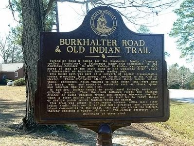
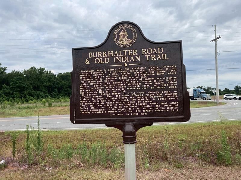
Burkhalter Road is named for the Burkhalter family (formerly spelled Burgholser), a Salzburger family that immigrated to the American colonies. In 1768, Rudolph Burkhalter was granted 400 acres of land on the south bank of the Ogeechee River where it intersected an important Indian trading path.
This Indian path was part of a network of ancient transportation routes stretching from modern day North Carolina to the Gulf of Mexico. These footpaths often developed along natural animal trails, connected Indian villages to each other, and were used for trade, war, and access to resources such as rivers, game, and minerals like salt and flint.
In addition, Indians tended to avoid travel through rough or difficult terrain. Thus, the trails followed ridges and drainage divides to avoid crossing rivers and marshes wherever possible. When a river had to be crossed, the trail led to rocky shoals or shallow points where fording would be easiest.
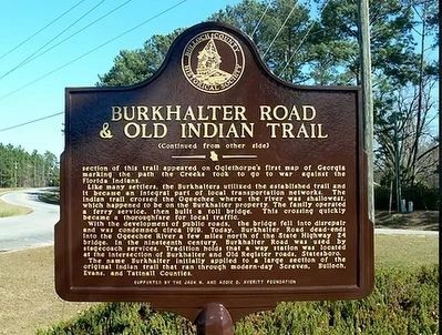
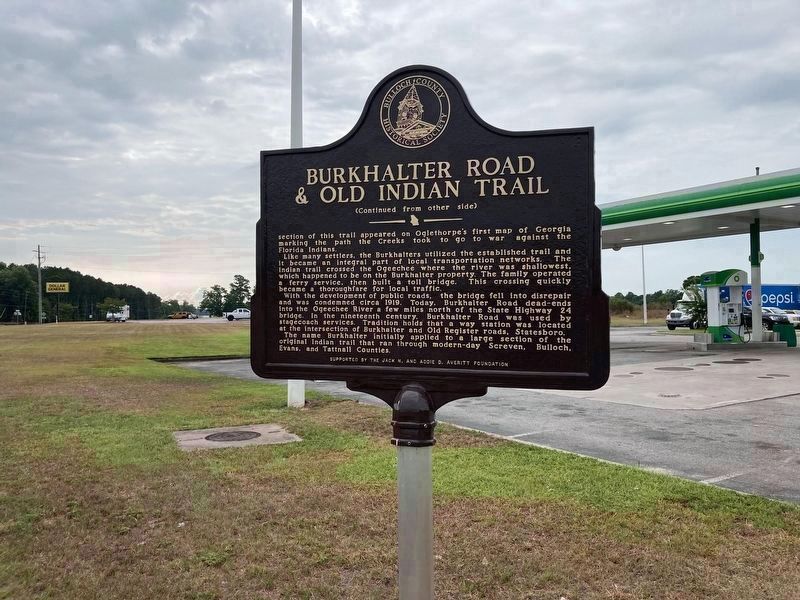
This trail was unique in the region because, unlike most other Indian trails that ran in an east-west direction and connected inland communities to the coast, this trail cut across the interior, thereby crossing a number of rivers. The earliest reference to a
Like many settlers, the Burkhalters utilized the established trail and it became an integral part of local transportation networks. The Indian trail crossed the Ogeechee where the river was shallowest, which happened to be on the Burkhalter property. The family operated a ferry service, then built a toll bridge. This crossing quickly became a thoroughfare for local traffic.
With the development of public roads, the bridge fell into disrepair and was condemned circa 1919. Today, Burkhalter Road dead-ends into the Ogeechee River a few miles north of the State Highway 24 bridge. In the nineteenth century, Burkhalter Road was used by stagecoach services. Tradition holds that a way station was located at the intersection of Burkhalter and Old Register roads, Statesboro.
The name Burkhalter initially applied to a large section of the original Indian trail that ran through modern-day Screven, Bulloch, Evans, and Tattnall Counties. However, only in Bulloch County has the road retained the Burkhalter name.
Erected 2017 by Bulloch County Historical Society.
Topics. This historical marker is listed in these topic lists: Native Americans • Roads & Vehicles • Settlements & Settlers. A significant historical year for this entry is 1768.
Location. 32° 24.989′ N, 81° 42.793′ W. Marker is in Statesboro, Georgia, in Bulloch County. Marker is at the intersection of Burkhalter Road and U.S. 80, on the right when traveling east on Burkhalter Road. Touch for map. Marker is at or near this postal address: 21201 US-80, Statesboro GA 30461, United States of America. Touch for directions.
Other nearby markers. At least 8 other markers are within 4 miles of this marker, measured as the crow flies. Kiwanis Ogeechee Fair / Kiwanis Club of Statesboro (approx. 2.8 miles away); Middleground Church Primitive Baptist (approx. 3.1 miles away); Statesboro High School (approx. 3.4 miles away); Savannah & Statesboro Railway (approx. 3˝ miles away); Savannah Avenue Historic District (approx. 3.7 miles away); The Bulloch County Hospital, 1937-2000 (approx. 3.9 miles away); Brooklet, Georgia (approx. 3.9 miles away); Donehoo-Brannen-NeSmith Mansion (approx. 4 miles away). Touch for a list and map of all markers in Statesboro.
More about this marker. Marker was relocated from its original location on Langston Chapel Rd (GPS 32.39491,-81.75966)
Credits. This page was last revised on July 28, 2023. It was originally submitted on May 15, 2022, by Duane and Tracy Marsteller of Murfreesboro, Tennessee. This page has been viewed 458 times since then and 85 times this year. Last updated on July 26, 2023, by Rodney J. Harville of Statesboro, Georgia. Photos: 1, 2. submitted on May 15, 2022, by Duane and Tracy Marsteller of Murfreesboro, Tennessee. 3, 4. submitted on July 28, 2023, by Rodney J. Harville of Statesboro, Georgia. • Bernard Fisher was the editor who published this page.


