Litchfield in Northwest Hills Region, Connecticut — The American Northeast (New England)
Litchfield
Photographed by Michael Herrick, February 22, 2010
1. Litchfield Marker
front
Inscription. [ front ]
Litchfield
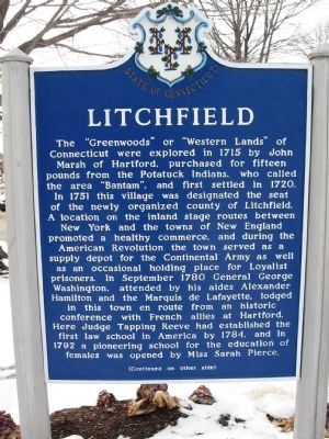
The "Greenwoods" or "Western Lands" of Connecticut were explored in 1715 by John Marsh of Hartford, purchased for fifteen pounds from the Potatuck Indians, who called the area "Bantam", and first settled in 1720. In 1751 this village was designated the seat of the newly organized county of Litchfield. A location on the inland stage routes between New York and the towns of New England promoted a healthy commerce, and during the American Revolution the town served as a supply depot for the Continental Army as well as an occasional holding place for Loyalist prisoners. In September 1780 General George Washington, attended by his aides Alexander Hamilton and the Marquis de Lafayette, lodged in this town en route from an historic conference with French allies at Hartford. Here Judge Tapping Reeve had established the first law school in America by 1784, and in 1792 a pioneering school for the education of females was opened by Miss Sarah Pierce.
[ back ]
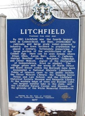
By 1810 Litchfield was the fourth largest town in Connecticut, but then, overlooked by railroads and large scale water-powered industry, the town declined
Click or scan to see this page online
in population for almost a century, fortunately preserving a large portion of the architecture of her golden age. Here can be seen the houses where Ethan Allen, Aaron Burr, John C. Calhoun, Harriet Beecher Stowe, Benjamin Tallmadge, and Oliver Wolcott, signer of the Declaration of Independence, lived or studied. The village green and the areas of North Street and South Street within the Borough have been designated a National Historic Landmark. Points of interest open to the public include the Oliver Wolcott Library, the Tapping Reeve House and Law School, and the Litchfield Historical Society Museum and Research Library. At the western edge of town are Bantam Lake, the largest natural lake in the state, and the Litchfield nature center and Museum, on the grounds of the White Memorial Foundation.
Erected by the Town of Litchfield
and the Connecticut Historical Commission
1977
Erected 1977 by Town of Litchfield, Connecticut Historical Commission.
Topics. This historical marker is listed in these topic lists: Colonial Era • Settlements & Settlers. A significant historical month for this entry is September 1780.
Location. 41° 44.832′ N, 73° 11.561′ W.
Photographed by Michael Herrick, February 22, 2010
2. Litchfield Marker
back
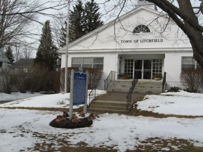
Marker is in Litchfield in Northwest Hills Region, Connecticut. It is at the intersection of West Street (U.S. 202) and Meadow Street (Connecticut Route 63), on the right when traveling west on West Street. Located in front of Litchfield Town Hall. Touch for map. Marker is at or near this postal address: 74 West Street, Litchfield CT 06759, United States of America. Touch for directions.
Regionally, this marker is in Connecticut’s Berkshire Foothills and in the Litchfield Hills. It is also in the American Northeast and in New England. Globally, it is in North America, the Western Hemisphere, the Western World, and the Anglosphere. Historically, it finds itself in what was once Litchfield County and also one of the original Thirteen Colonies.
Also see . . . 1. A Brief History of Litchfield. Litchfield Historical Society website entry (Submitted on March 11, 2010, by Michael Herrick of Southbury, Connecticut.)
2. Litchfield, Connecticut. Wikipedia entry (Submitted on March 11, 2010, by Michael Herrick of Southbury, Connecticut.)
Credits. This page was last revised on August 10, 2026. It was originally submitted on March 11, 2010, by Michael Herrick of Southbury, Connecticut. This page has been viewed 1,883 times since then and 52 times this year. Last updated on July 27, 2023, by Carl Gordon Moore Jr. of North East, Maryland. Photos:1, 2, 3. submitted on March 11, 2010, by Michael Herrick of Southbury, Connecticut. • Bill Pfingsten was the editor who published this page.