Waynesville in Haywood County, North Carolina — The American South (South Atlantic)
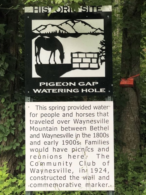
Pigeon Gap Watering Hole
Photographed by Duane and Tracy Marsteller, June 25, 2023
1. Pigeon Gap Watering Hole Marker
Erected by Bethel Rural Community Organization.
Topics. This historical marker is listed in this topic list: Waterways & Vessels. A significant historical year for this entry is 1924.
Location. 35° 28.369′ N, 82° 56.444′ W. Marker is in Waynesville, North Carolina, in Haywood County. It is at the intersection of Pigeon Road (U.S. 276) and Sentelle Road, on the right when traveling east on Pigeon Road. Touch for map. Marker is in this post office area: Waynesville NC 28786, United States of America. Touch for directions.

Regionally, this marker is in the Mountains, specifically in Greater Asheville, and in the Great Smoky Mountains. It is also in the American South, specifically in the Upper South, in Appalachia, and specifically in Southern Appalachia. Globally, it is in North America, the Western Hemisphere, the
this page online
Other nearby markers. At least 8 other markers are within 3 miles of this marker, measured as the crow flies: Rutherford Trace (within shouting distance of this marker); West Fork Pigeon River Truss Bridge (1891) (approx. 2.4 miles away); Museum Of N.C. Handicrafts (approx. 2.7 miles away); Museum of North Carolina Handicrafts (approx. 2.7 miles away); The Gateway to the Great Smoky Mountains Arch (approx. 2.9 miles away); Old Time Music (approx. 2.9 miles away); Battle House (approx. 2.9 miles away); Haywood County Quilt Trails (approx. 2.9 miles away). Touch for a list and map of all markers in Waynesville.
Regarding Pigeon Gap Watering Hole. The spring is on privately owned land.

Photographed by Duane and Tracy Marsteller, June 25, 2023
2. Pigeon Gap Watering Hole Marker
Photographed by Tom Bosse, April 18, 2025
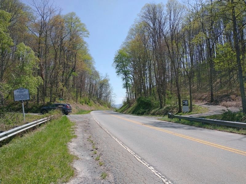
3. Rutherford Trace Marker on Left. Pigeon Gap Watering Hole Marker on Right.
Credits. This page was last revised on May 27, 2025. It was originally submitted on July 28, 2023, by Duane and Tracy Marsteller of Murfreesboro, Tennessee. This page has been viewed 1,323 times since then and 69 times this year. Photos: 1, 2. submitted on July 28, 2023, by Duane and Tracy Marsteller of Murfreesboro, Tennessee. 3. submitted on May 26, 2025, by Tom Bosse of Jefferson City, Tennessee.
