Lima in Allen County, Ohio — The American Midwest (Great Lakes)
Solar Refinery
Photographed by William Fischer, Jr., May 9, 2009
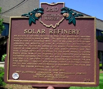
1. Solar Refinery Marker (Side A)
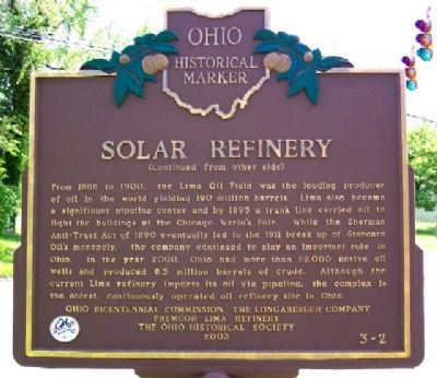
From 1886 to 1900, the Lima Oil Field was the leading producer of oil in the world yielding 190 million barrels. Lima also became a significant pipeline center and by 1893 a trunk line carried oil to light the buildings at the Chicago World's Fair. While the Sherman Anti-Trust Act of 1890 eventually
this page online
Erected 2003 by Ohio Bicentennial Commission, The Longaberger Company, Premcor Lima Refinery, and The Ohio Historical Society. (Marker Number 3-2.)
Topics and series. This historical marker is listed in these topic lists: Exploration • Industry & Commerce • Man-Made Features. In addition, it is included in the Ohio Historical Society / The Ohio History Connection series list. A significant historical year for this entry is 1885.
Location. 40° 43.333′ N, 84° 6.805′ W. Marker is in Lima, Ohio, in Allen County. It is at the intersection of Metcalf Street and Paul Street, on the right when traveling south on Metcalf Street. Marker is at the refinery entrance. Touch for map. Marker is at or near this postal address: 1150 S Metcalf Street, Lima OH 45804, United States of America.
Photographed by William Fischer, Jr., May 9, 2009
2. Solar Refinery Marker (Side B)

Regionally, this marker is in the Till Plains. It is also in the American Midwest and in the Corn Belt. Globally, it is in North America, the Western Hemisphere, the Western World, and the Anglosphere. Historically, it finds itself in what was once the Haudenosaunee (Iroquois) Confederacy, the territory of the Mississippian Culture, and the Northwest Territory.
Other nearby markers. At least 8 other markers are within walking distance of this marker: Oil Refinery (about 700 feet away, measured in a direct line); The Shawnee Indian Reservation (approx. 0.6 miles away); Hog Creek (approx. 0.6 miles away); St. John Catholic Church (approx. 0.6 miles away); American Legion Post No. 96 Veterans Memorial Wall (approx. ¾ mile away); a different marker also named American Legion Post No. 96 Veterans Memorial Wall (approx. ¾ mile away); Encore Theatre (approx. 0.8 miles away); Tawa Town (approx. 0.9 miles away). Touch for a list and map of all markers in Lima.
Photographed by William Fischer, Jr., May 9, 2009
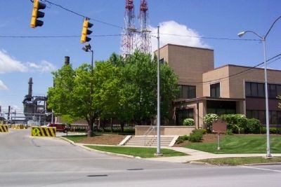
3. Solar Refinery and Marker

Photographed by Craig Doda, July 6, 2024
4. Solar Refinery Marker
New location of the marker.
Credits. This page was last revised on July 17, 2024. It was originally submitted on October 3, 2009, by William Fischer, Jr. of Reynoldsburg, Ohio. This page has been viewed 3,547 times since then and 139 times this year. Photos: 1, 2, 3. submitted on October 3, 2009, by William Fischer, Jr. of Reynoldsburg, Ohio. 4. submitted on July 10, 2024, by Craig Doda of Napoleon, Ohio.
