Sandy Springs in Fulton County, Georgia — The American South (South Atlantic)
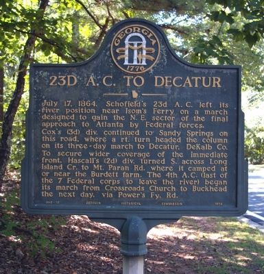
23d A.C. to Decatur
Cox’s (3d) div continued to Sandy Springs on this road where a rt. turn headed the column on its three-day march to Decatur, DeKalb Co. To secure wider coverage of the immediate front, Hascall’s (2d) div. turned south across Long Island Cr. to Mt. Paran Rd. where it camped at or near the Burdett farm. The 4th A.C. (last of the 7 Federal corps to leave the river) began its march from Crossroads Church to Buckhead the next day, via Power’s Fy. Rd.
Erected 1954 by Georgia Historical Commission. (Marker Number 060-10.)
Topics and series. This historical marker is listed in this topic list: War, US Civil. In addition, it is included in the Georgia Historical Society series list. A significant historical date for this entry is July 17, 1746.
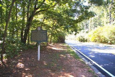
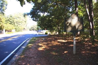
Location. 33° 55.125′ N, 84° 23.582′ W. Marker is in Sandy Springs, Georgia, in Fulton County. Marker is at the intersection of Mount Vernon Highway and Long Island Drive NW, on the right when traveling east on Mount Vernon Highway. Touch for map. Marker is in this post office area: Atlanta GA 30328, United States of America. Touch for directions.
Other nearby markers. At least 8 other markers are within 2 miles of this marker, measured as the crow flies. To Sandy Springs and Old Cross Keys (approx. ¼ mile away); Sandy Springs United Methodist Church Historic Cemetery (approx. 0.6 miles away); The History of the City of Sandy Springs, Georgia (approx. 0.6 miles away); The Sandy Springs (approx. 0.6 miles away); Gen. J. D. Cox's Div. To Old Cross Keys (approx. one mile away); 4th & 23d A.C. Advance (approx. 1.6 miles away); Isom's Ferry (approx. 1.7 miles away); Hascall’s Div. Camped (approx. 1.9 miles away). Touch for a list and map of all markers in Sandy Springs.
Credits. This page was last revised on June 16, 2016. It was originally submitted on October 3, 2009, by David Seibert of Sandy Springs, Georgia. This page has been viewed 893 times since then and 13 times this year. Photos: 1, 2, 3. submitted on October 3, 2009, by David Seibert of Sandy Springs, Georgia. • Craig Swain was the editor who published this page.


