
Near Jackson in Madison County, Tennessee — The American South (East South Central)
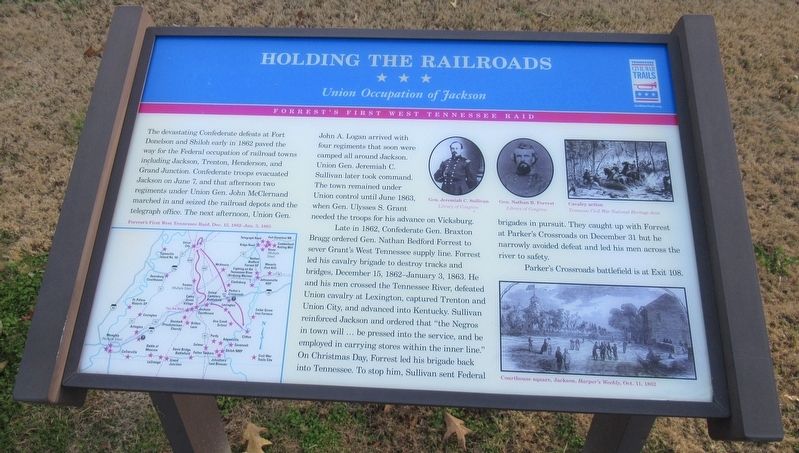
Holding The Railroads
Union Occupation of Jackson
| — | Forrest's First West Tennessee Raid | — |
Photographed by Jason Armstrong, December 2, 2022
1. Holding The Railroads Marker
Late in 1862, Confederate Gen. Braxton Bragg ordered Gen. Nathan Bedford Forrest to sever Grant's West Tennessee supply line. Forrest led his cavalry brigade to destroy tracks and bridges, December 15, 1862 - January 3, 1863. He and his men crossed the Tennessee River, defeated Union cavalry at Lexington, captured Trenton and Union City, and advanced into Kentucky. Sullivan reinforced Jackson and ordered that "the Negros in town will... be pressed into the
this page online
Parker's Crossroads battlefield is at Exit 108.
Erected by Tennessee Civil War Trails.
Topics and series. This historical marker is listed in this topic list: War, US Civil. In addition, it is included in the Tennessee Civil War Trails series list. A significant historical date for this entry is December 15, 1862.
Location. 35° 37.423′ N, 88° 58.647′ W. Marker is near Jackson, Tennessee, in Madison County. It is on Interstate 40 at milepost 72, 4½ miles east of Providence Road (Tennessee Highway 138), on the right when traveling east. Marker is located at the I-40 Rest Area. Touch for map. Marker is in this post office area: Jackson TN 38301, United States of America. Touch for directions.

Regionally, this marker is in West Tennessee. It is also in the American South, specifically in the Deep South, and specifically

Photographed by David Austin, May 29, 2025
2. Holding The Railroads Marker
Other nearby markers. At least 8 other markers are within 7 miles of this marker, measured as the crow flies: Union Occupations (approx. 0.6 miles away); John Murrell (approx. 2.6 miles away); Haywood County / Madison County (approx. 6.1 miles away); Denmark Danes (approx. 6.4 miles away); Denmark Presbyterian Church (approx. 6.4 miles away); a different marker also named Denmark Presbyterian Church (approx. 6.4 miles away); Denmark Presbyterian Church Cemetery (approx. 6.4 miles away); Denmark Presbyterian Church Mulberry Grove (approx. 6½ miles away). Touch for a list and map of all markers in Jackson.
Credits. This page was last revised on May 31, 2025. It was originally submitted on August 2, 2023, by Jason Armstrong of Talihina, Oklahoma. This page has been viewed 283 times since then and 26 times this year. Photos: 1. submitted on August 2, 2023, by Jason Armstrong of Talihina, Oklahoma. 2. submitted on May 29, 2025, by David Austin of Scotts Hill, Tennessee. • Bernard Fisher was the editor who published this page.
