Rockwood in Somerset County, Pennsylvania — The American Northeast (Mid-Atlantic)
Rockwood
A Highlight of the Laurel Highlands/Trail Map and Points of Interest
(Front):
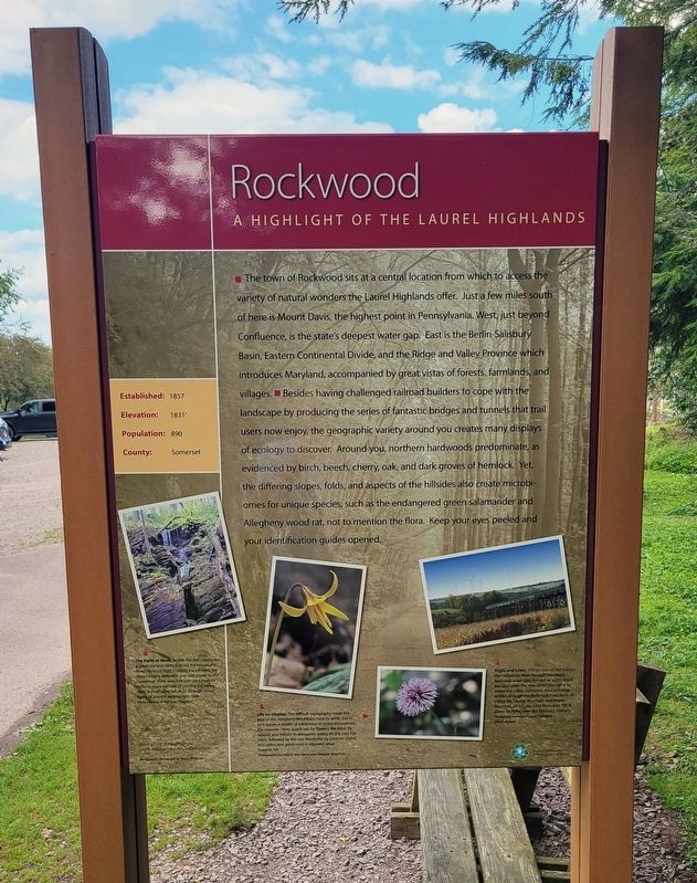
■ The town of Rockwood sits at a central location from which to access the variety of natural wonders the Laurel Highlands offer. Just a few miles south of here is Mount Davis, the highest point in Pennsylvania. West, just beyond Confluence, is the state's deepest water gap. East is the Berlin-Salisbury Basin, Eastern Continental Divide, and the Ridge and Valley Province which introduces Maryland, accompanied by great vistas of forests, farmlands, and villages. ■ Besides having challenged railroad builders to cope with the landscape by producing the series of fantastic bridges and tunnels that trail users now enjoy, the geographic variety around you creates many displays of ecology to discover. Around you, northern hardwoods predominate, as evidenced by birch, beech, cherry, oak, and dark groves of hemlock. Yet, the differing slopes, folds, and aspects of the hillsides also create microbiomes for unique species, such as the endangered green salamander and Allegheny wood rat, not to mention the flora. Keep your eyes peeled and your identification guides opened.
[Caption]: Established: 1857 • Elevation: 1831' • Population: 890 • County: Somerset
[Photo Captions]:
The Earth at Work: Beside the trail nearby are a great many rivulets that cut the mountains down from on high. Eroding the hillsides, the streams carry sediment and add power to the Casselman River, which in turn continues its millions-years-old task of carving the valley. Here, a small waterfall slices through visible layers of ancient sedimentary rock.
Photo courtesy of Trail Town Program
Life on Display: The difficult topography made this area of the Allegheny Mountains hard to settle, but in turn leaves a wealth of wilderness to enjoy throughout the seasons. Here, watch out for flowers like trout lily (above) and trillium to announce spring on the cool hillsides, followed by the rare Marshallia by summer (right), and asters and goldenrod in exposed areas towards fall.
Photographs courtesy of John Barna and Ohiopyle State Park.
Highs and Lows: This section of trail follows the Casselman River through the Negro Mountain water gap, formed as uplift raised the land while the river sliced through it to create the valley. Upstream, the Casselman ambles through the Berlin-Salisbury Basin dividing Big Savage Mountain and Negro Mountain, which you cross from over 100 ft above by riding over the Salisbury Viaduct.
Photograph courtesy of Laurel Highlands Visitors Bureau
(Rear):
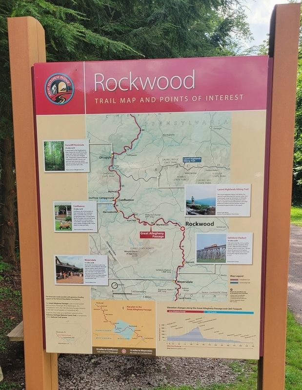
Ferncliff Peninsula
29 miles north
A sharp bend in the Youghiogheny River creates the Ferncliff Peninsula, edged with steep rocky ledges that also form the dramatic Ohiopyle Falls. Designated a National Natural Landmark, Ferncliff is home to an oak forest and many rare plants. The trail crosses its neck and the river twice in less than half a mile.
Photo courtesy of Ohiopyle State Park
Confluence
18 miles north
Confluence sits at the junction of three waterways: the Casselman River, Laurel Hill Creek, and the Youghiogheny River. Annual events like the Pumpkin Fest and Old Home Days are held in its town square. Local diners, riverside restaurants, and a variety of lodging offer visitors places to enjoy and relax.
Photo courtesy of Allegheny Trail Alliance
Meyersdale
12 miles south
Meyersdale introduces itself on the trail with a restored Western Maryland Railroad station, which serves as a visitor center and historical exhibit area. The town is the highest along the trail, and proudly wears its celebrated history as a major producer of maple syrup as well as a former transportation hub.
Photo by William Prince
Laurel Highlands Hiking Trail
The Laurel Highlands Hiking Trail follows the spine of Laurel Mountain for seventy miles, from Conemaugh Gorge by Johnstown to Ohiopyle. Part of the Potomac Heritage National Scenic Trail, it is popular among backpackers and other wilderness seekers and yet another of great recreational opportunities in the region.
Photo by Dylan Winters Courtesy of Laurel Highlands Visitors Bureau
Salisbury Viaduct
10 miles south
Trail users cross Rte. 219, an active railroad, and the Casselman River on the 1,908-foot long Salisbury Viaduct, which is more than 100 feet above the ground at its highest point. Eight workers lost their lives during the original construction in 1911.
Photo by Kevin Scanlon
(Sidebar):
The Great Allegheny Passage is part of a trail system that connects Pittsburgh, PA to Washington, DC. Conceived in 1975, the 150-mile-long Passage connects to the C&O Canal Towpath in Cumberland, MD.
Together, they make up a significant segment of the Potomac Heritage National Scenic Trail, a component of the National Trail System.
Erected by The Richard King Mellon Foundation.
Topics. This historical marker is listed in these topic lists: Disasters • Natural Features • Parks & Recreational Areas. A significant historical year for this entry is 1857.
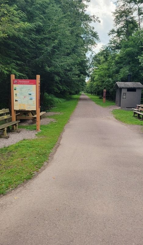
Location. 39° 54.653′ N, 79° 9.704′ W. Marker is in Rockwood, Pennsylvania , in Somerset County. Marker is at the intersection of Rockdale Road and Markleton School Road, on the right when traveling south on Rockdale Road. Marker is located west of the Great Allegheny Passage trail access parking area. Touch for map. Marker is at or near this postal address: 111 Rockdale Road, Rockwood PA 15557, United States of America. Touch for directions.
Other nearby markers. At least 8 other markers are within 3 miles of this marker, measured as the crow flies. Maynard Ralph Sembower (here, next to this marker); a different marker also named Rockwood (about 300 feet away, measured in a direct line); Rockwood Honor Roll (approx. 0.6 miles away); Dedicated to the Glorious Youth of This Community (approx. 0.7 miles away); New Centreville (approx. 2.7 miles away); Site of Gideons German Reformed and Lutheran Church (approx. 2.7 miles away); Capt. William M. Schrock's Civil War Regiment Monument (approx. 2.7 miles away); a different marker also named New Centreville (approx. 2.8 miles away). Touch for a list and map of all markers in Rockwood.
Regarding Rockwood. Marker includes a diagram showing the Elevation changes along the Great Allegheny Passage and C&O Towpath.
Credits. This page was last revised on August 5, 2023. It was originally submitted on August 4, 2023, by Bradley Owen of Morgantown, West Virginia. This page has been viewed 74 times since then and 18 times this year. Photos: 1, 2, 3. submitted on August 5, 2023, by Bradley Owen of Morgantown, West Virginia.


