Middlecreek Township near New Centerville in Somerset County, Pennsylvania — The American Northeast (Mid-Atlantic)
Laurel Hill Creek
Laurel Hill Creek Watershed
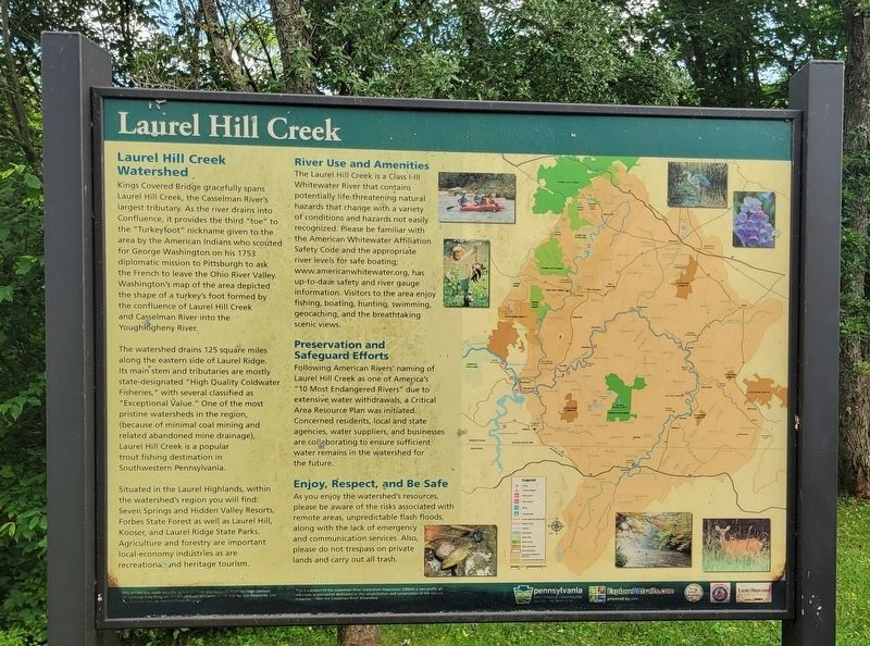
Kings Covered Bridge gracefully spans Laurel Hill Creek, the Casselman River's largest tributary. As the river drains into Confluence, it provides the third "toe" to the "Turkeyfoot" nickname given to the area by the American Indians who scouted for George Washington on his 1753 diplomatic mission to Pittsburgh to ask the French to leave the Ohio River Valley. Washington's map of the area depicted the shape of a turkey's foot formed by the confluence of Laurel Hill Creek and Casselman River into the Youghiogheny River.
The watershed drains 125 square miles along the eastern side of Laurel Ridge. Its main stem and tributaries are mostly state-designated "High Quality Coldwater Fisheries," with several classified as "Exceptional Value." One of the most pristine watersheds in the region, (because of minimal coal mining and related abandoned mine drainage), Laurel Hill Creek is a popular trout fishing destination in Southwestern Pennsylvania.
Situated in the Laurel Highlands, within the watershed's region you will find: Seven Springs and Hidden Valley Resorts, Forbes State Forest as well as Laurel Hill, Kooser, and Laurel Ridge State Parks. Agriculture and forestry are important local-economy industries as are recreational and heritage tourism.
River Use and Amenities
The Laurel Hill Creek is a Class I-III Whitewater River that contains potentially life-threatening natural hazards that change with a variety of conditions and hazards not easily recognized. Please be familiar with the American Whitewater Affiliation Safety Code and the appropriate river levels for safe boating; www.americanwhitewater.org, has up-to-date safety and river gauge information. Visitors to the area enjoy fishing, boating, hunting, swimming, geocaching, and the breathtaking scenic views.
Preservation and Safeguard Efforts
Following American Rivers' naming of Laurel Hill Creek as one of America's "10 Most Endangered Rivers" due to extensive water withdrawals, a Critical Area Resource Plan was initiated. Concerned residents, local and state agencies, water suppliers, and businesses are collaborating to ensure sufficient water remains in the watershed for the future.
Enjoy, Respect, and Be Safe
As you enjoy the watershed's resources, please be aware of the risks associated with remote areas, unpredictable flash floods, along with the lack of emergency and communication services. Also, please do not trespass on private lands and carry out all trash.
Erected by The National Road Heritage Corridor, PA Heritage Area Program, PA Department of Conservation and Natural
Resources, Somerset County Tourism Grant Program and the Casselman River Watershed Association (CRWA).
Topics and series. This historical marker is listed in these topic lists: Environment • Native Americans. In addition, it is included in the Former U.S. Presidents: #01 George Washington series list. A significant historical year for this entry is 1753.
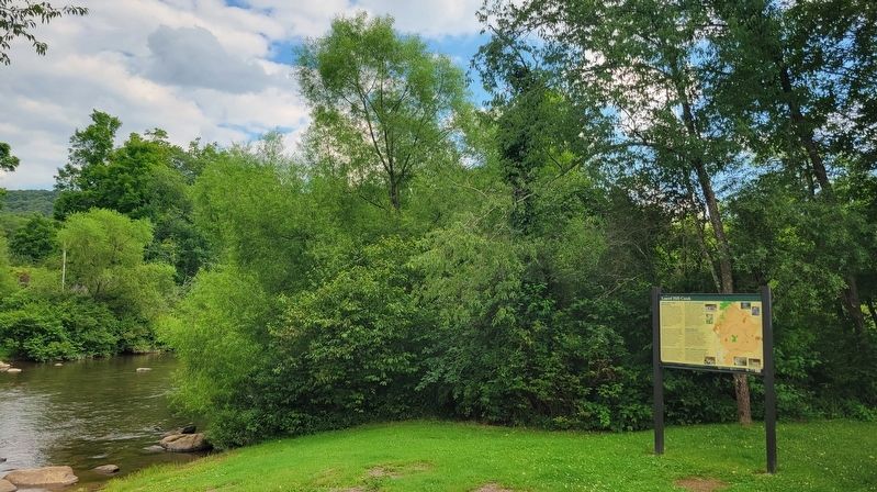
Location. 39° 56.251′ N, 79° 16.293′ W. Marker is near New Centerville, Pennsylvania, in Somerset County. It is in Middlecreek Township. Marker is on Scullton Road (Pennsylvania Route 653) 0.1 miles east of Ream Road (Pennsylvania Route 3035), on the right when traveling east. Marker is located on the west side of the bridge. Touch for map. Marker is in this post office area: Rockwood PA 15557, United States of America. Touch for directions.
Other nearby markers. At least 8 other markers are within 6 miles of this marker, measured as the crow flies. History of the Kings Covered Bridge (a few steps from this marker); History of the Barronvale Covered Bridge (approx. 1.1 miles away); New Centreville (approx. 4 miles away); Capt. William M. Schrock's Civil War Regiment Monument (approx. 4.1 miles away); Site of Gideons German Reformed and Lutheran Church (approx. 4.4 miles away); a different marker also named New Centreville (approx. 4.4 miles away); Roosevelt's Tree Army (approx. 5.6 miles away); Camp Life (approx. 5.6 miles away). Touch for a list and map of all markers in New Centerville.
Credits. This page was last revised on August 5, 2023. It was originally submitted on August 5, 2023, by Bradley Owen of Morgantown, West Virginia. This page has been viewed 71 times since then and 22 times this year. Photos: 1, 2. submitted on August 5, 2023, by Bradley Owen of Morgantown, West Virginia.

