
Penn Laird in Rockingham County, Virginia — The American South (Mid-Atlantic)
Battle of Cross Keys
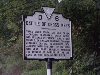
Photographed by J. J. Prats, September 25, 2007
1. Battle of Cross Keys Marker
Erected 1941 by Virginia Conservation Commission. (Marker Number D-6.)
Topics and series. This historical marker is listed in this topic list: War, US Civil. In addition, it is included in the Virginia Department of Historic Resources (DHR) series list. A significant historical date for this entry is June 8, 1862.
Location. This marker has been replaced by another marker nearby. It was located near 38° 23.511′ N, 78° 48.601′ W. Marker was in Penn Laird, Virginia, in Rockingham County. It was on Spotswood Trail (U.S. 33) west of Cross Keys Road (Virginia Route 276), on the right when traveling west. Touch for map. Marker was in this post office area: Penn Laird VA 22846, United States of America. Touch for directions.

Regionally, this marker was in Virginia’s Shenandoah Valley. It was also in the American
this page online
Other nearby markers. At least 8 other markers are within 3 miles of this location, measured as the crow flies: A different marker also named Battle of Cross Keys (here, next to this marker); Kyles Mill House (approx. 1.6 miles away); a different marker also named Battle of Cross Keys (approx. 2.6 miles away); The Battle Dies Out (approx. 2.7 miles away); Walker's Flank Attack (approx. 2.7 miles away); The Attack on Buell's Battery (approx. 2.7 miles away); Cross Keys Cemetery (approx. 2.9 miles away); Union Church (approx. 2.9 miles away).
Other markers no longer nearby. The Armies Brace for Battle (was approx. 2.1 miles away but has been confirmed missing); a different marker also named Battle of Cross Keys (was approx. 2.7 miles away but has been replaced with another marker
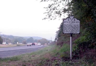
Photographed by J. J. Prats, September 25, 2007
2. Battle of Cross Keys Marker
Related marker. Click here for another marker that is related to this marker. New Marker At This Location also titled "Battle of Cross Keys"
Credits. This page was last revised on August 9, 2023. It was originally submitted on November 11, 2007, by J. J. Prats of Powell, Ohio. This page has been viewed 1,990 times since then and 30 times this year. Last updated on August 8, 2023, by Anonymous of Fredericksburg, Virginia. Photos: 1, 2. submitted on November 11, 2007, by J. J. Prats of Powell, Ohio. • Bernard Fisher was the editor who published this page.
