Near Niverville in Columbia County, New York — The American Northeast (Mid-Atlantic)
The Valatie Kill
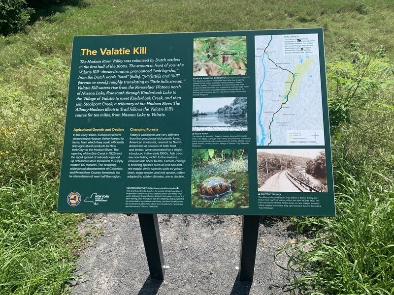
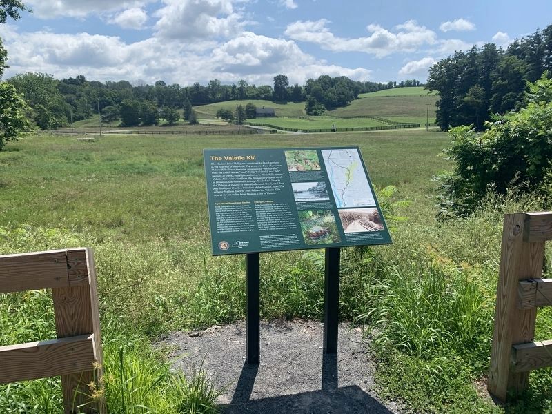
The Hudson River Valley was colonized by Dutch settlers in the first half of the 1600s. The stream in front of you - the Valatie Kill - draws its name, pronounced "vah-lay-sha," from the Dutch words "vaal" (falls), "je" (little), and "kill" (stream or creek), roughly translating to "little falls stream." Valatie Kill waters rise from the Rensselaer Plateau north of Nassau Lake, flow south through Kinderhook Lake to the Village of Valatie to meet Kinderhook Creek, and then join Stockport Creek, a tributary of the Hudson River. The Albany-Hudson Electric Trail follows the Valatie Kill's course for ten miles, from Nassau Lake to Valatie.
Agricultural Growth and Decline
In the early 1800s, European settlers cleared most Hudson Valley forests for farms, from which they could efficiently ship agricultural products to New York City via the Hudson River. The opening of the Erie Canal in 1825 and the rapid spread of railroads opened up rich midwestern farmlands to supply eastern US markets. The resulting widespread abandonment of Columbia and Rensselaer County farmlands led to reforestation of over half the region
Changing Forests
Today's woodlands are very different from the precolonial old-growth forest. American chestnuts, revered by Native Americans as sources of both food and timber, were decimated by a blight introduced in the early 1900s. Ash trees are now falling victim to the invasive emerald ash borer beetle. Climate change is favoring species such as red oak and red maple, while species such as yellow birch, sugar maple, and red spruce, better adapted to colder climates, are in decline.
(photos counterclockwise from top left)
BROOK SNAKETAIL DRAGONFLY (Ophiogamaphus aspersus)
The Kinderhook creek watershed hosts this rare dragonfly named for the males' snakelike mating claspers. Among the most colorful US dragonflies, it is also among the most environmentally sensitive, and its presence indicates high water quality. It also needs undisturbed fields and woodlands for feeding and breeding. Source: Hawthorne Valley Farmscape Ecology Program.
WILD'S POND
The Valatie Kill fed Wild's Pond in Valatie, dammed for mills in the 1820's. Although man-made, the pond was considered scenic and was featured among postcards sold by Vole news agent Frank L. Fowler. Source: Village of Valatie / Guy Goamello Collection
EASTERN BOX TURTLE (Terrapene carolina caralina)
This land based turtle found in the greater Kinderhock Creek watershed is omnivorous and inhabits forests and fields near water Although it typically lives thirty to forty years or more, it is slow moving, slow to mature has few offspring and is imperiled by automobiles, agricultural machinery and land development It is in decline in New York where it is considered a "species of special concern. Source: Hudsonia
ELECTRIC TROLLEY
The Albany-Hudson Electric Traill follows a former trolley line, shown here north of Valatie, which ran from 1900 to 1929 The trail crosses the Valatie Kill five times on new bridges installed where original ones were long ago removed. Source: Schodack Town Historian
TRAIL AND KILL
The Valatie Kill watershed, highlighted in yellow, arises on the Rensselaer Plateau. The stream runs south through Nassau and Kinderhook Lakes, joining Kinderhook Creek in Valatie, Source: Alto Planning + Design.
Topics. This historical marker is listed in these topic lists: Environment • Railroads & Streetcars • Waterways & Vessels. A significant historical year for this entry is 1825.
Location. 42° 27.701′ N, 73° 38.708′ W. Marker is near Niverville, New York, in Columbia County. Marker can be reached from Albany-Hudson Electric Trail south of Little Lake Road, on the left when traveling south. Touch for map. Marker is in this post office area: Valatie NY 12184, United States of America. Touch for directions.
Other nearby markers. At least 8 other markers are within 4 miles of this marker, measured as the crow flies. Electric Park (approx. 0.7 miles away); North Chatham Depot (approx. 1.1 miles away); Mohican Homelands (approx. 1.4 miles away); The Empire State Trail (approx. 2.1 miles away); a different marker also named The Valatie Kill (approx. 2.7 miles away); Abraham Van Ness (approx. 2.7 miles away); a different marker also named Abraham Van Ness (approx. 2.7 miles away); Quackenboss Tavern (approx. 3.1 miles away). Touch for a list and map of all markers in Niverville.
Credits. This page was last revised on August 15, 2023. It was originally submitted on August 9, 2023, by Steve Stoessel of Niskayuna, New York. This page has been viewed 71 times since then and 21 times this year. Photos: 1, 2. submitted on August 9, 2023, by Steve Stoessel of Niskayuna, New York. • Michael Herrick was the editor who published this page.

