
Central Hamilton , Ontario — Central Canada (North America)
Harmony Apartments
Photographed by Tim Boyd, January 1, 2020
1. Harmony Apartments Marker
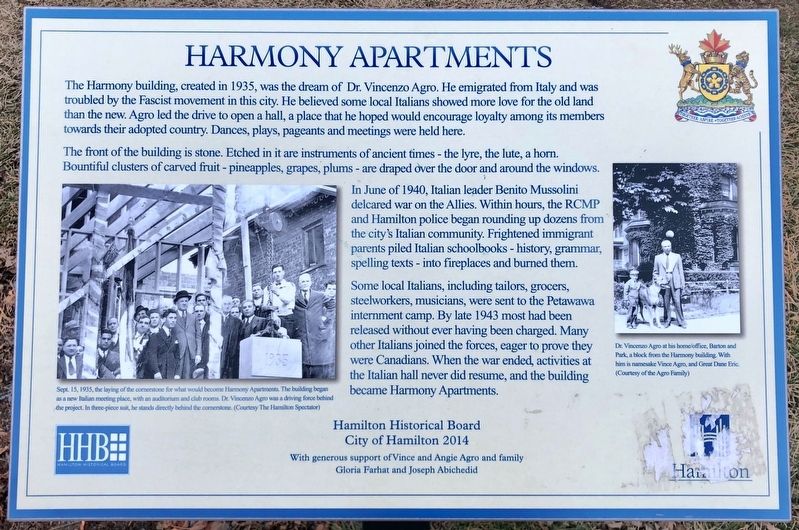
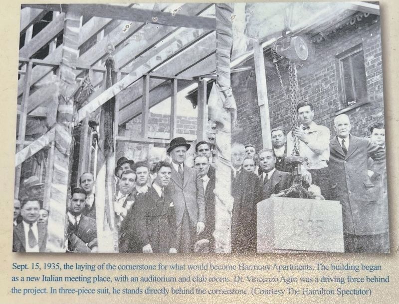
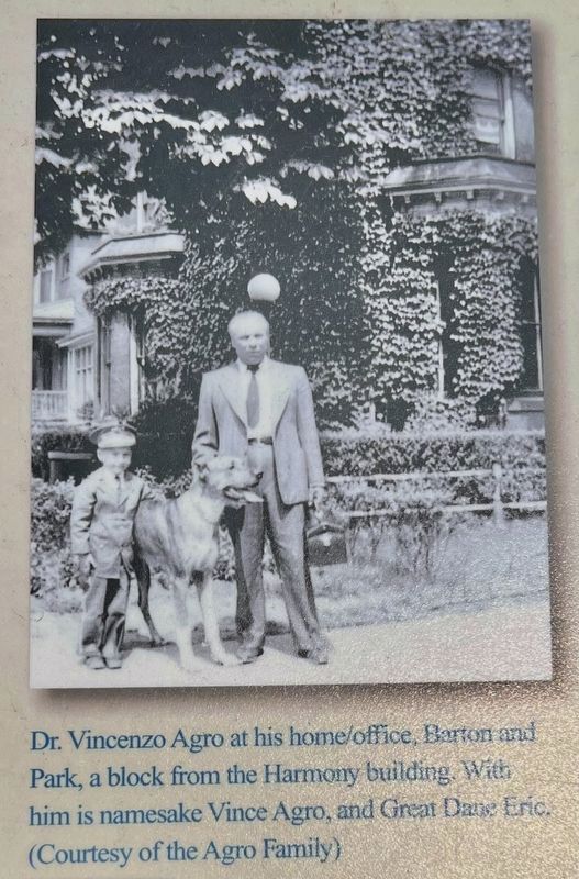
The Harmony building, created in 1935, was the dream of Dr. Vincenzo Agro. He emigrated from Italy and was troubled by the Fascist movement in this city. He believed some local Italians showed more love for the old land than the new. Agro led the drive to open a hall, a place that he hoped would encourage loyalty among its members towards their adopted country. Dances, plays, pageants and meetings were held here.
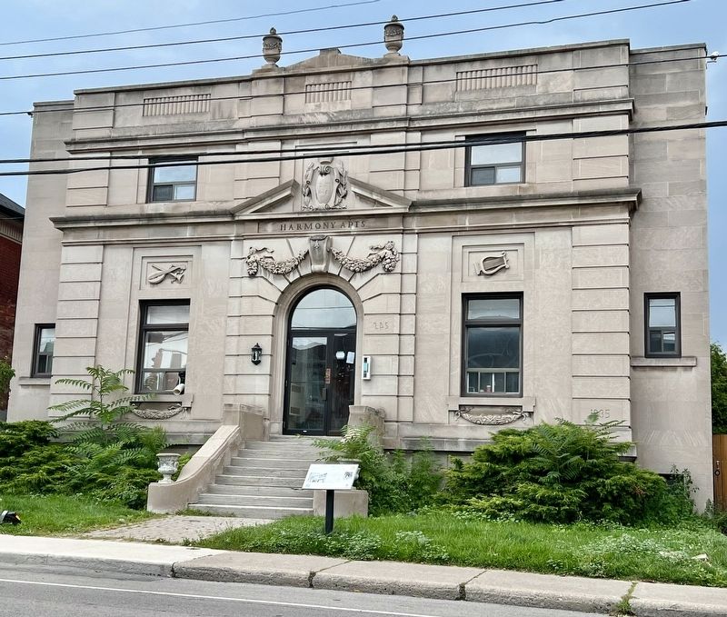
The front of the building is stone. Etched in it are instruments of ancient times - the lyre, the lute, a horn. Bountiful clusters of carved fruit - pineapples, grapes, plums - are draped over the door and around the windows.
In June of 1940, Italian leader Benito Mussolini declared war on the Allies. Within hours, the RCMP and Hamilton police began rounding up dozens from the city's Italian community. Frightened immigrant parents piled Italian schoolbooks - history, grammar, spelling texts - into fireplaces and burned them.
Some local Italians, including tailors, grocers, steelworkers, musicians, were sent to the Petawawa internment camp. By late 1943 most had been released without ever having
this page online
Hamilton Historical Board
City of Hamilton 2014
With generous support of Vince and Angie Agro and family
Gloria Farhat and Joseph Abichedid
Erected 2014 by Hamilton Historical Board.
Topics. This historical marker is listed in these topic lists: Architecture • Immigration • War, World II. A significant historical year for this entry is 1935.
Location. 43° 15.928′ N, 79° 52.192′ W. Marker is in Hamilton, Ontario. It is in Central Hamilton. It is at the intersection of Bay Street North and Barton Street West, on the left when traveling north on Bay Street North. Touch for map. Marker is at or near this postal address: 245 Bay Street North, Hamilton ON L8L 1M2, Canada. Touch for directions.

Regionally, this marker is on Ontario’s Golden Horseshoe, in the Hamilton-Halton-Brant Area, and specifically in the Toronto Metropolitan Area. It is also in Central Canada. Globally, it is in North America, on
Photographed by Tim Boyd, August 10, 2023
2. Harmony Apartments Marker
Other nearby markers. At least 8 other markers are within walking distance of this marker: St. Mary’s Pro-Cathedral (about 240 meters away, measured in a direct line); Hamilton Customs House / La Maison de la douane de Hamilton (about 240 meters away); 1879 (about 240 meters away); a different marker also named 1879 (about 240 meters away); Italian Canadians as ‘Enemy Aliens’ (approx. 0.4 kilometers away); Christ’s Church Cathedral (approx. 0.4 kilometers away); Christ’s Church Cathedral / La Cathédrale de l’Eglise du Christ (approx. 0.4 kilometers away); Hamilton CN Station / La gare du CN de Hamilton (approx. 0.4 kilometers away). Touch for a list and map of all markers in Hamilton.
courtesy the Hamilton Spectator, September 15, 1935
3. Harmony Apartments Marker detail
courtesy of the Agro family
4. Harmony Apartments Marker detail
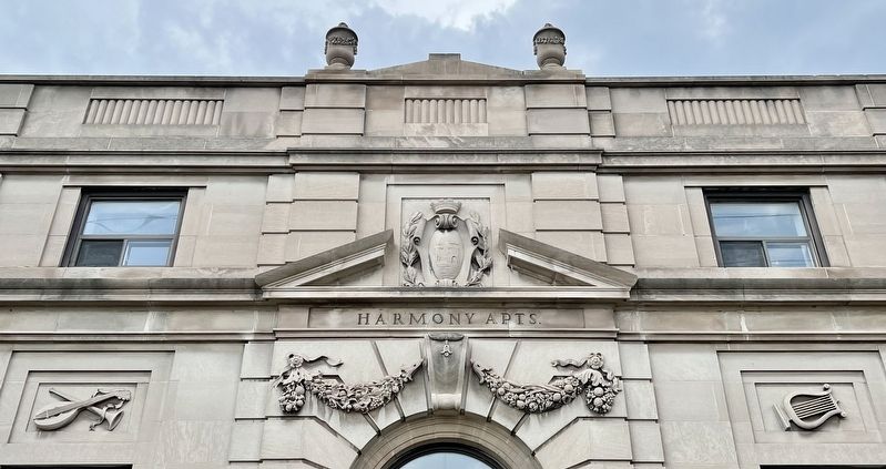
Photographed by Tim Boyd, August 10, 2023
5. Harmony Apartments architectural details
Credits. This page was last revised on August 11, 2023. It was originally submitted on August 10, 2023, by Tim Boyd of Hamilton, Ontario. This page has been viewed 947 times since then and 126 times this year. Photos: 1, 2, 3, 4, 5. submitted on August 10, 2023, by Tim Boyd of Hamilton, Ontario. • Andrew Ruppenstein was the editor who published this page.
