Brattleboro in Windham County, Vermont — The American Northeast (New England)
Brattleboro / Molly Stark Byway
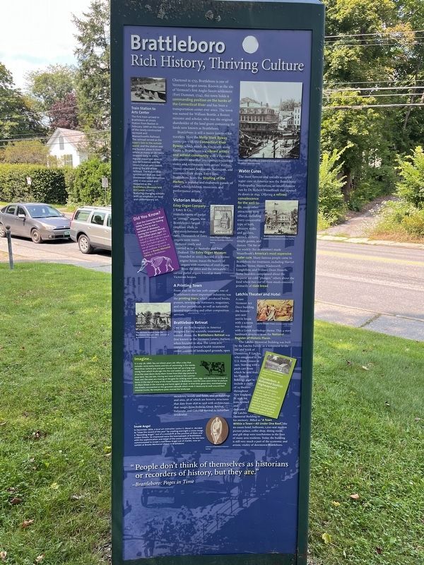
Brattleboro
Rich History, Thriving Culture
Chartered in 1753, Brattleboro is one of Vermont's largest towns. Known as the site of Vermont's first Anglo-Saxon settlement (Fort Drummer, 1724), this town holds a commanding position on the banks of the Connecticut River and has been a transportation center ever since. The town was named for William Brattle, a Boston minister and scholar, who was the original shareholder of the land grant containing the lands now known as Brattleboro.
Brattleboro is still a major junction for travelers. Here the Molly Stark Byway converges with the Connecticut River Byway, which wends its way north along Route 5. Brattleboro is a vibrant artistic and activist community with a thriving downtown area that intersperses traditional stores and restaurants with artists' studios, owner-operated bookstores, boutiques, and counterculture shops. Every June, Brattleboro hosts the Strolling of the Heifers, a popular and exuberant parade of cows, schoolchildren, musicians, and performance artists.
Victorian Music
Estey Organ Company-J. Estey & Co., manufacturers of parlor or "cottage" organs, was Brattleboro's largest employer while in operation between 1846-1960. Thousands of Estey organs were manufactured yearly and carried as far as Australia and New Zealand. The Estey Organ Museum (founded in 2002), housed in a former engine house, traces the history of organs with examples of reed organs from the 1860s and the intricately carved parlor organs found in many Victorian houses.
A Printing Town
From 1790 to the late 20th century, one of Brattleboro's most important industries was the printing trade, which produced books, posters, newspapers, stationary, magazines, and other periodicals, as well as nationally favored typesetting and other composition services.
Brattleboro Retreat
One of the first hospitals in America designed for the scientific treatment of mental illness, the Brattleboro Retreat was first known as the Vermont Lunatic Asylum when founded in 1834. The 1,000-acre comprehensive mental health treatment center consists of landscaped grounds open meadows, woods and fields, and 58 buildings and sites, 38 of which are historic structures that date from 1838 to 1938 with architecture that ranges from Federal, Greek Revival, Italianate, and Colonial Revival to suburban residential.
Water Cures
The most famous and socially accepted water cure in America was the Brattleboro Hydropathic Institution, an establishment run by Dr. Robert Wesselhoeft that opened its doors in 1845. Offering a refined convalescence for the well-to-do, many other attractions were offered,
Latchis Theater and Hotel
A rare Vermont Art Deco building, the historic 900-seat movie house with 3 screens was designed with a Greek mythology theme. This 4-story landmark structure is on the National Register of Historic Places.
The Latchis Memorial Building was built by the Latchis Family as a testament to the life and work of Demetrius P. Latchis, who emigrated to the U.S. from Greece in 1901. Starting with a push cart from which he sold fruit, his business holdings grew to include a chain of 14 theaters throughout New England. In 1938, his sons opened and dedicated the Latchis Memorial Building to his memory. Billed as "A Town Within a Town-All Under One Roof," the 60-room hotel, ballroom, 1,200 seat motion picture palace, coffee shop, dining room, and gift shop were touchstones in the lives of many area residents. Today, the building is still very
"People don't think of themselves as historians or recorders of history, but they are."
- Bratleboro: Pages in Time
Train Station to Arts Center
The first train arrived in Brattleboro at Union Station from Boston in February 1849 on the tracks of the newly constructed Vermont and Massachusetts Railroad. The railroad served as the town's link to the outside world, and the station was the busies place in town where as many as 18 trains stopped daily. In 1966, regular passenger service was terminated and the Union Station was closed, ending the era of the railroad. The station that symbolized that era was threatened with demolition until it was saved and reopened as the Brattleboro Museum and Art Center in 1972, featuring changing exhibits with emphasis on local and contemporary art.
Did You Know?
…that the Connecticut River Valley is known for having been home to many varieties of dinosaurs during the Jurassic Period, 100 million years ago? The tusk of a fossil elephant was found in about 1883 in a much bed, 5 feet below ground. It was 48 inches long and in good condition. It is now on display at Brooks Memorial Library in Brattleboro.
Imagine…
It is July 18, 1849. You are eleven
Snow Angel
In December 1856, a local art instructor, Larkin G. Mead Jr., decided to "close the record of the year" by creating overnight a snow image, a "Recording Angel," out of a snowdrift at the junction of Main and Linden Streets. So impressed were the townspeople of Brattleboro with the sophistication and detail of the snow sculpture, he was later commissioned to sculpt a real Snow Angel out of marble, now on exhibit at Brooks Memorial Library in Brattleboro.
Thunderbolt: A Reformed Scottish Highwayman?
Known to Brattleboro residents as Dr. John Wilson, legend has it that this colorful physician, designer, and teacher was really a former notorious Scottish highway robber who had immigrated to Vermont where he lived until his death in 1847.
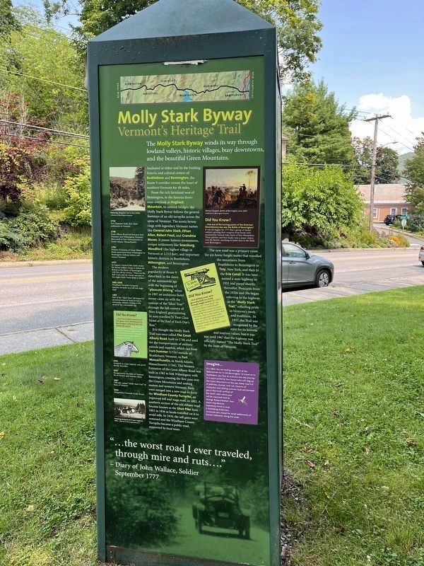
Molly Stark Byway
Vermont's Heritage Trail
The Molly Stark Byway winds its way through lowland valleys, historic villages, busy downtowns, and the beautiful Green Mountains.
Anchored at either end by the bustling historic and cultural centers of Brattleboro and Bennington, the Route 9 corridor crosses the heart of southern Vermont for 48 miles.
From the rich farmland west of Bennington, to the famous three-state-overlook at Hogback Mountain, to covered bridges, the Molly Stark Byway follows the general footsteps of an old turnpike across the spine of Vermont. The scenic byway rings with legendary Vermont names like General John Stark, Ethan Allen, Robert Frost, and Grandma Moses. It passes famous monuments, unique settlements like Searsburg, Woodford (the highest village in Vermont at 2,215 feet), and important historic districts in Brattleboro, Wilmington, and Bennington.
The modern popularity of Route 9 dates back to the dawn of the automobile age with the beginning of "pleasure driving" when in 1907 an ambitious hotel owner came up with the concept of the "Ideal Tour" through the hill country of New England, guaranteeing to auto travelers "A First Class Hotel at the End of Each Day's Run."
It is thought the Molly Stark Trail was once called The Great Albany Road, built in 1746 and used for the transportation of military patrols and supplies, which ran from Fort Drummer (1724) outside of Brattleboro, Vermont, to Fort Massachusetts, in North Adams, Massachusetts (1746). The Western Extension of the Great Albany Road was built in 1762 to link Wilmington with Bennington, creating the first pass over the Green Mountains and uniting eastern and western Vermont. Parts were merged into a new road to form the Windham County Turnpike, an improved toll and stage road, in 1802. A southern section of the old Albany road became known as the Shun Pike from 1802 to 1836 as locals travelled on it to avoid tolls. In 1836, the toll gates were removed and the Windham County Turnpike became a public road, supported by local taxes.
The new road was a primary route for six-horse freight teams that travelled from the mountains from Brattleboro to Bennington to Troy, New York, and then to the Erie Canal. It was later named a state highway in 1931 and paved shortly thereafter. Postcards from the 1920s and 30s began referring to the highway as the "Molly Stark Trail", reflecting pride in Vermont's roots and traditions. In 1937, the Trail was recognized by the state for its historic and tourism values, but it was not until 1967 that the highway was officially named "The Molly Stark Trail" by the State of Vermont.
"…the worst road I ever traveled, through mire and ruts...."
- Diary of John Wallace, Soldier
September 1777
[Timeline:]
1724 Fort Drummer built, first white settlement in Vermont.
1746 Great Albany Road laid between Fort Drummer and Wilmington, Vermont, then south to Fort Massachusetts in North Adams, Massachusetts.
1762 Western Extension of Great Albany Road constructed from Wilmington to Bennington, linking western and eastern Vermont.
1777 In August, General John Stark rouses his farmer soldier troops to defeat the British at the Battle of Bennington with his call for victory, "There are the Red Coasts and the enemy are ours or this night Molly Stark sleeps a widow."
1802-1836 Windham Turnpike Company operates turnpike as a toll and stage road.
1907 Part of the "Ideal Tour," developed by an entrepreneurial hotel owner to encourage pleasure driving at the dawn of the automobile age.
1931 Accepted as a state highway and paved shortly thereafter.
1937 Recognized by the State of Vermont for its historic and tourism values.
1967 Officially named "Molly Stark Trail" by State of Vermont.
2003 Designated a Vermont Scenic Byway
Did You Know?
…that five (highly unpopular) toll gates from Battleboro to Bennington collected tolls for nearly 40 years? Fees charged by independent toll operators included $1 for 4-horse stagecoaches, 50 cents to 63 cents for 4-wheeled vehicles, and a penny each for sheep and swine.
Did You Know?
...that one of the turning points of the American Revolutionary war was the Battle of Bennington?
It was on August 16, 1777 that a group of farmer soldiers carrying their weapons from home were mustered by General John Stark of New Hampshire. These patriots and their leader won a major victory over the British, marching in battle lines to the fields near Bennington.
Did You Know?
…that military roads were generally built in a hurry through rough terrain? By today's standards, the "Great Road" was little move than a widened path following Native American traces through the mountains of southern Vermont. Trees in the roadway were often not uprooted; their trunks were cut 12" to 18" off the ground, adequate height for military wagons, cannons, and carts to pass over them.
Imagine…
It is 1804. You are resting overnight at the Walloomsac Inn in Old Bennington. To travel on to Brattleboro, you face an arduous two-day journey in a coach pulled by four horses who will slog up the Green Mountains on the raw, steep road full of potholes, stumps, and ruts. Swarms of mosquitos and stifling summer heat will torment you in the small confines of the coach cabin where you will be crammed next to strange fellow travelers. Your coach may become hopelessly mired in mud. A forbidding wilderness surrounds you, except for small settlements of human habitation along the route.
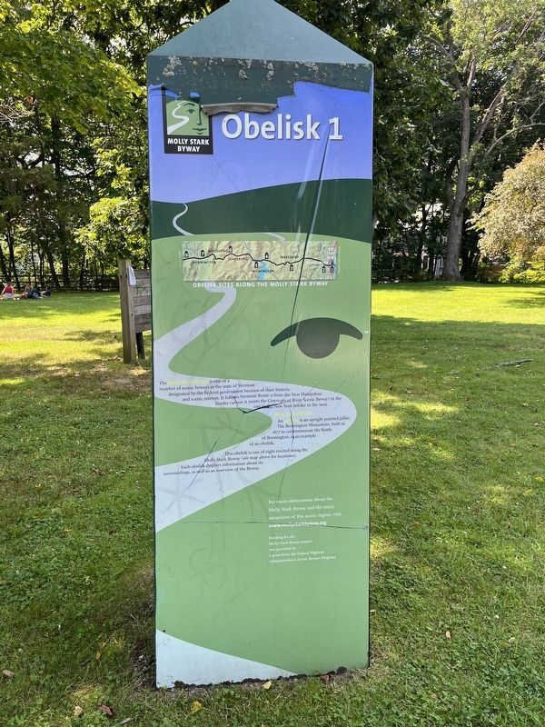
Obelisk 1
Molly Stark Byway
The Molly Stark Byway is one of a number of scenic byways in the state of Vermont designated by the Federal government because of their historic and scenic interest. It follows Vermont Route 9 from the New Hampshire border (where it meets the Connecticut River Scenic Byway) in the east to the New York border in the west.
What is an obelisk?
An obelisk is an upright pointed pillar. The Bennington Monument, built in 1877 to commemorate the Battle of Bennington, is an example of an obelisk.
This obelisk is one of eight erected along the Molly Stark Byway (see map above for locations). Each obelisk displays information about its surroundings, as well as an overview of the Byway.
For more information about the Molly Stark Byway and the many attractions of this scenic region, visit www.mollystarkbyway.org
Erected by Federal Highway Administration's Scenic Byways Program. (Marker Number 1.)
Topics. This historical marker is listed in these topic lists: Colonial Era • Industry & Commerce • Railroads & Streetcars • Roads & Vehicles. A significant historical year for this entry is 1907.
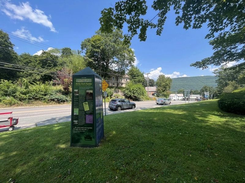
Location. 42° 51.129′ N, 72° 34.043′ W. Marker is in Brattleboro, Vermont, in Windham County. Marker is on Western Avenue (Vermont Route 9) east of Union Street, on the right when traveling east. Touch for map. Marker is at or near this postal address: 19 Western Avenue, Brattleboro VT 05301, United States of America. Touch for directions.
Other nearby markers. At least 8 other markers are within walking distance of this marker. Centre Congregational Church (approx. half a mile away); The First Building of the Centre Congregational Church (approx. half a mile away); Estey Organ Company (approx. half a mile away); Memorial Tree (approx. half a mile away); Brattleboro Civil War Monument (approx. half a mile away); Brattleboro Veterans Monument (approx. 0.6 miles away); Veterans Memorial (approx. ¾ mile away); Prospect Hill Soldier's Lot (approx. ¾ mile away). Touch for a list and map of all markers in Brattleboro.
Credits. This page was last revised on November 6, 2023. It was originally submitted on August 11, 2023, by Devry Becker Jones of Washington, District of Columbia. This page has been viewed 97 times since then and 29 times this year. Photos: 1, 2, 3, 4. submitted on August 11, 2023, by Devry Becker Jones of Washington, District of Columbia.


